Four years worth of offroad trail reports - 2005-2009

The_Roadie

Original poster
Lifetime VIP Donor
Member
Nov 19, 2011
9,957
Portland, OR
From what I call the "Golden Age of Trailvoy Offroading", starting in 2005 back when almost nobody had lifts, and nobody was wheeling them hard because many of our trucks were brand new and had loans and warranties. Moved the content from the OS over to Offroadtb.com.

OffRoad TB - View forum - Pacific U.S.

Will also add them to this thread, which is about to get massively long. Hang on for the ride!!!
 

The_Roadie

Original poster
Lifetime VIP Donor
Member
Nov 19, 2011
9,957
Portland, OR
- - - Updated - - -

One of the trips that prompted me to start this never-ending upgrade project was a mud trip. Last winter (2005), the desert had the most spectacular wildflower displays in 20 years.

Flowers on ocotillo cactus.
flower1.JPG


Fields:
flower2.JPG


But the reason for the blooming was the heaviest rainfall in years. And with rainfall comes mud. River washes with swift flowing water (less than 6 inches deep) were no problem as long as I kept moving.

mud0.JPG


But the Envoy was still stock - A/T tires filled up with mud and lost traction. I had the dumbest add-on I've ever put on a vehicle - running boards. Looked great - lost clearance.

mud2.JPG


mud3.JPG


Then, before I had GPS on-board, I ended up in what's called the Borrego Sink, the lowest point in the desert (other than the Salton Sea, about 25 miles east). Lots of washes all dump into the sink, and the fine, fine silt that ends up there is the slickest crap I've ever had the misfortune to touch. Locals call it as slick as axle grease. I misjudged the depth, and within ten feet had sunk up to the frame - trapping the spare tire - down to the running boards. All four tires spinning. No Hi-lift jack. Only a small shovel. No way to get a jack under the frame to lift it up to put the lawn chairs I was carrying under the wheels to get some traction. No trees or boulders to use as winch points. No buddy to pull me out.

But there were campers about a mile away with ATVs and monster trucks, and after an hour of trying to dig out, we (Mrs. Roadie was with me to witness my idiocy and get muddy helping) were about to hike to them and ask for help. Just then an ATV came near, and he said he'd come back with the truck. Hooked up my recovery strap and he pulled me ten feet to dry mud. Gave him $40 for beer money, which was a great bargain for me and he got to tell his buddies what the city-slicker SUV idiot had done.

I have *no* photos of this embarassing situation, but I regret that decision now, since it was very instructive. Took an hour in the shower for each of us to get relatively clean, and I still shudder what sand and silt we left in the motel carpet. :rolleyes:

The aftermath was that it took over an hour with a hose under the car to get the mud out of every orifice and crevice. The next picture is what it looked like after 20 miles on the freeway flinging mud off the tires like a dirty rooster tail, until finally enough flung off that the wheels were sort-of in balance so I could do 45 MPH. Could not go faster until I had at least gone into a self-serve car wash to get more mud off the rims.

mud4.JPG


mud1.JPG


So that's why the Roadie avoids mud.
 

The_Roadie

Original poster
Lifetime VIP Donor
Member
Nov 19, 2011
9,957
Portland, OR
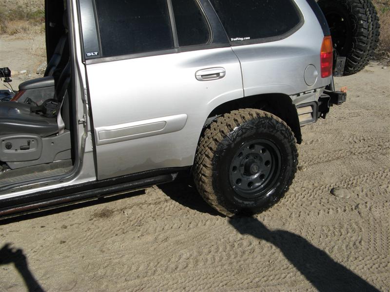
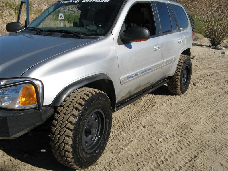
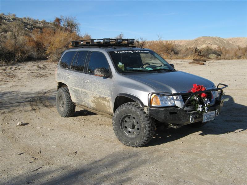
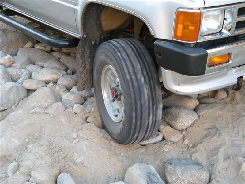
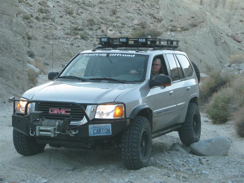
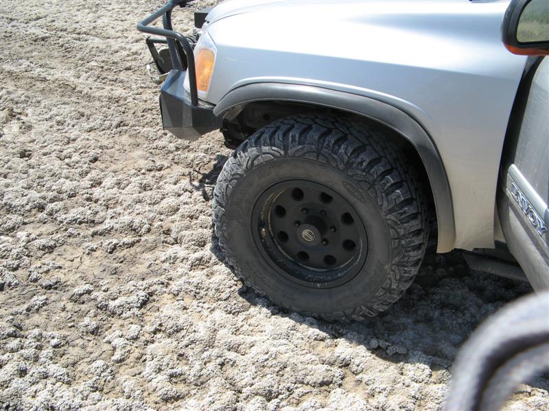
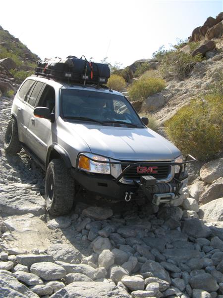
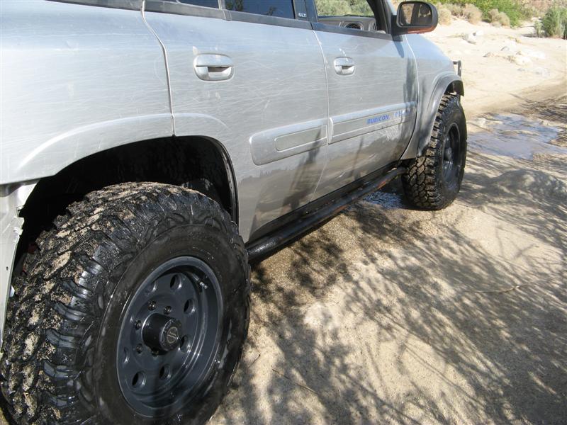
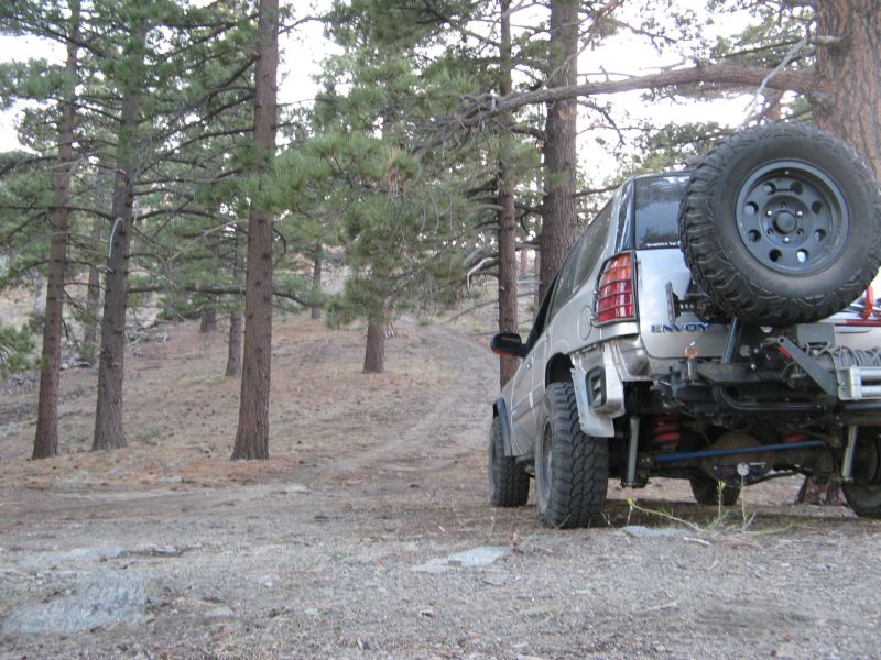
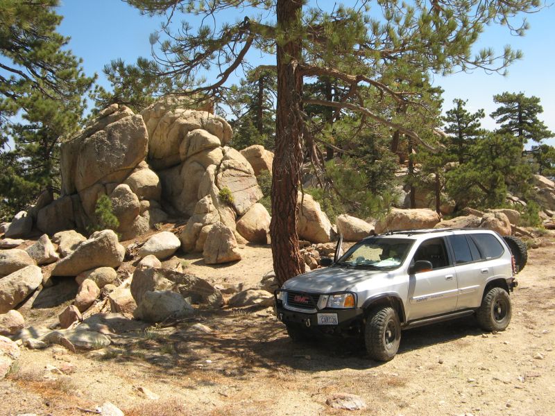
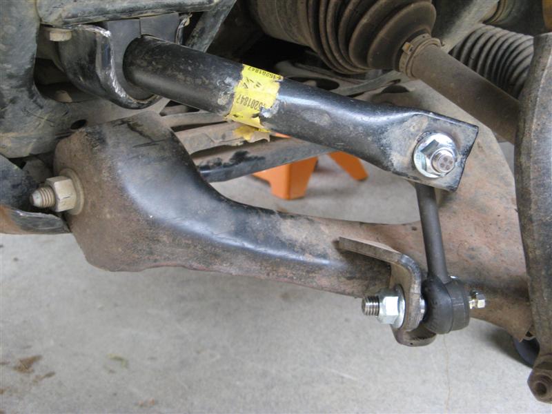
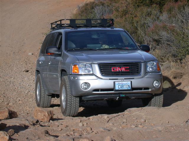
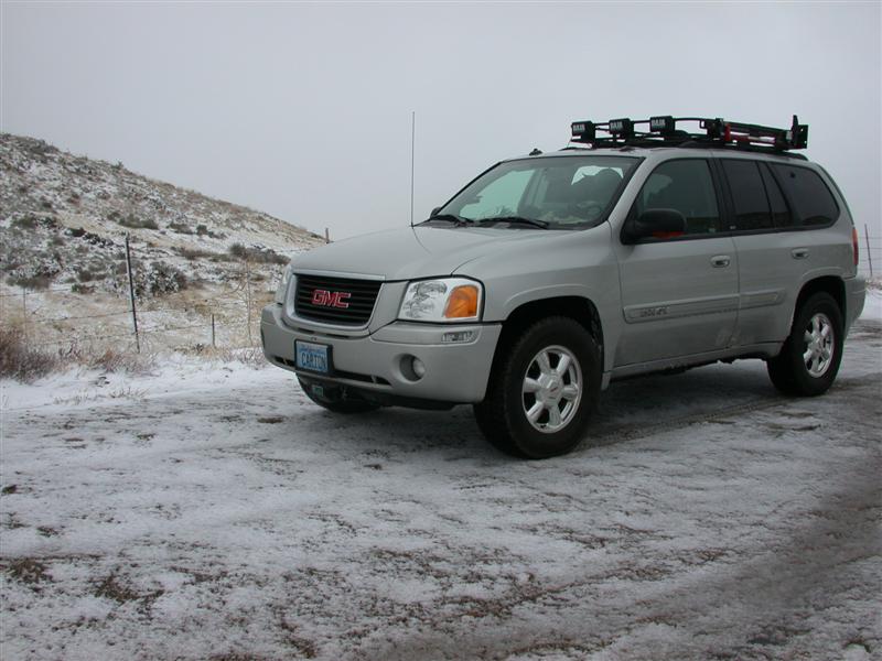
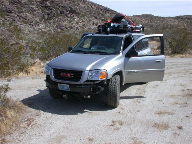
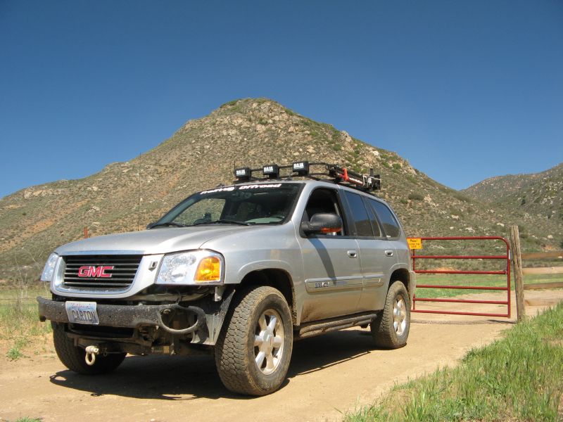
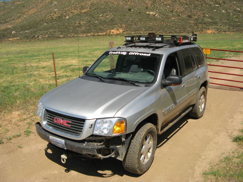
More ancient content. This was Roadiemobile 1.0. SuspensionMAXX thin spacers - Goodyear Silent Armor AT tires.


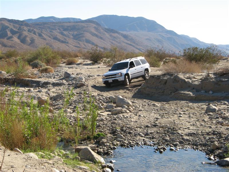
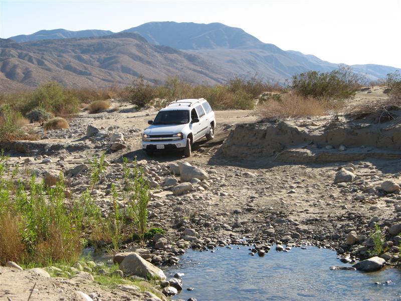
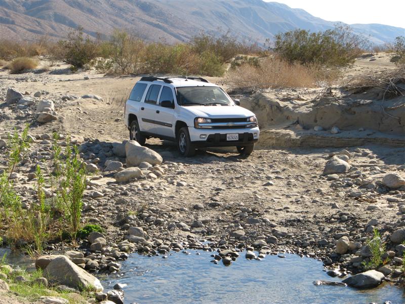
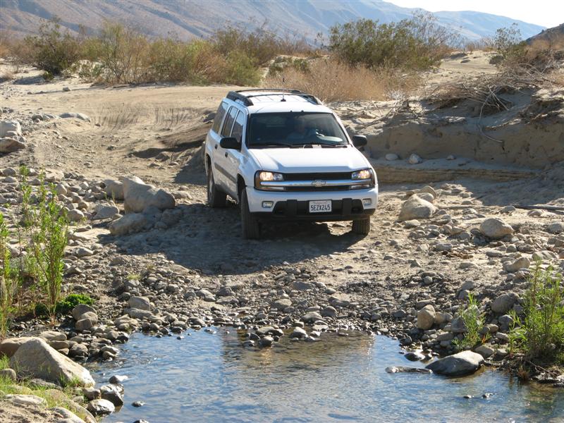
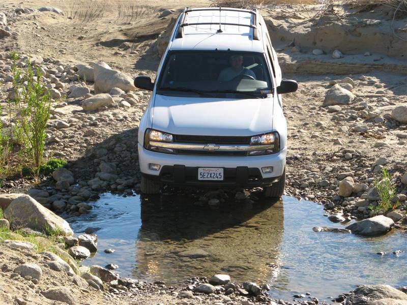
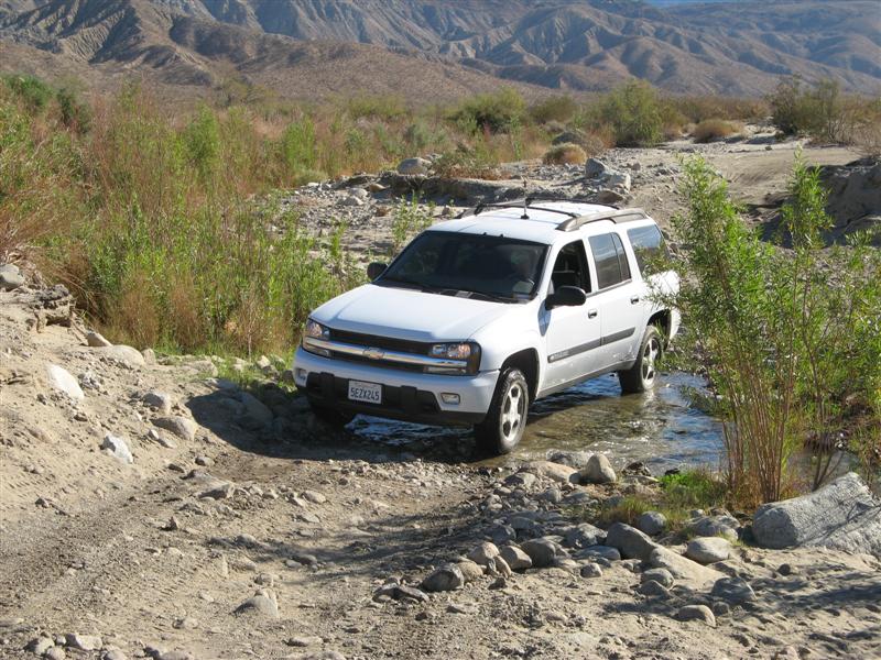
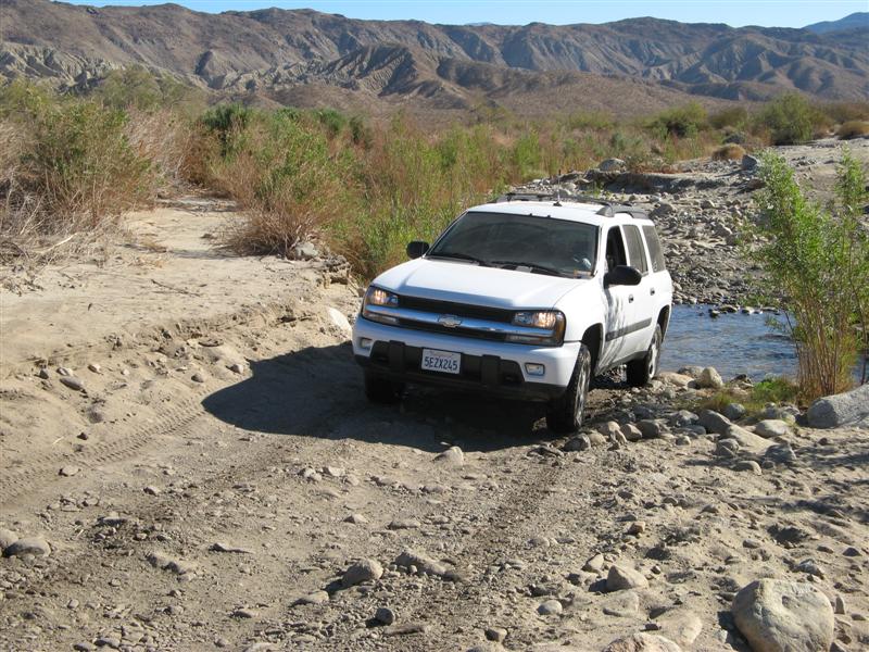
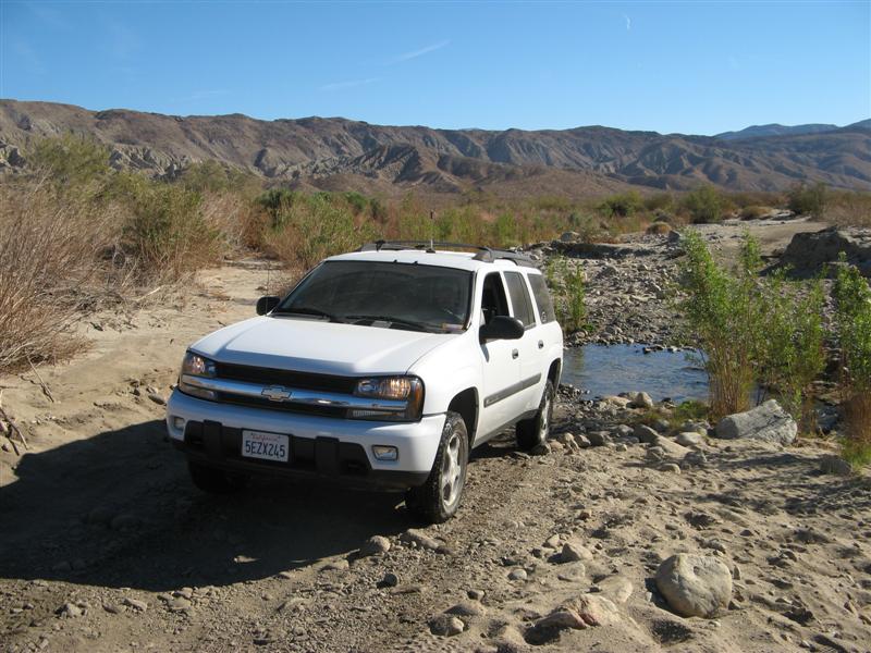
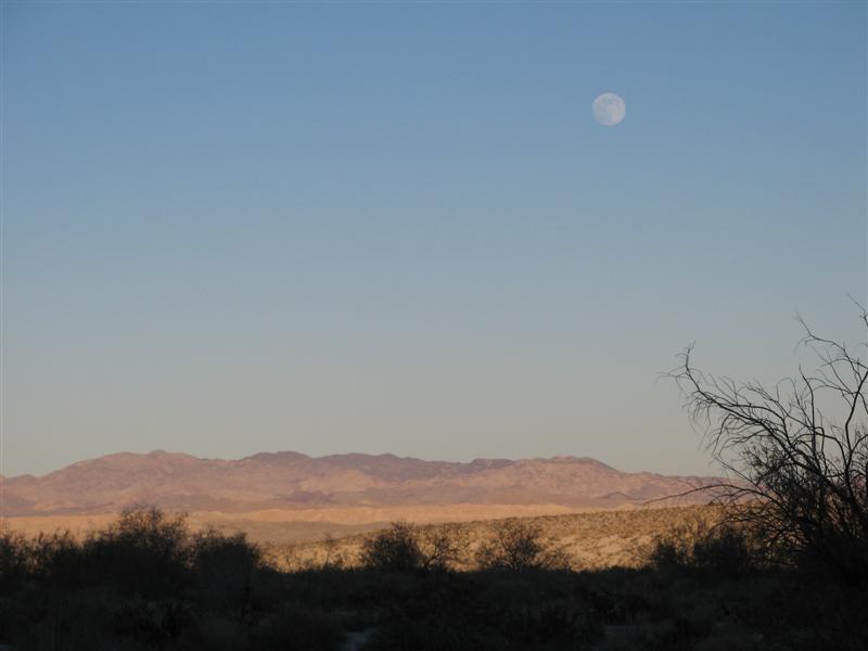
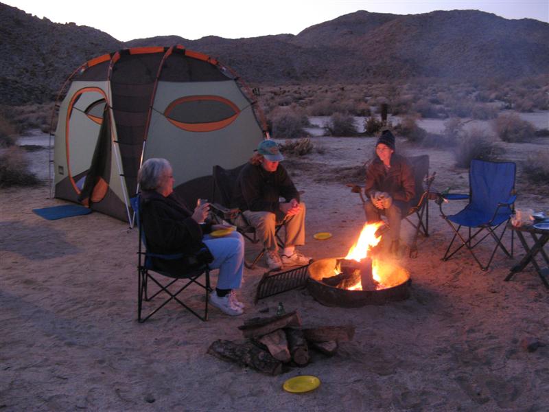
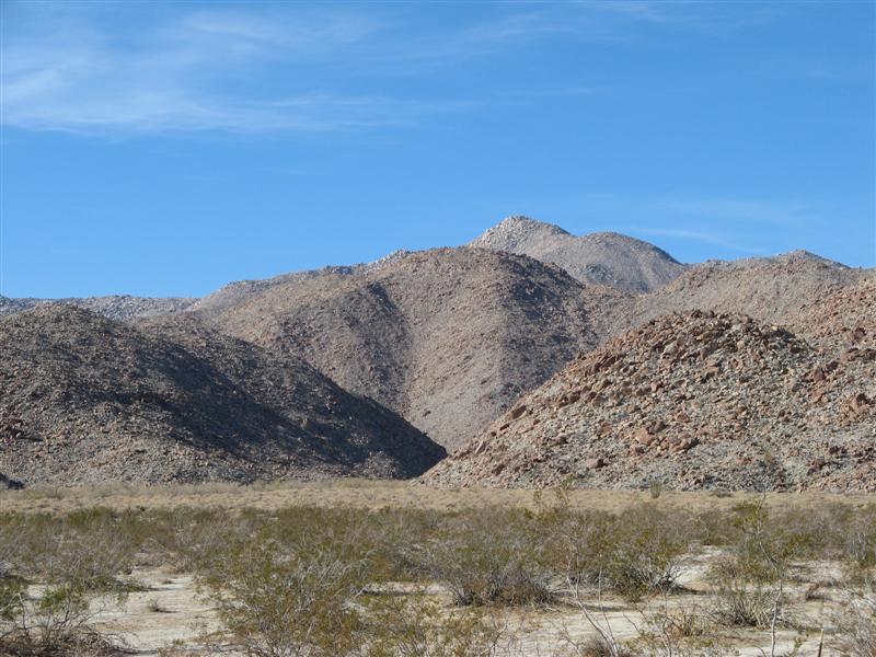
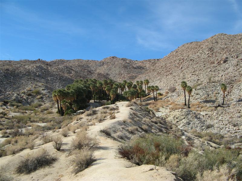
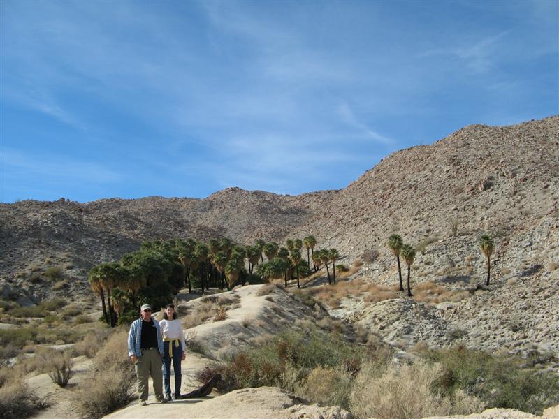
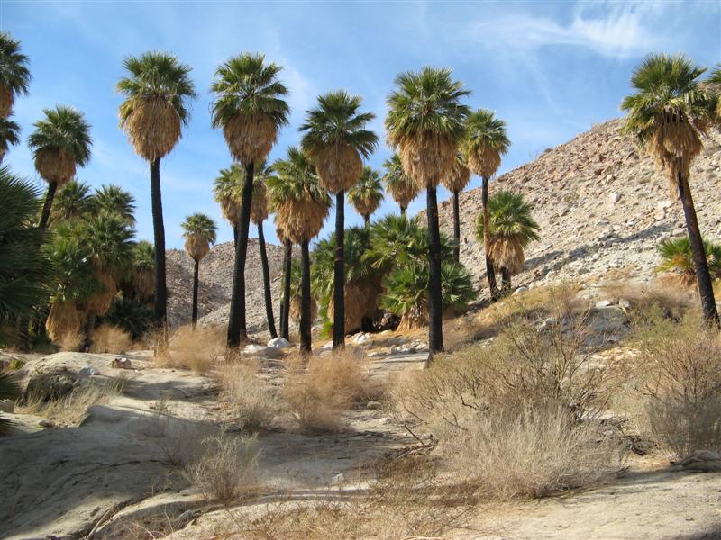
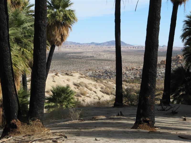
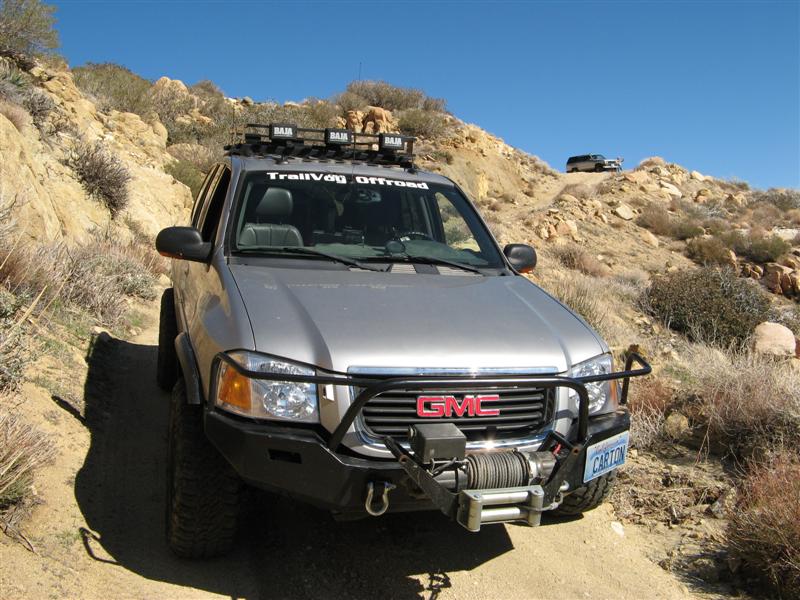
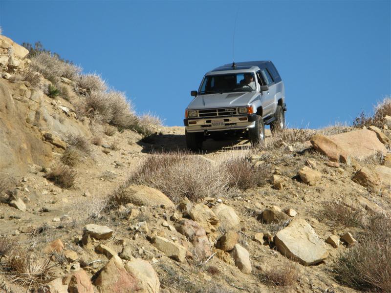
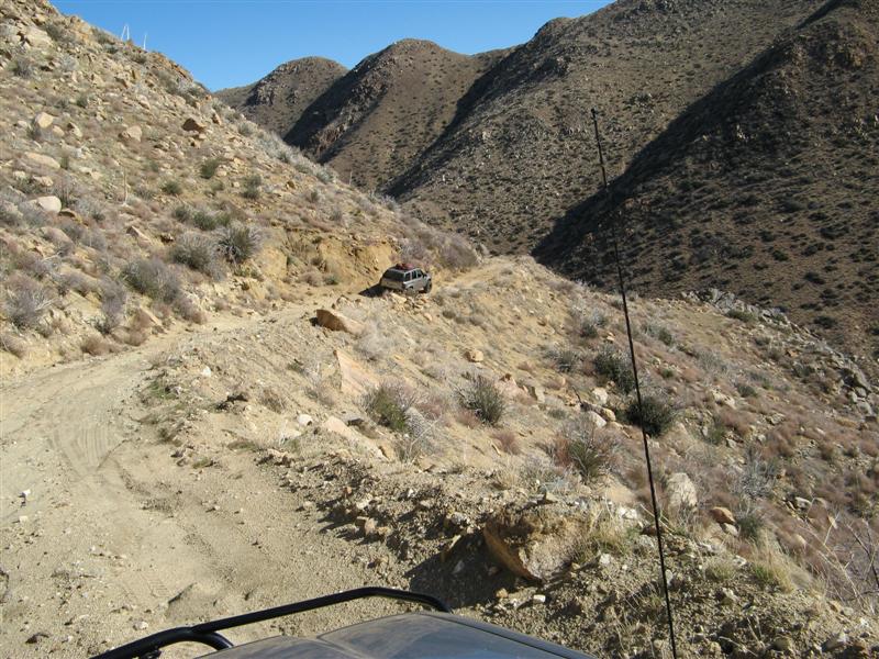
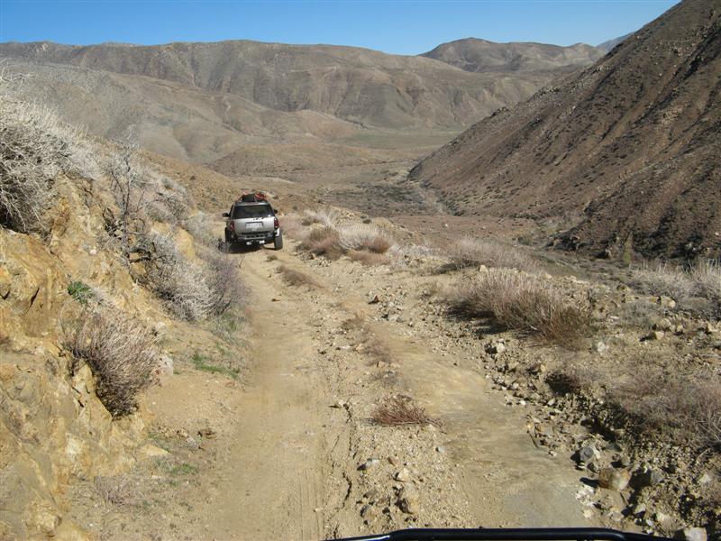
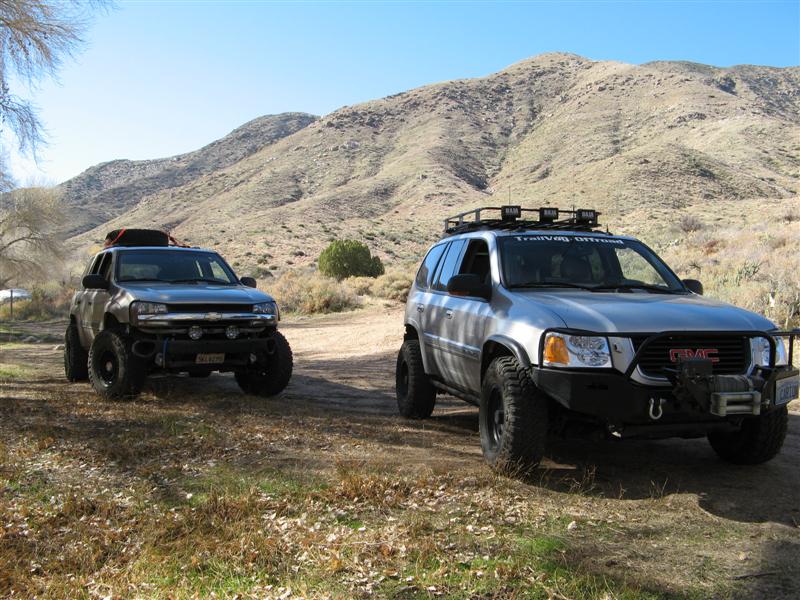
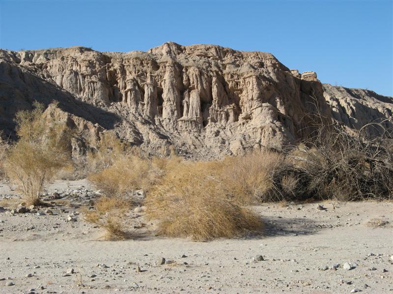
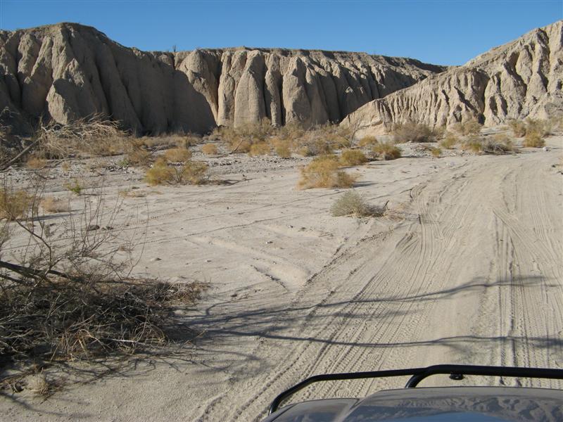
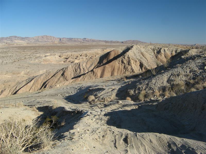
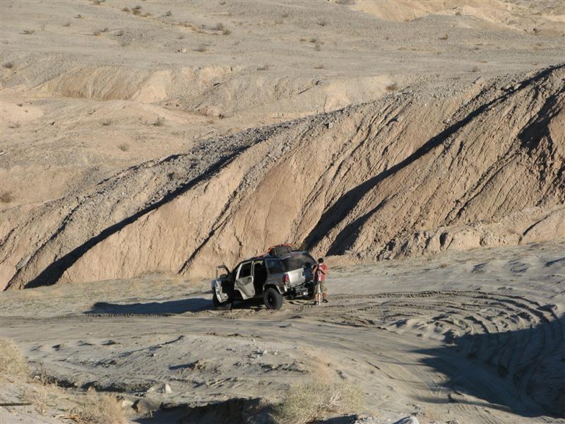
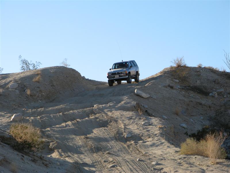
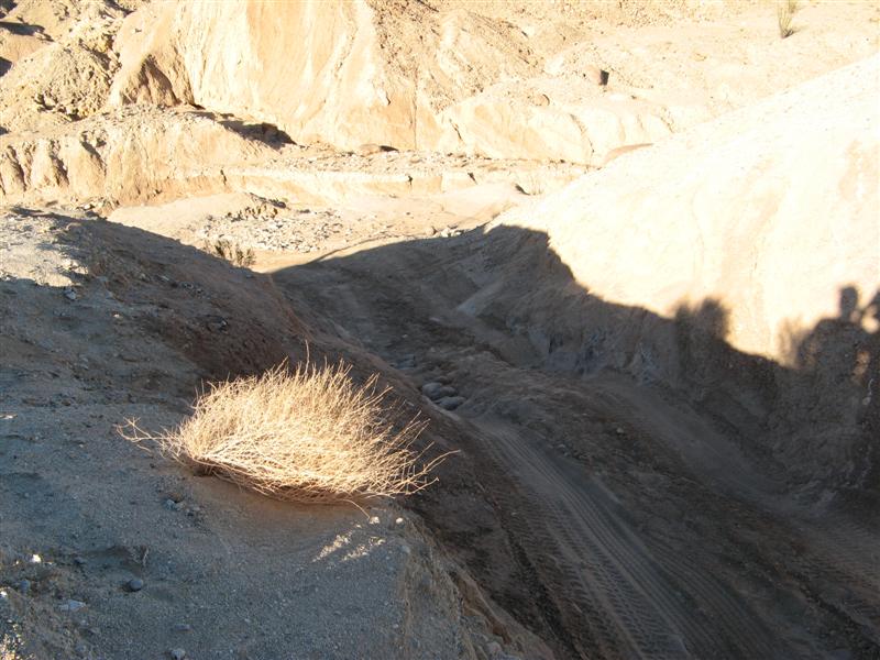
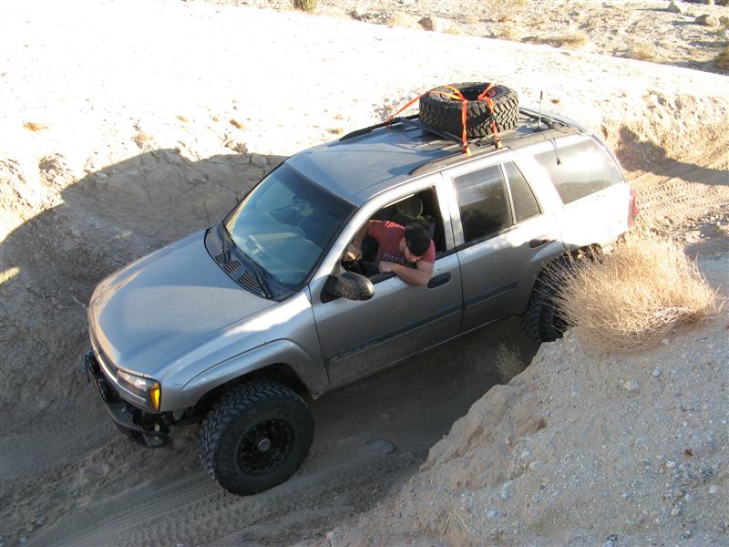
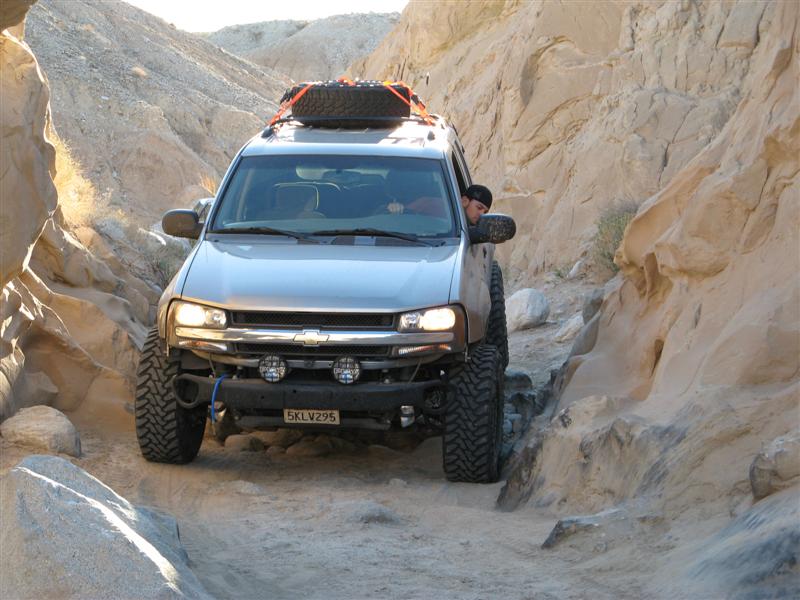
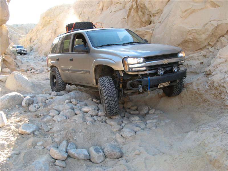
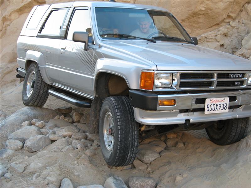
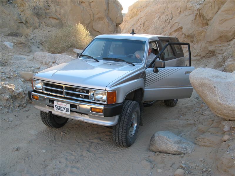
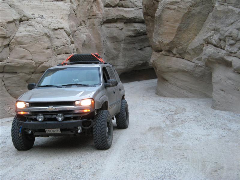
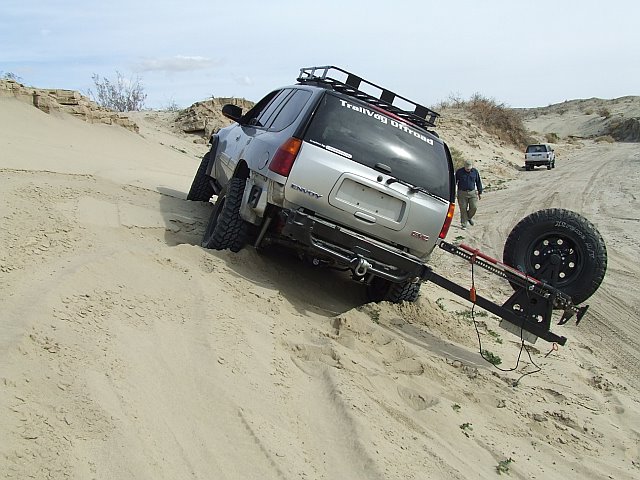
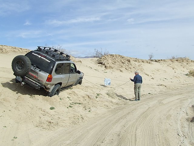
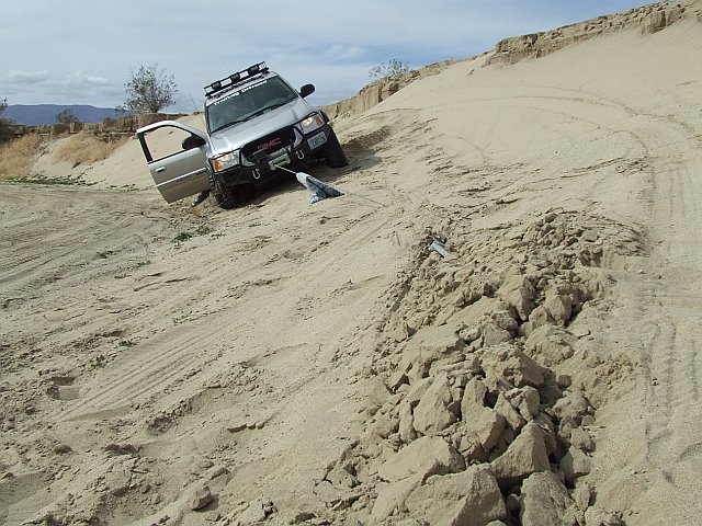
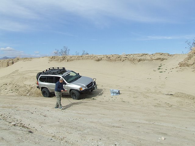
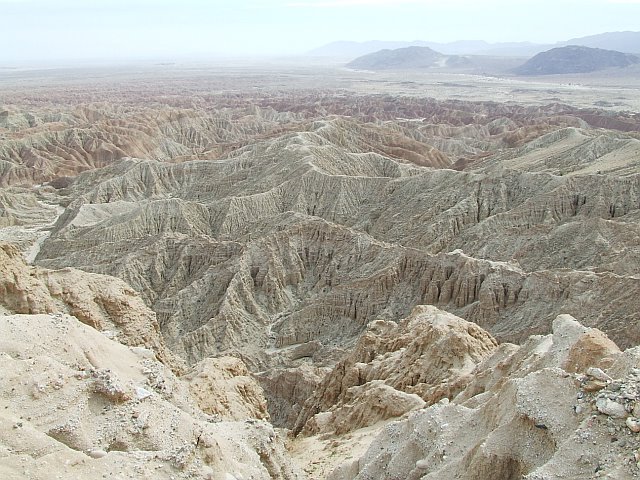
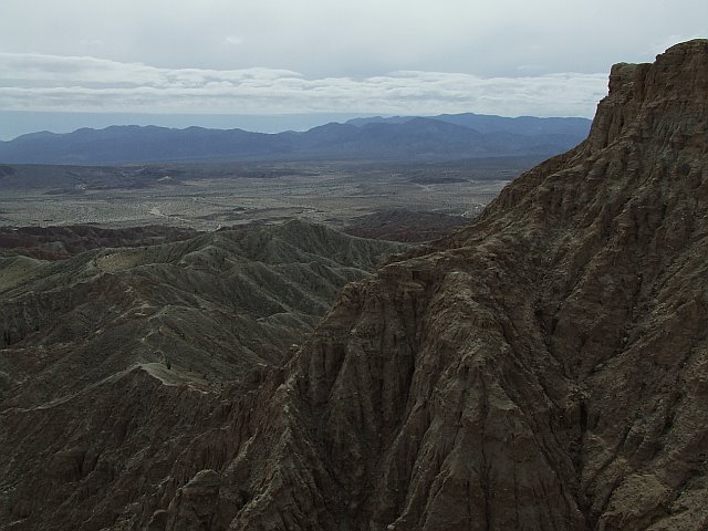
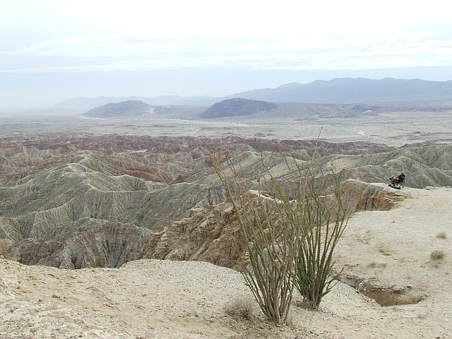
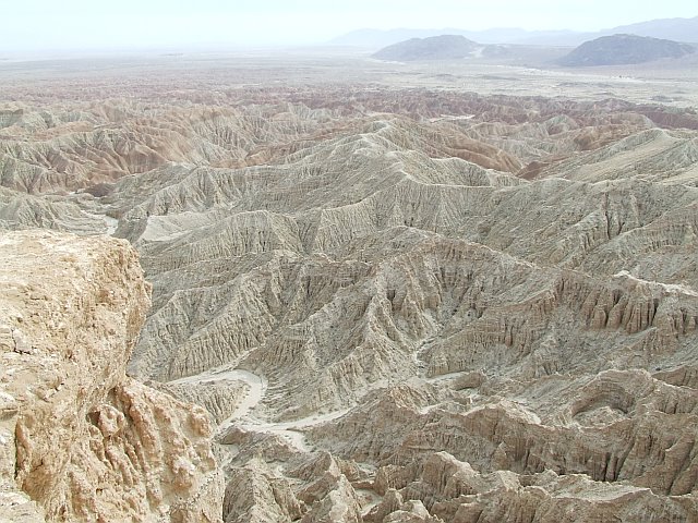
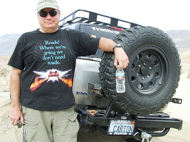
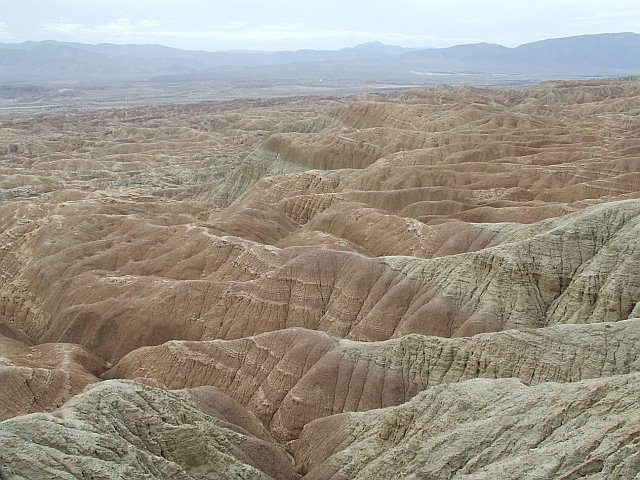
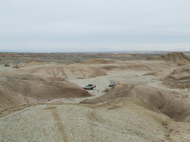
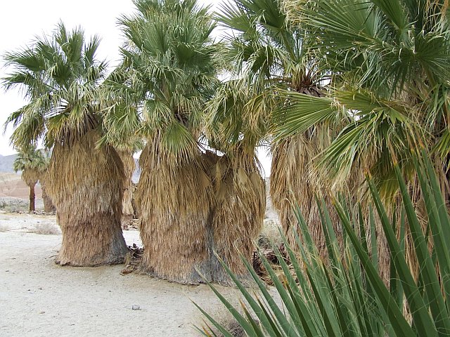
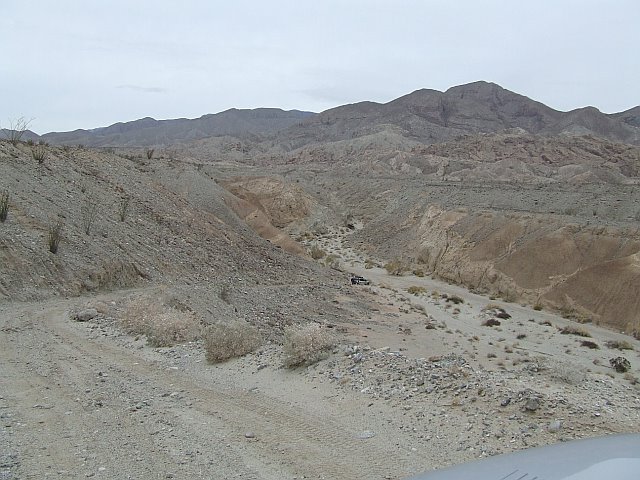
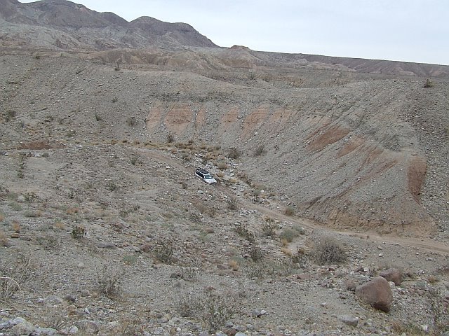
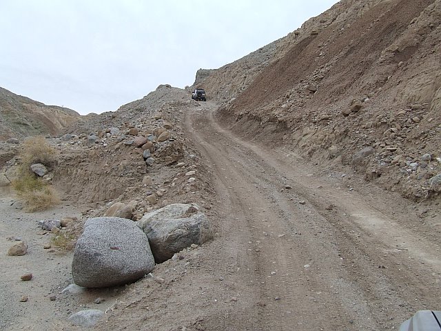
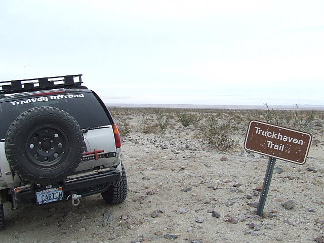
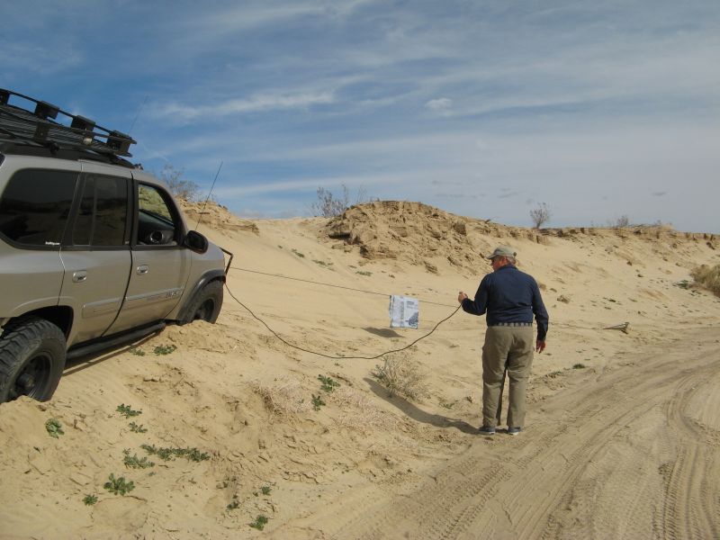
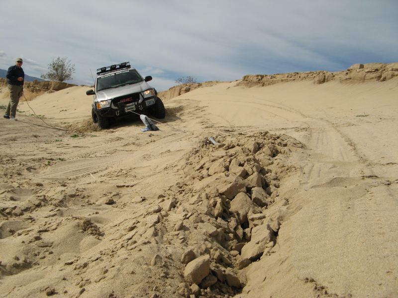
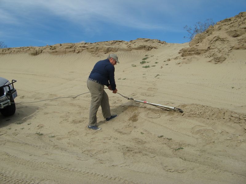
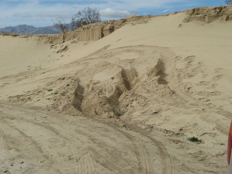
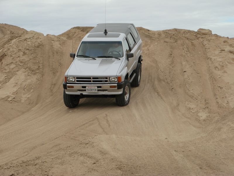
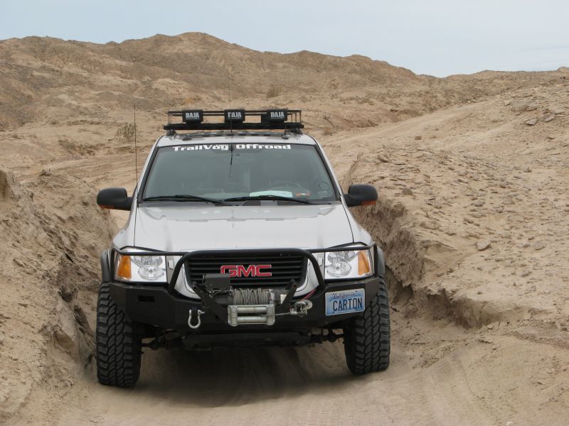
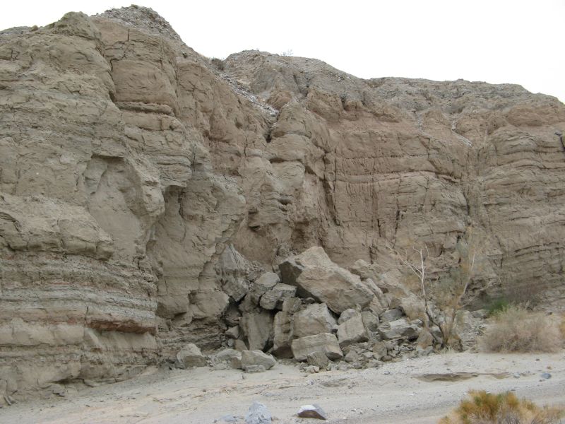
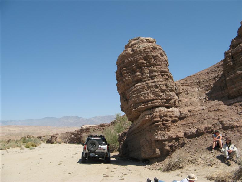
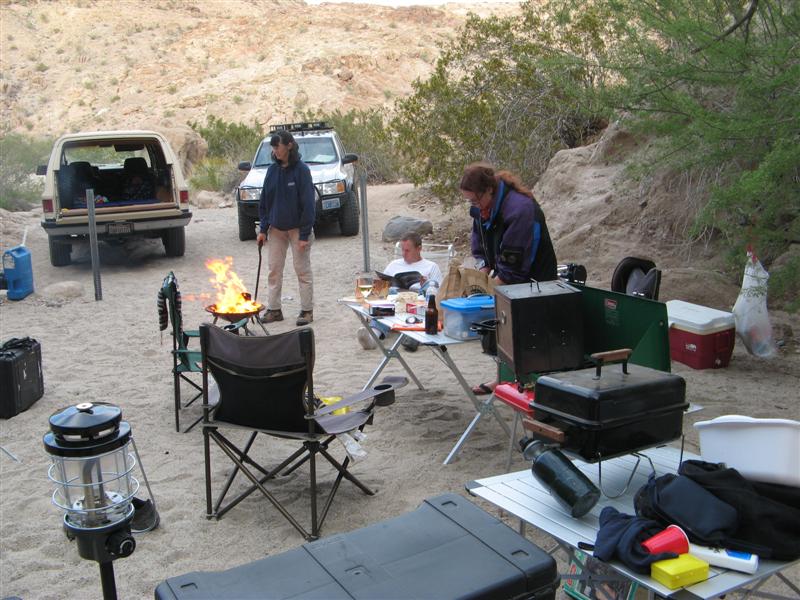
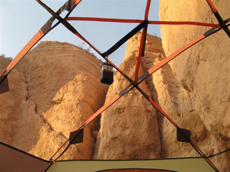
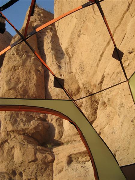
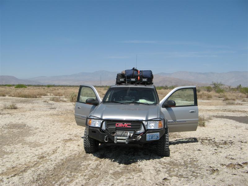
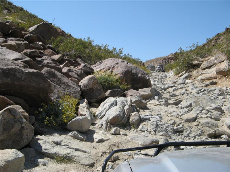
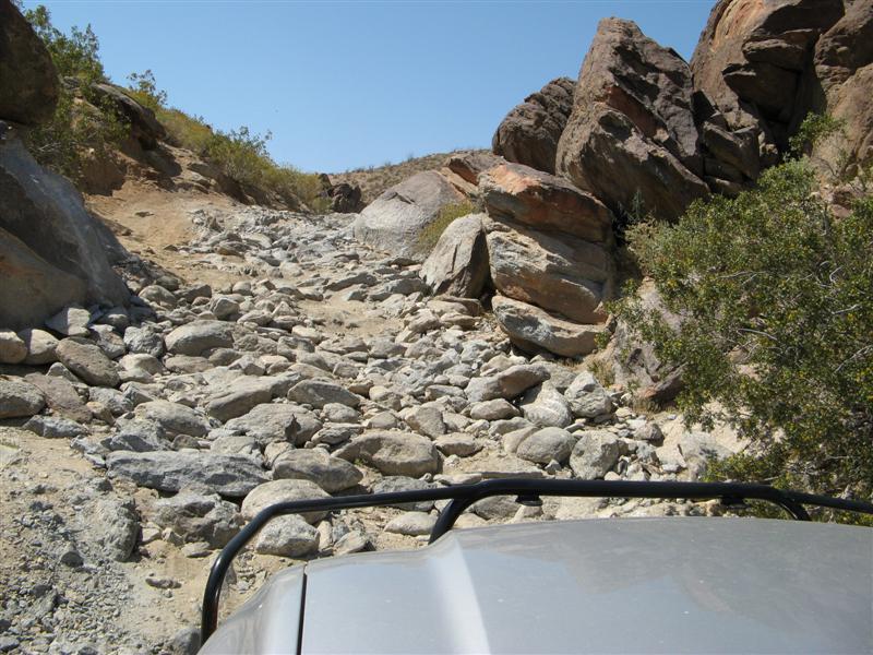
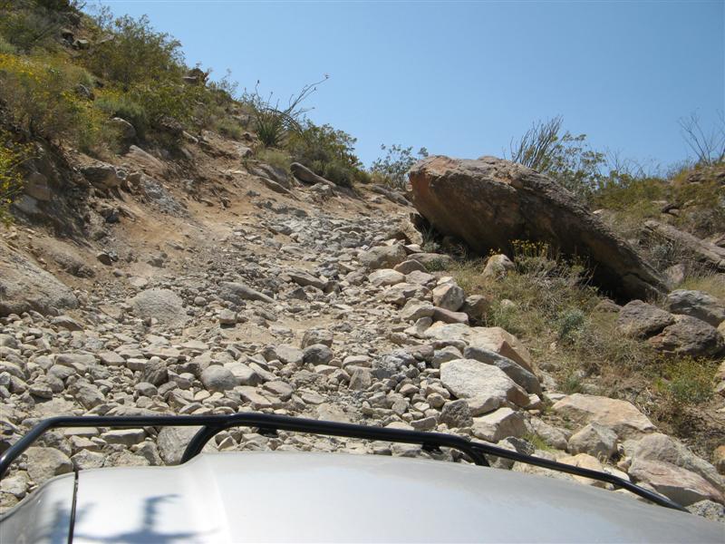
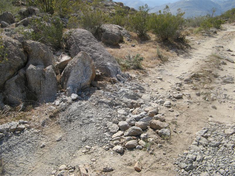
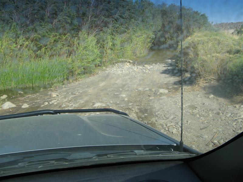
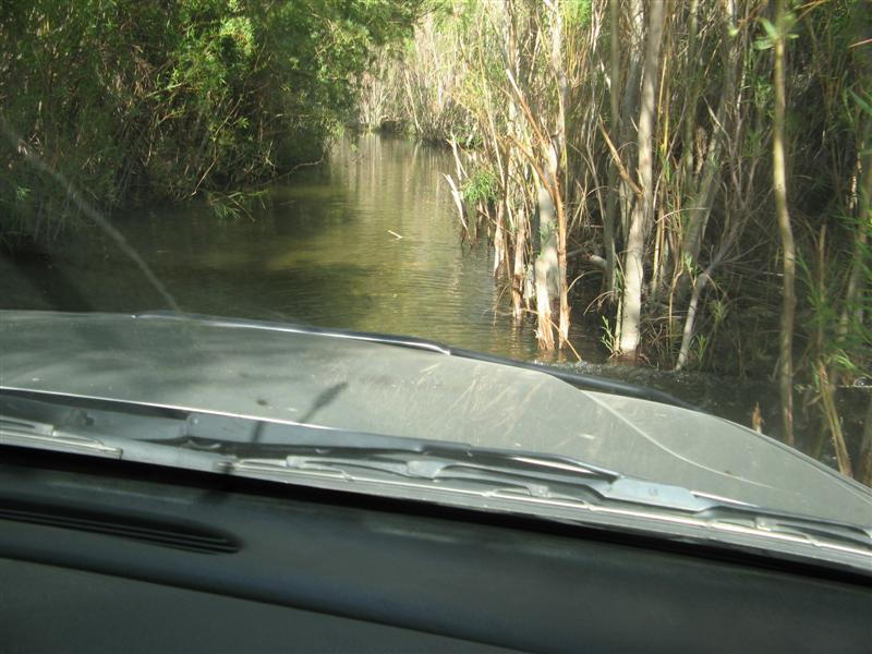
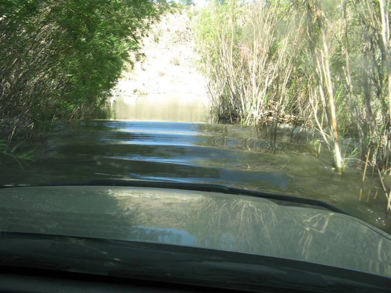
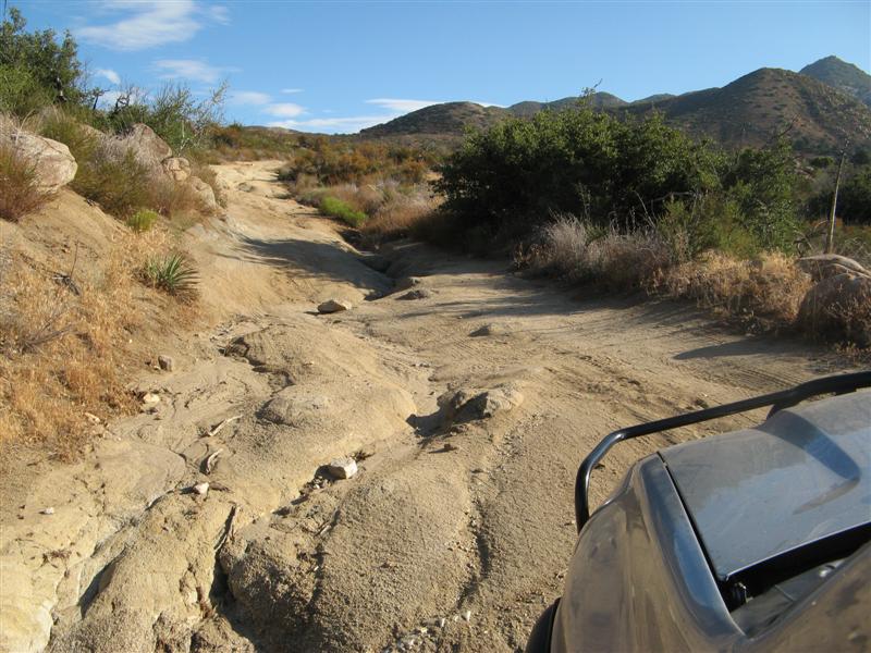
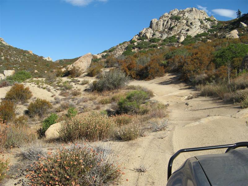
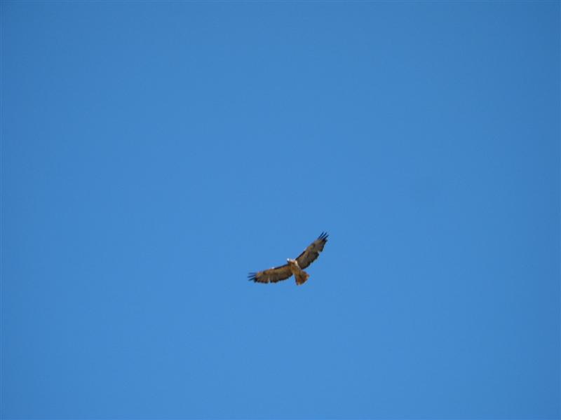
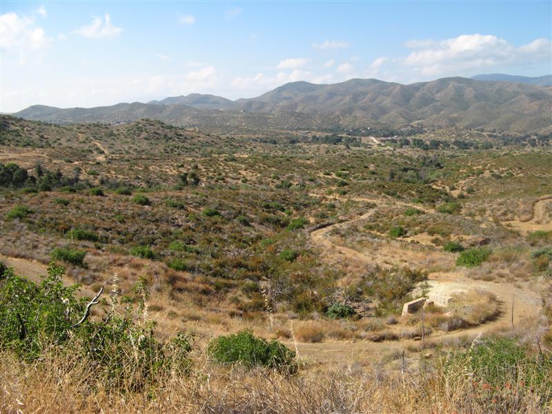
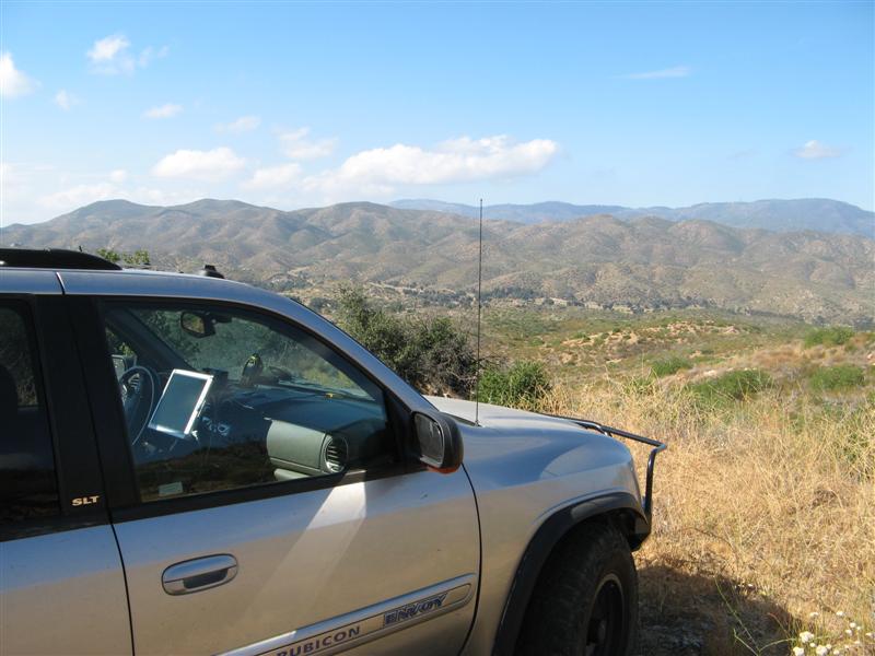
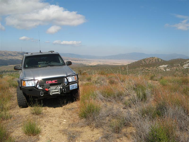
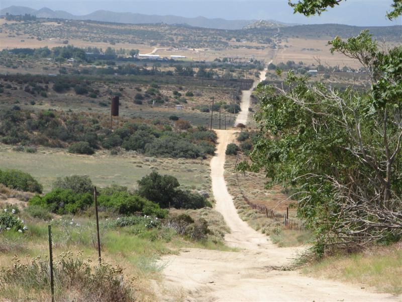
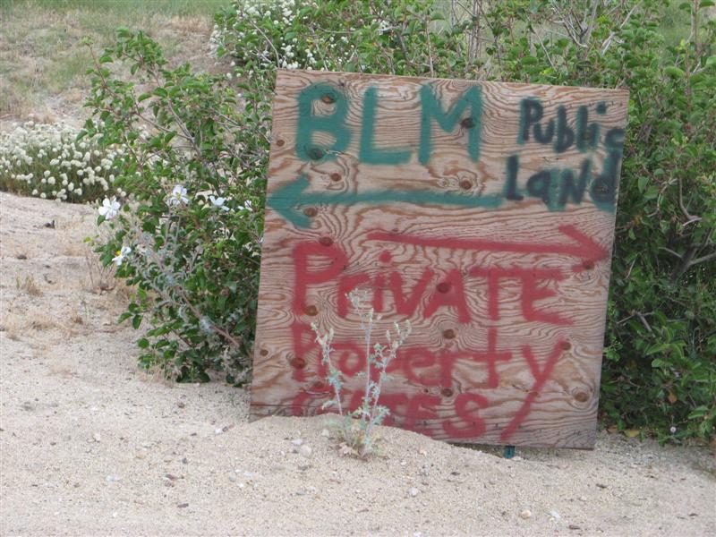
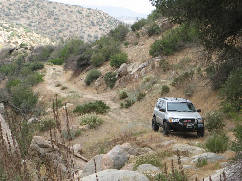
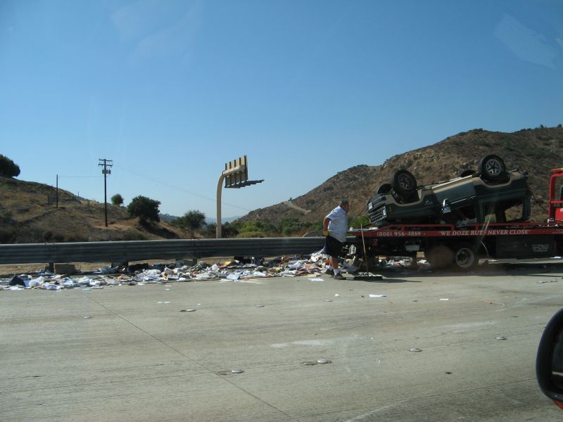
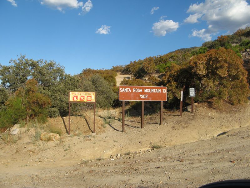
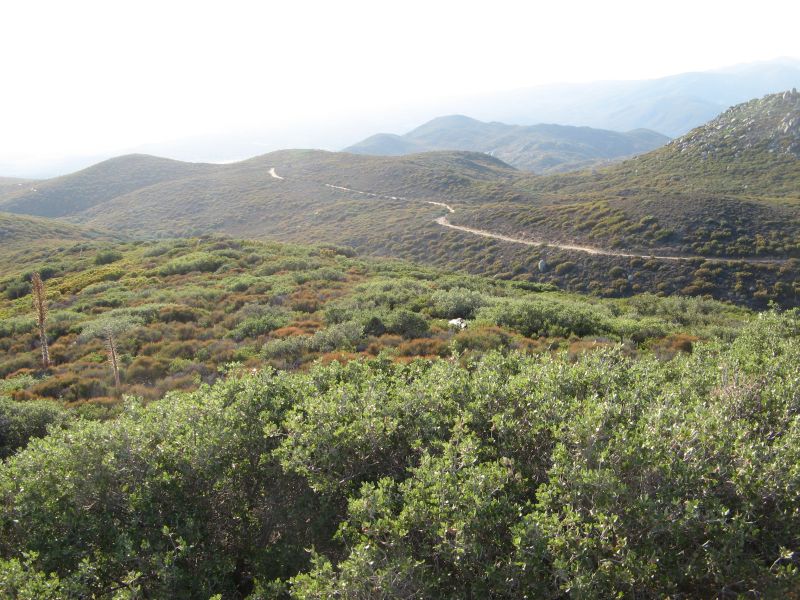
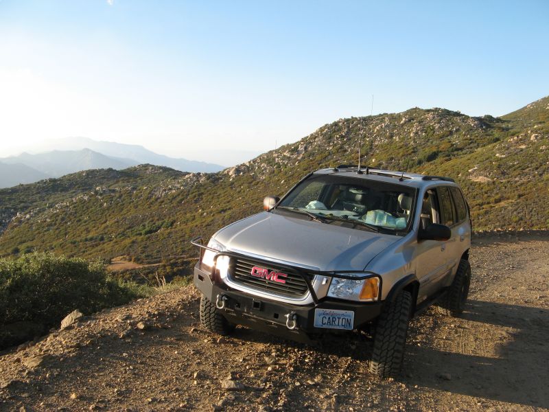
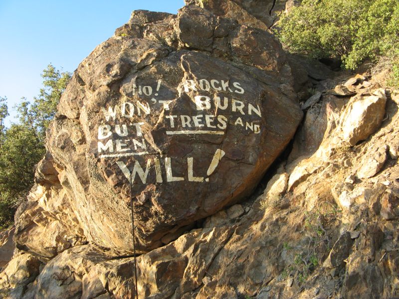
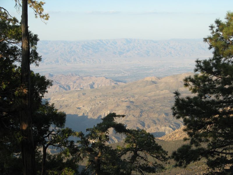
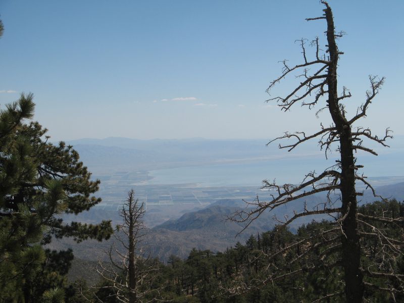
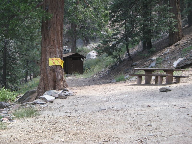
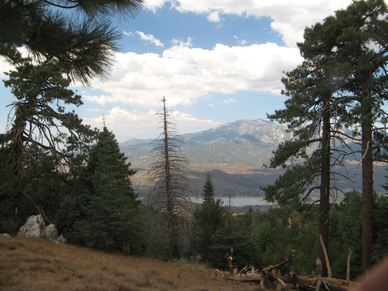
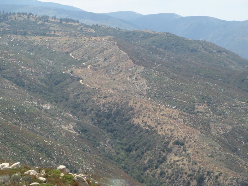
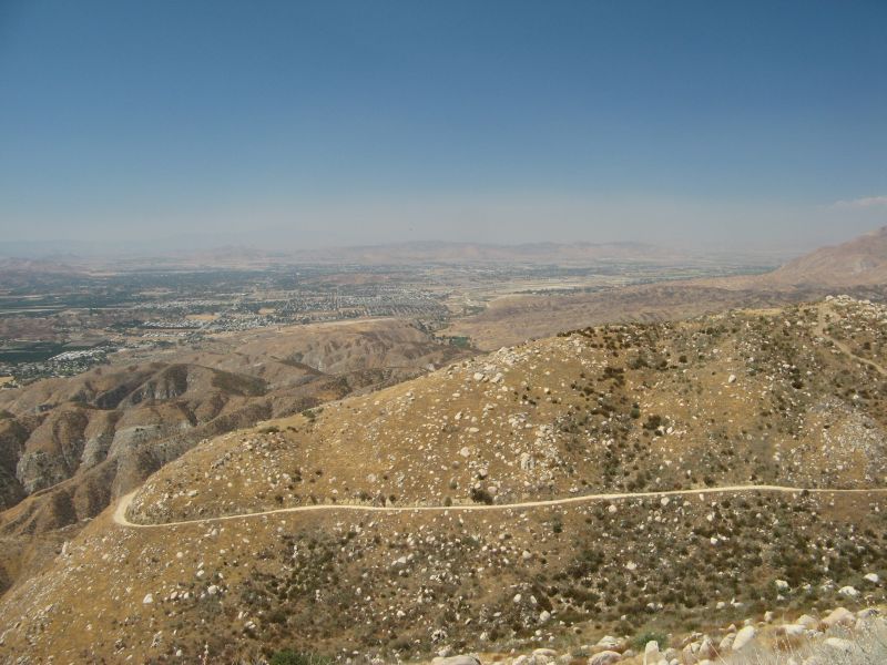
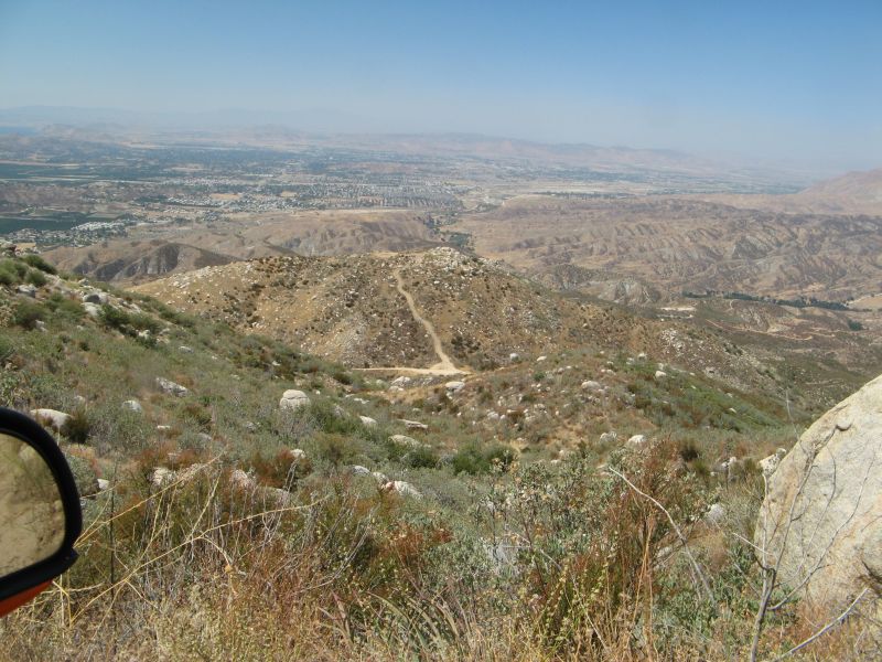
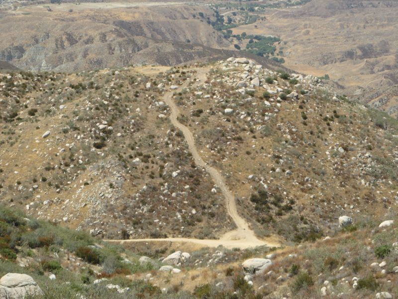
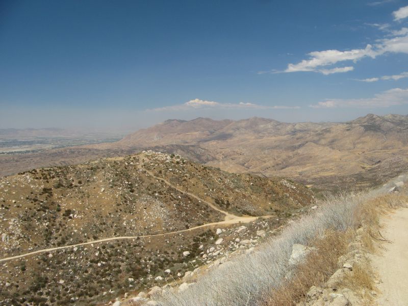
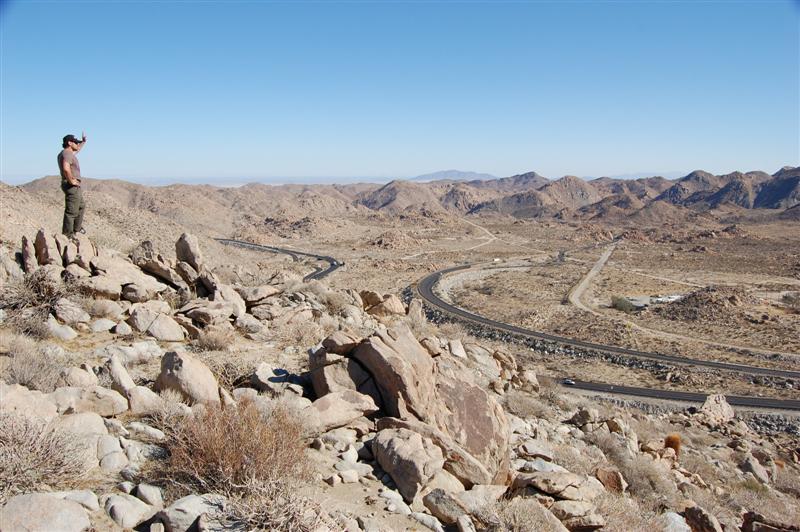
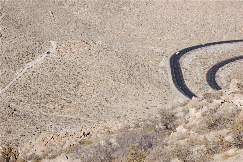
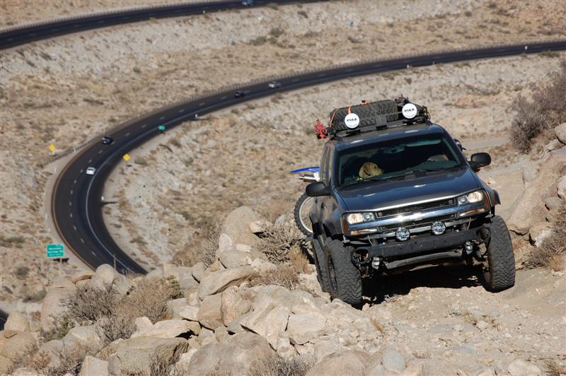
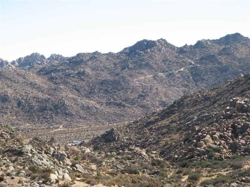
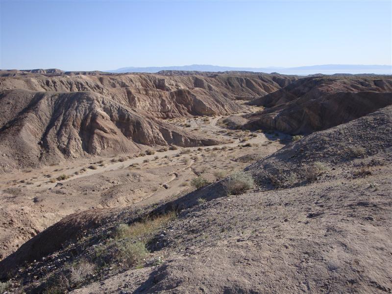
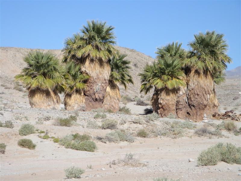
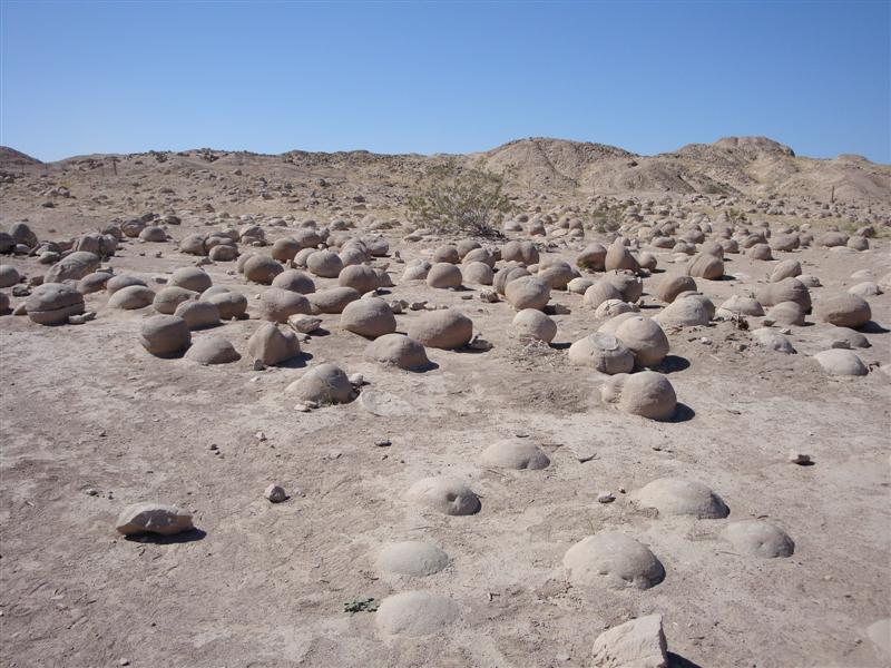
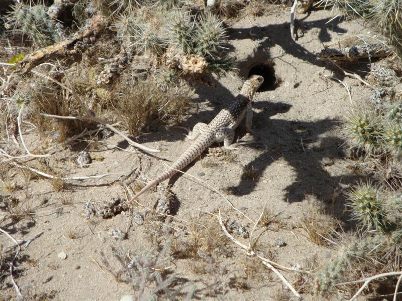
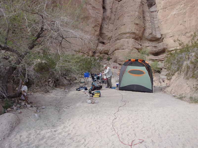
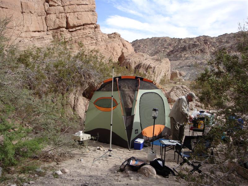
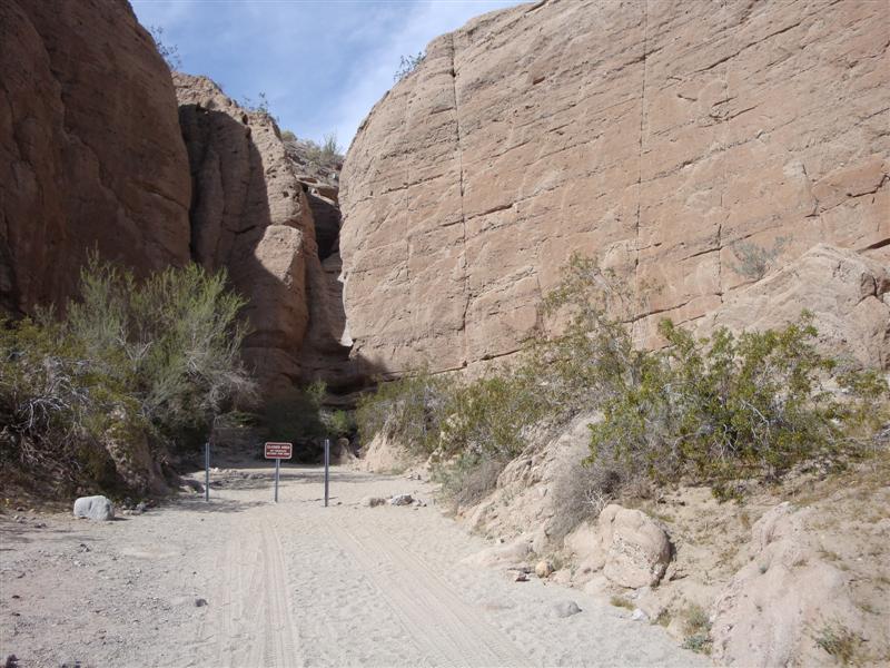
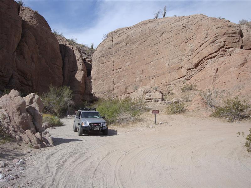
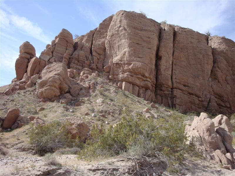
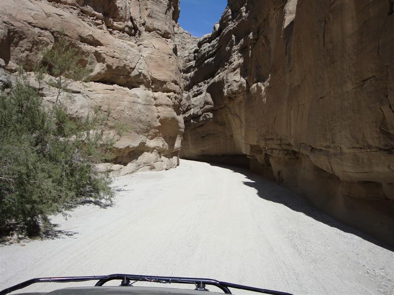
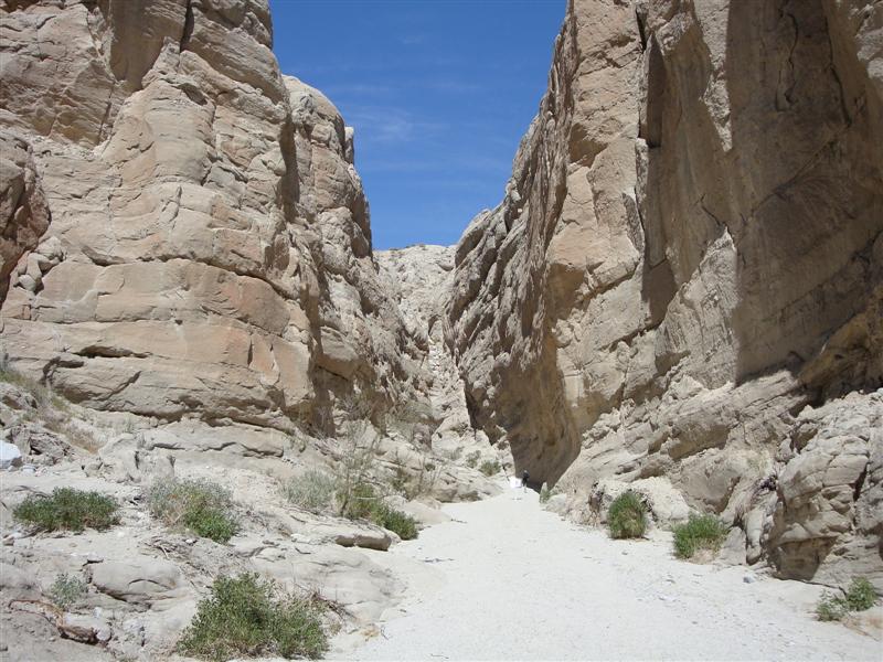
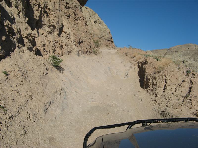
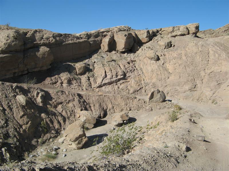
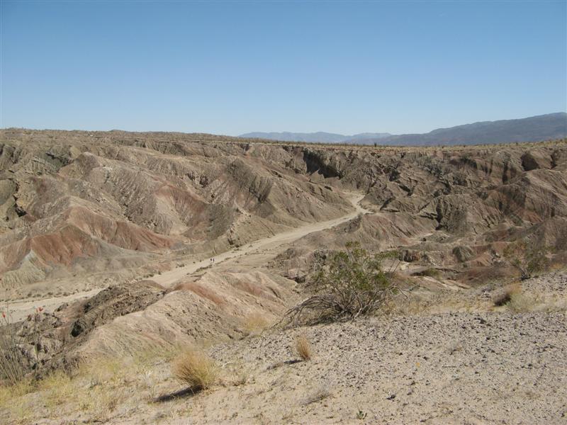
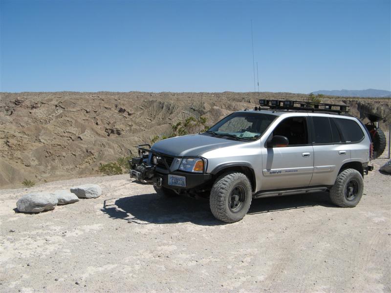
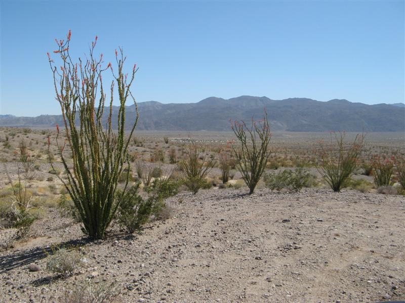
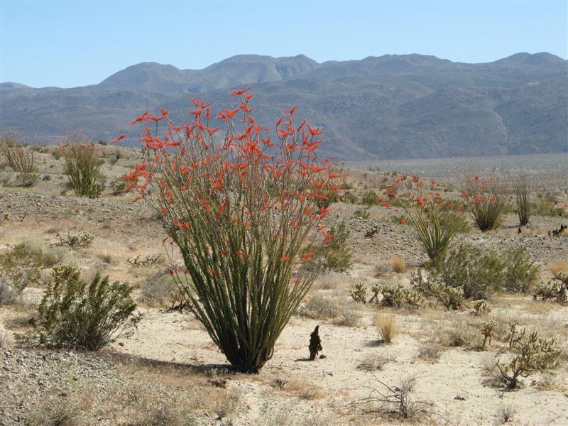
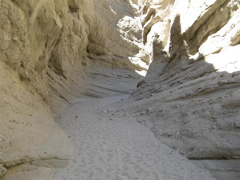
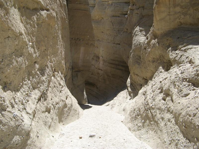
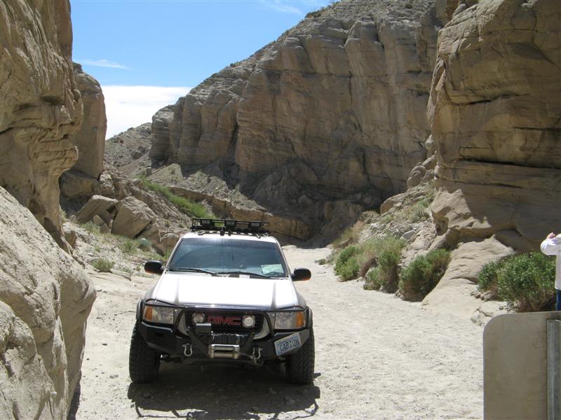
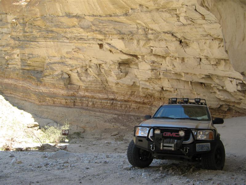
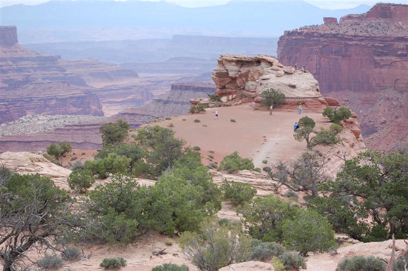
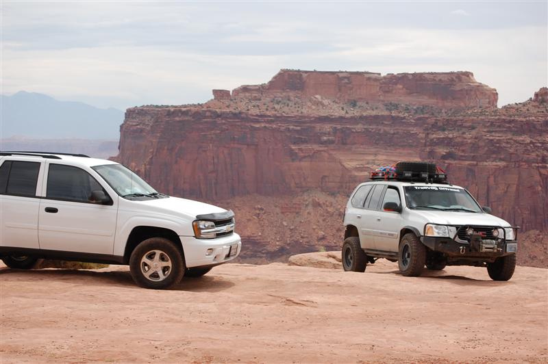
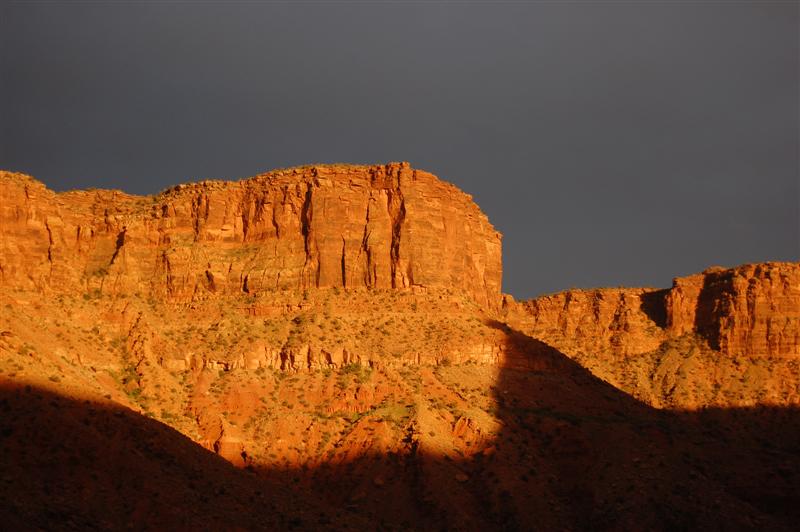
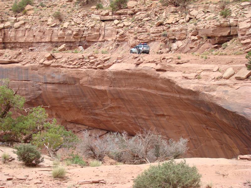
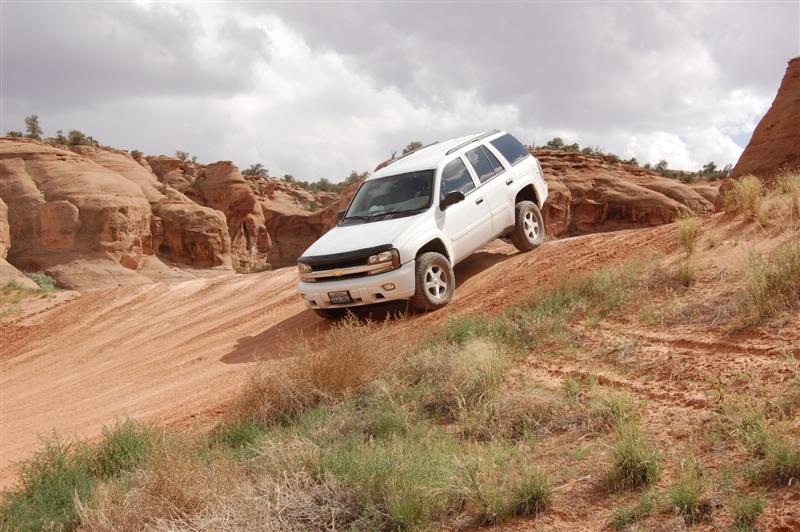
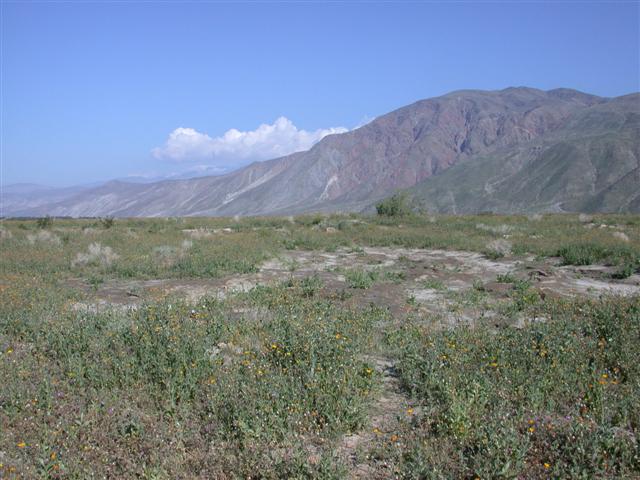
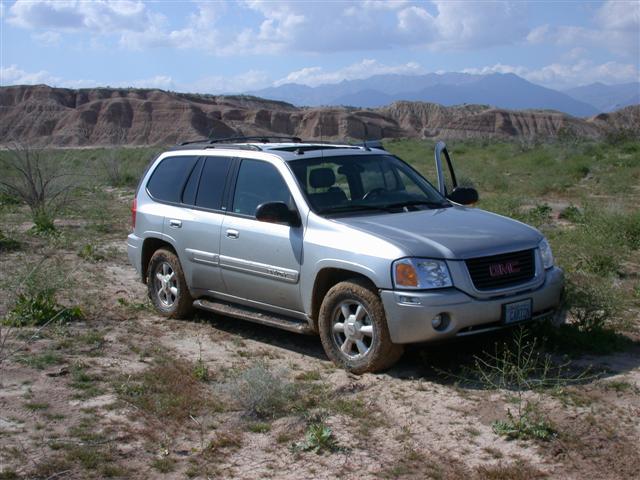
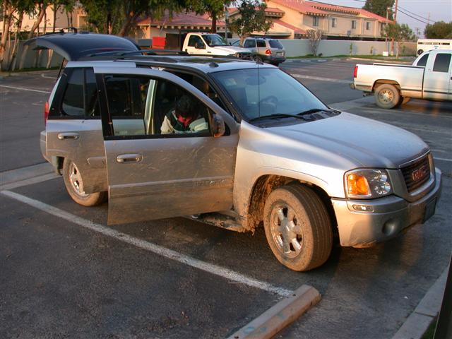
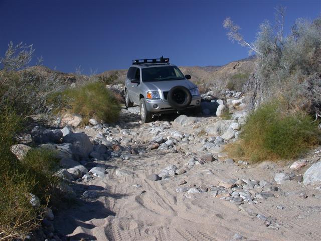
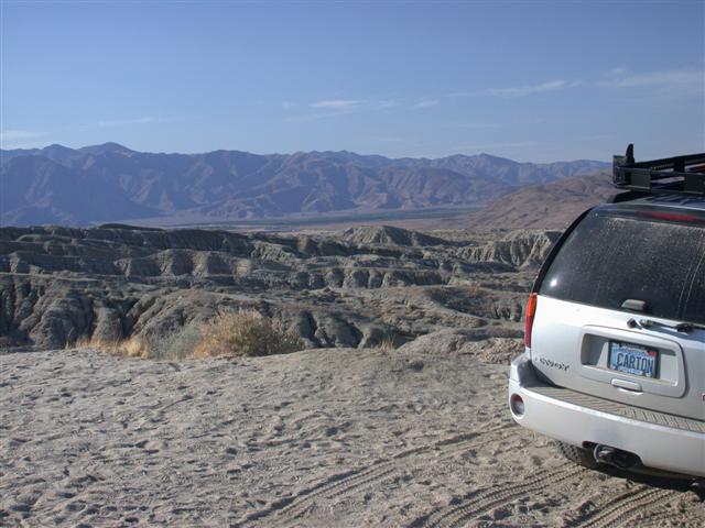
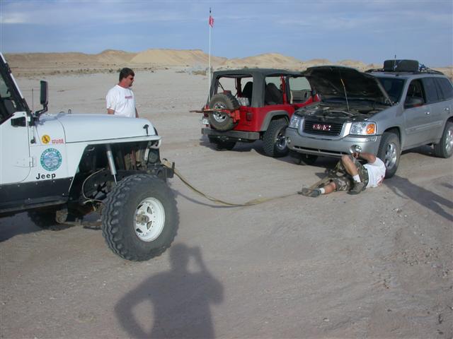
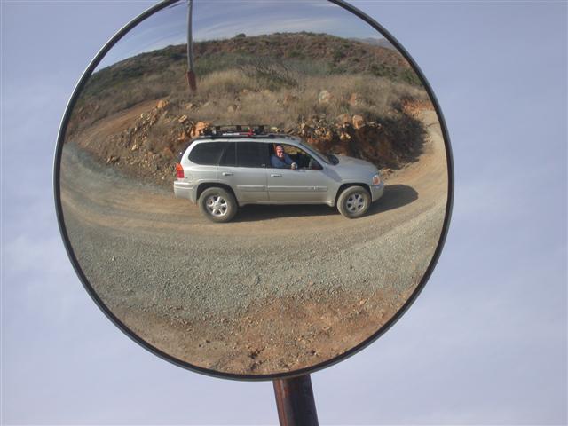
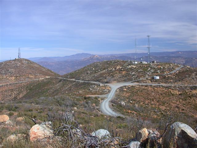
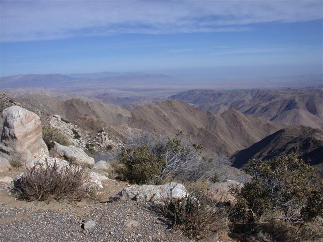
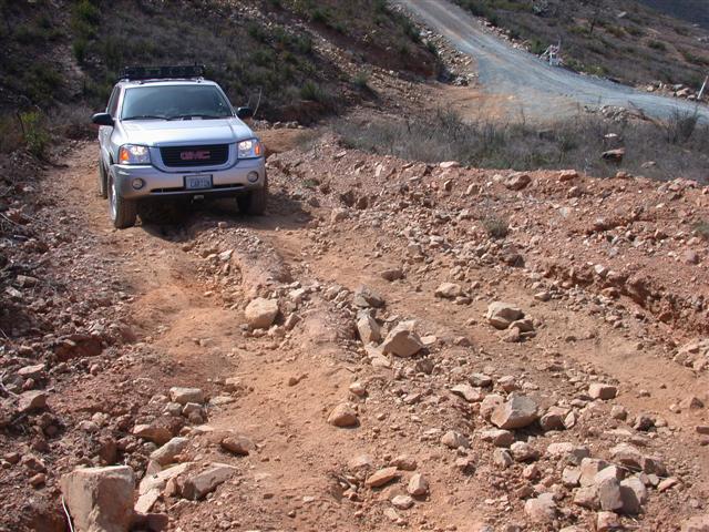
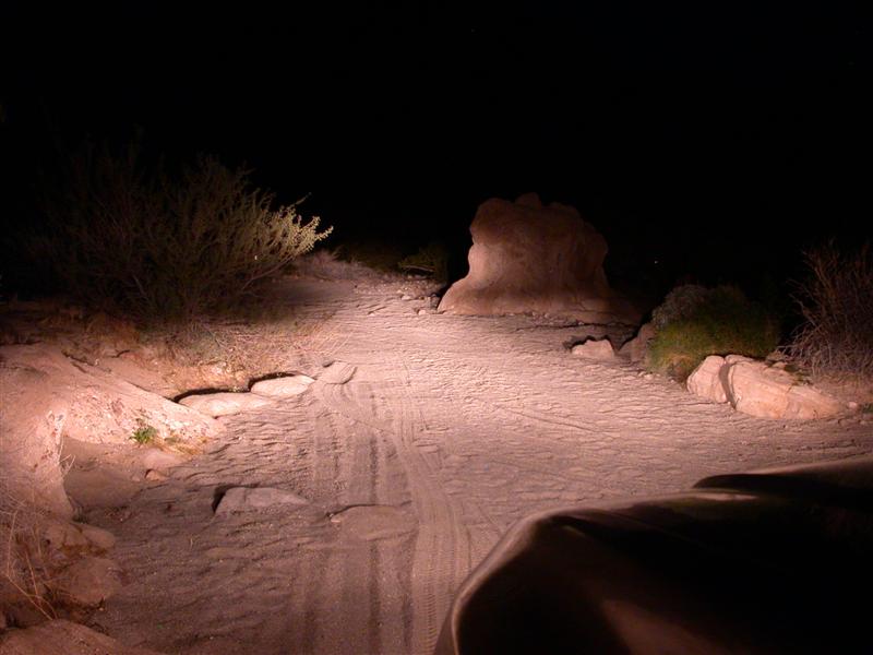
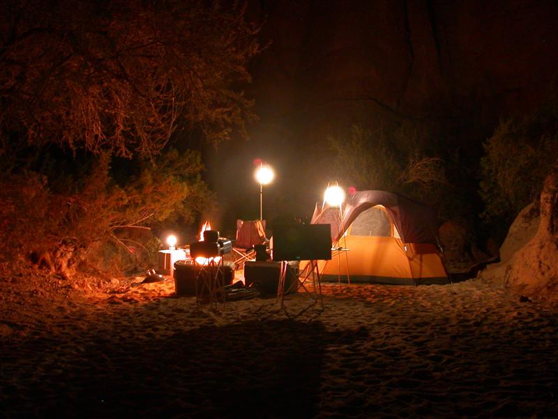
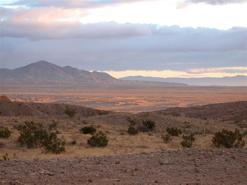
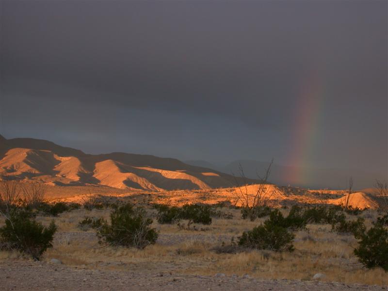
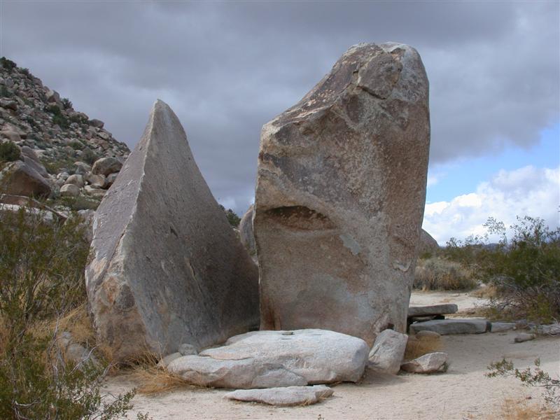
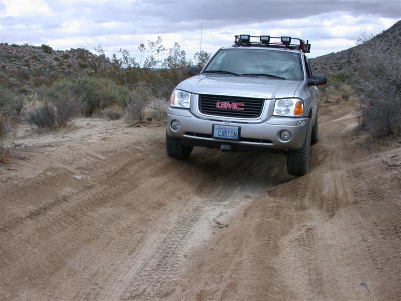
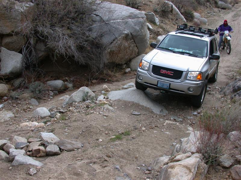
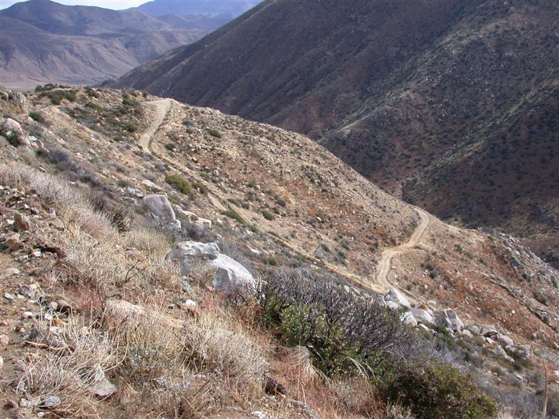
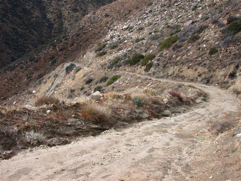
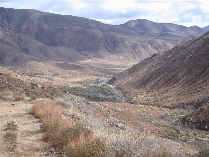
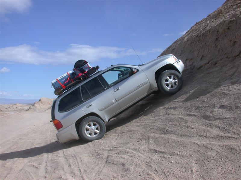
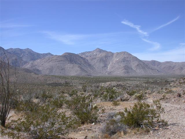
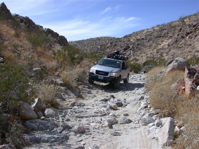
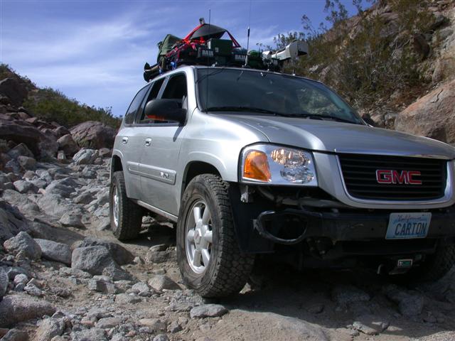
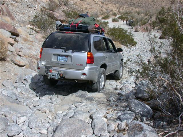
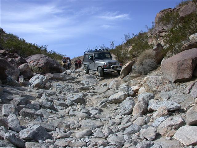
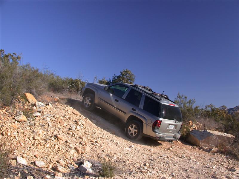
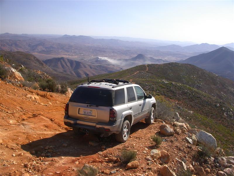
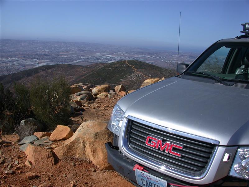
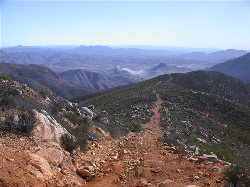
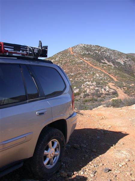
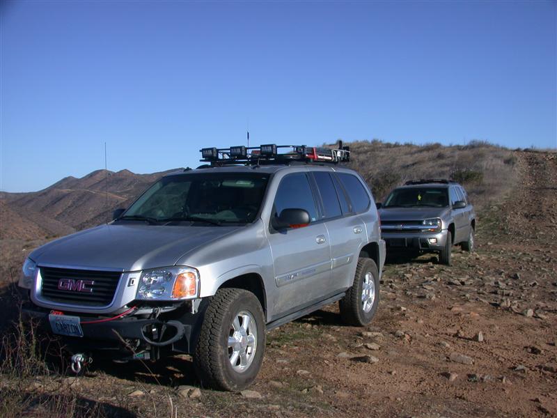
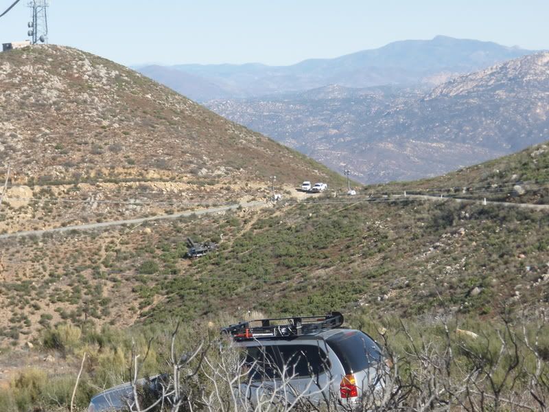
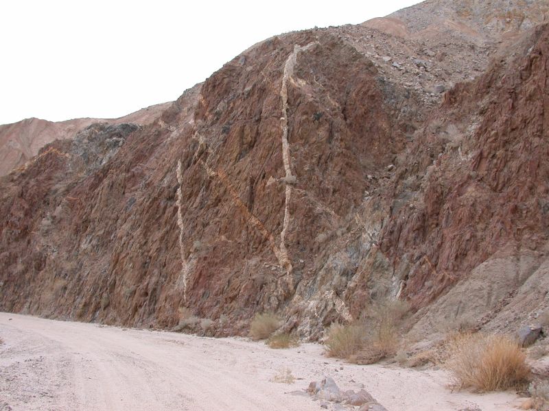
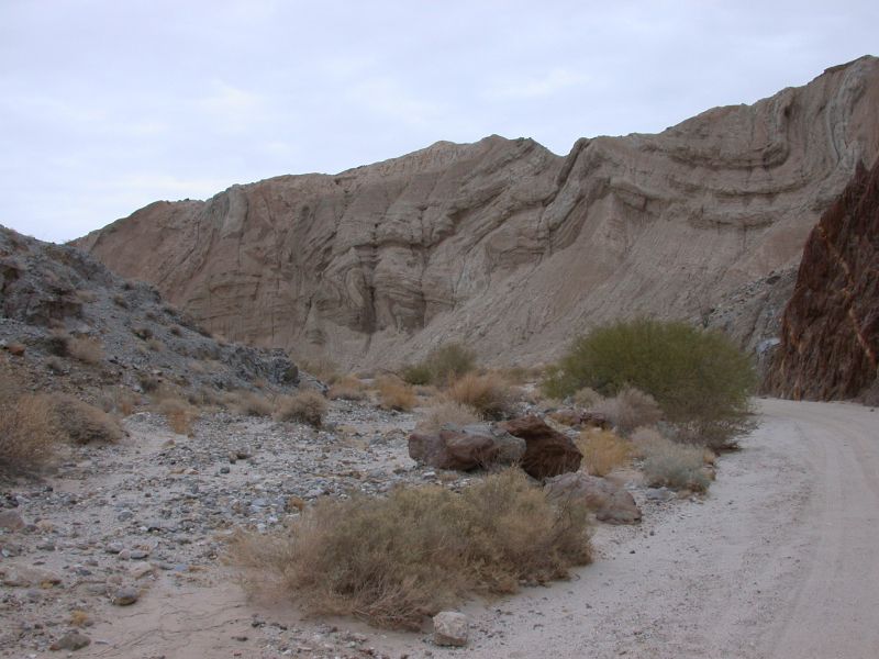
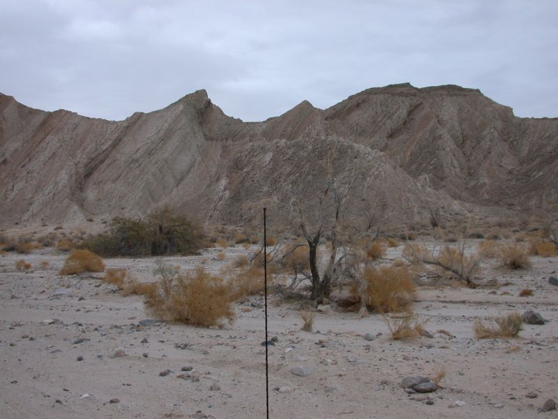
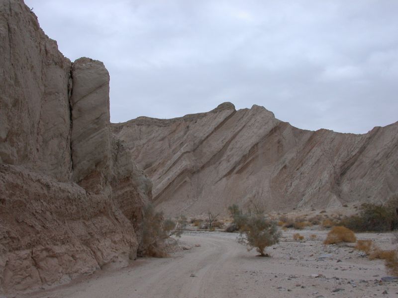
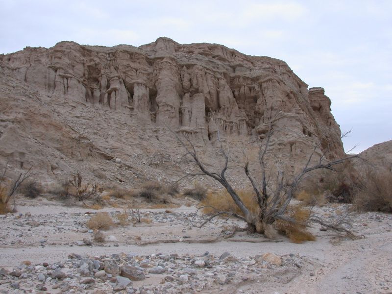
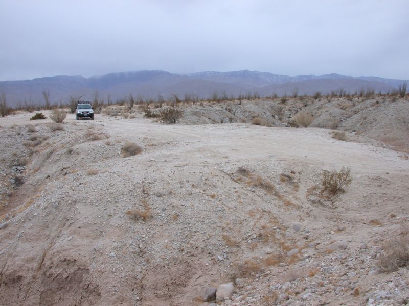
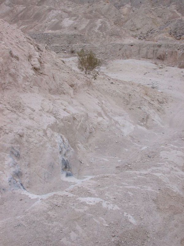
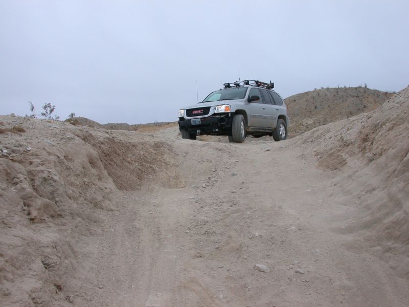
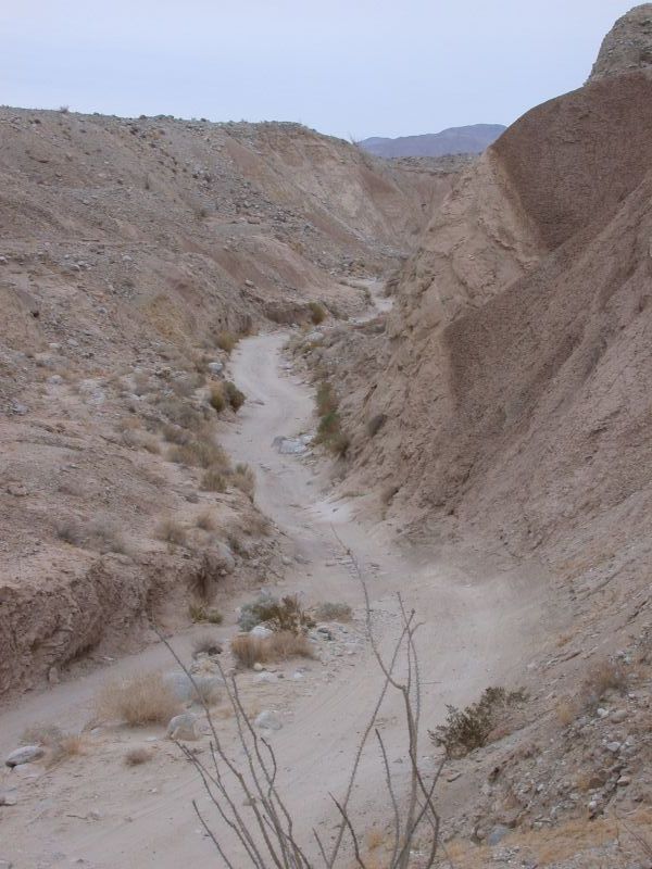
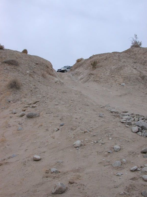
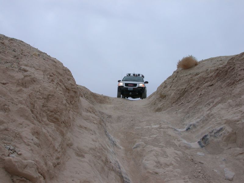
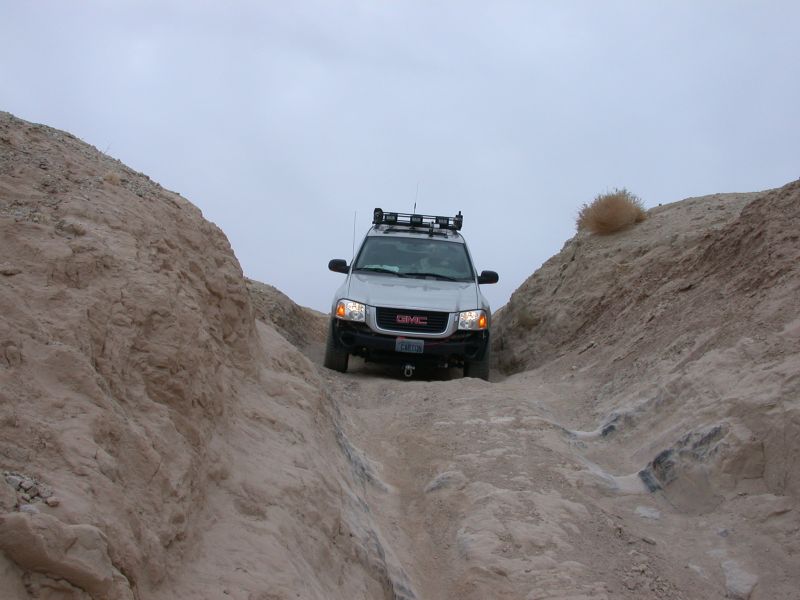
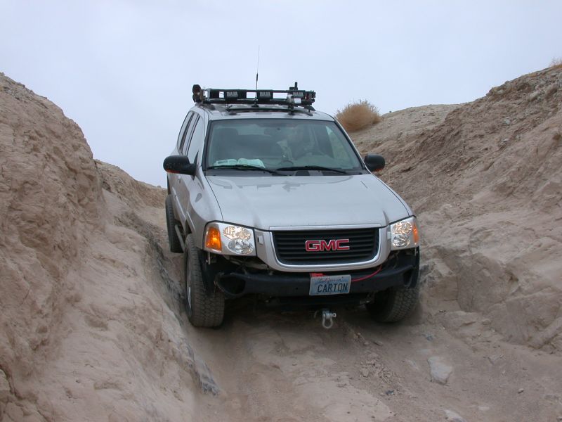
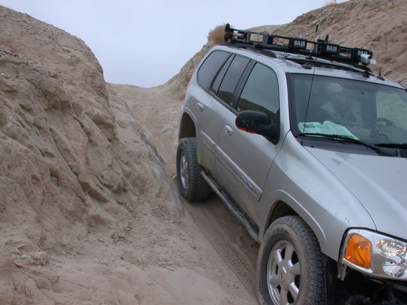
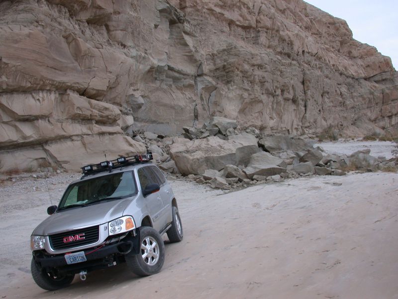
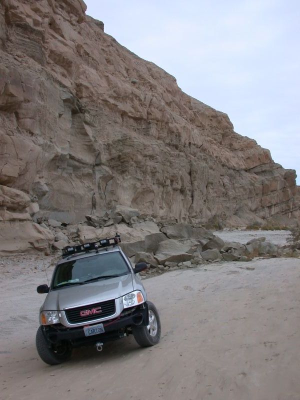
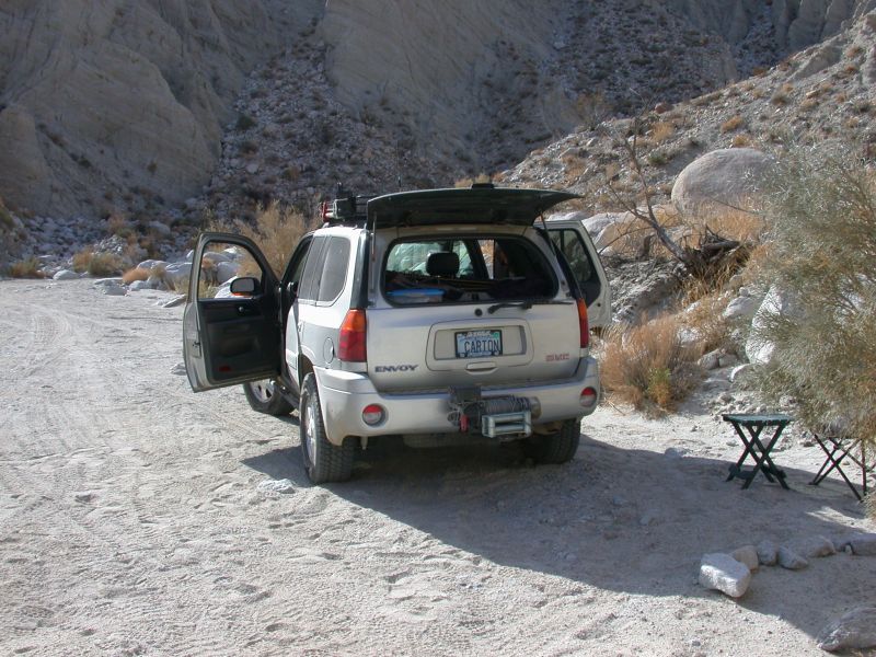
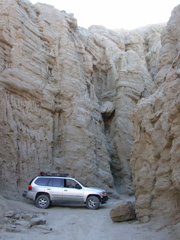
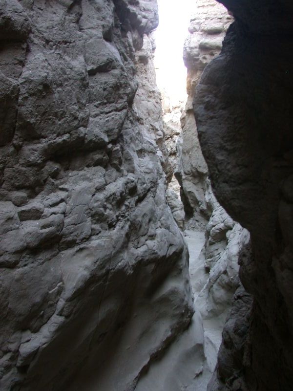
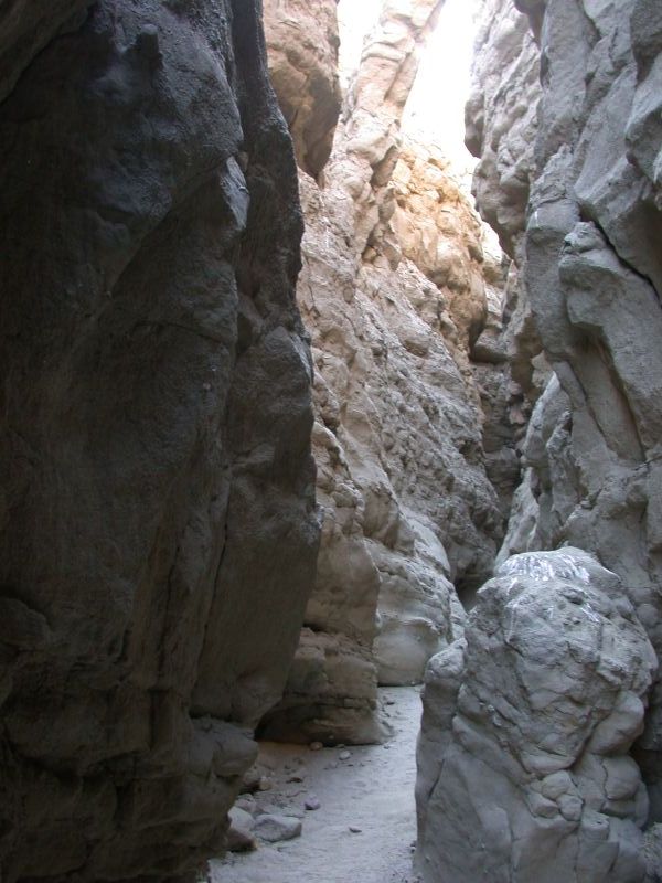
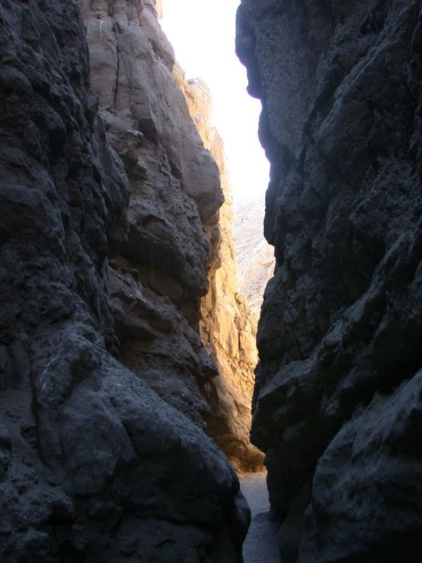
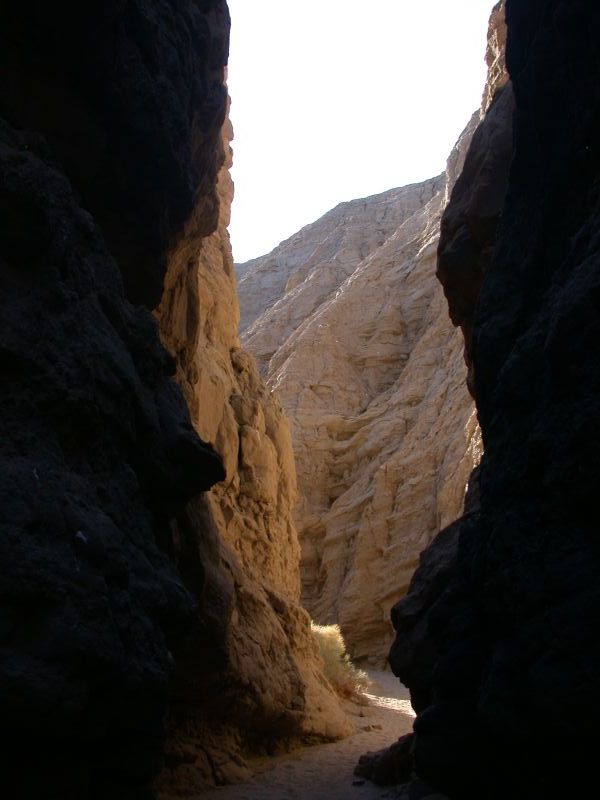
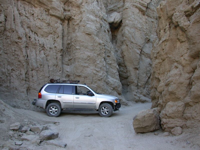
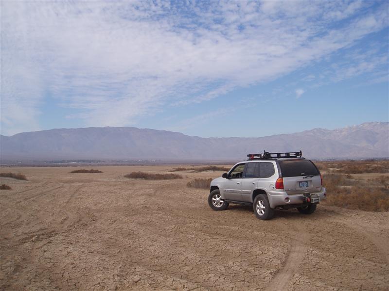
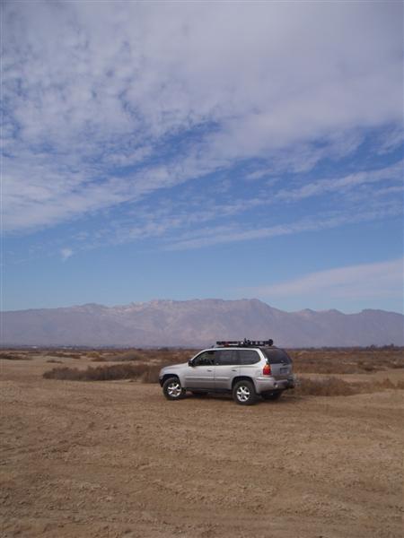
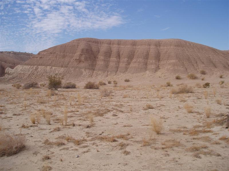
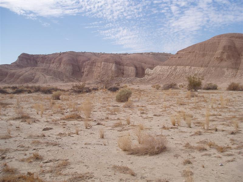
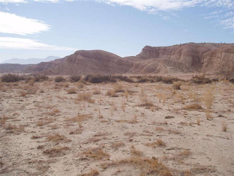
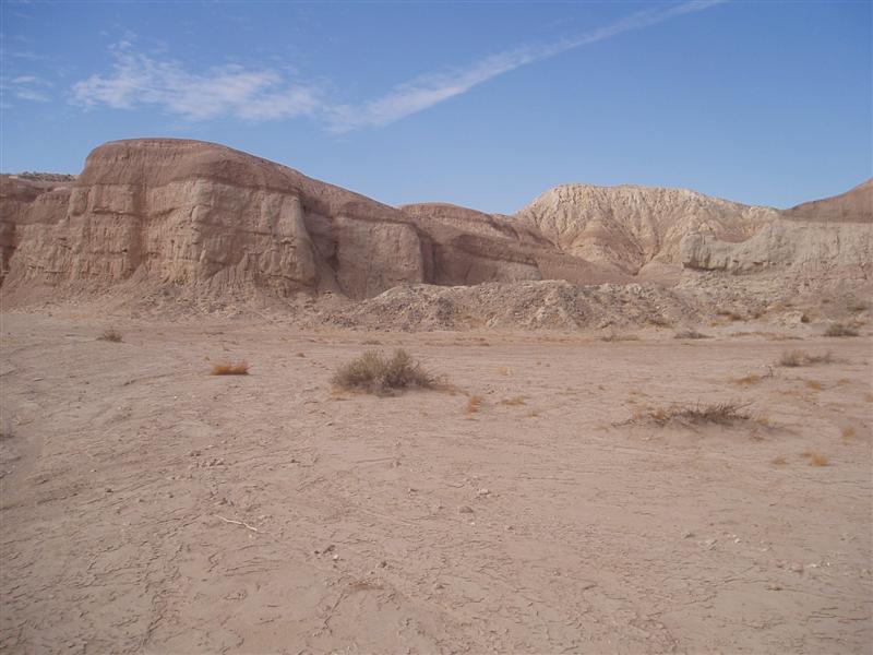
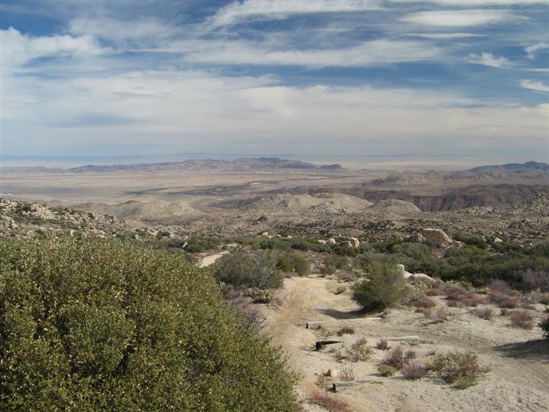
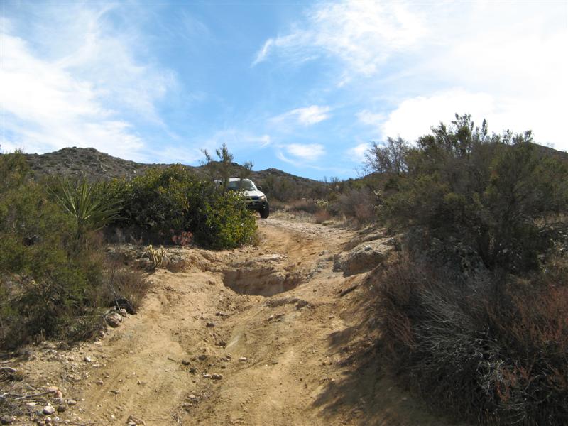
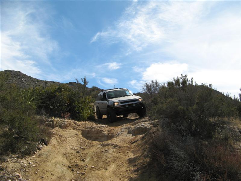
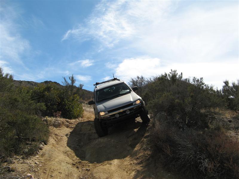
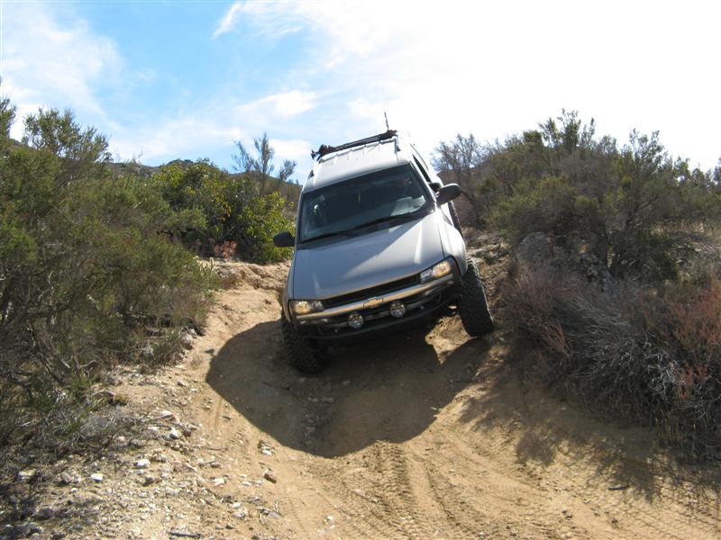
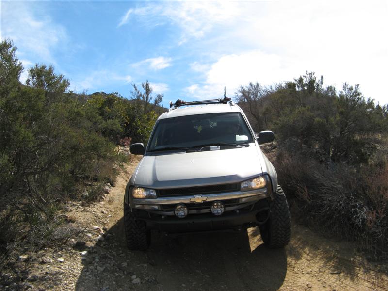
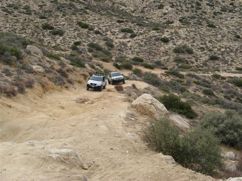
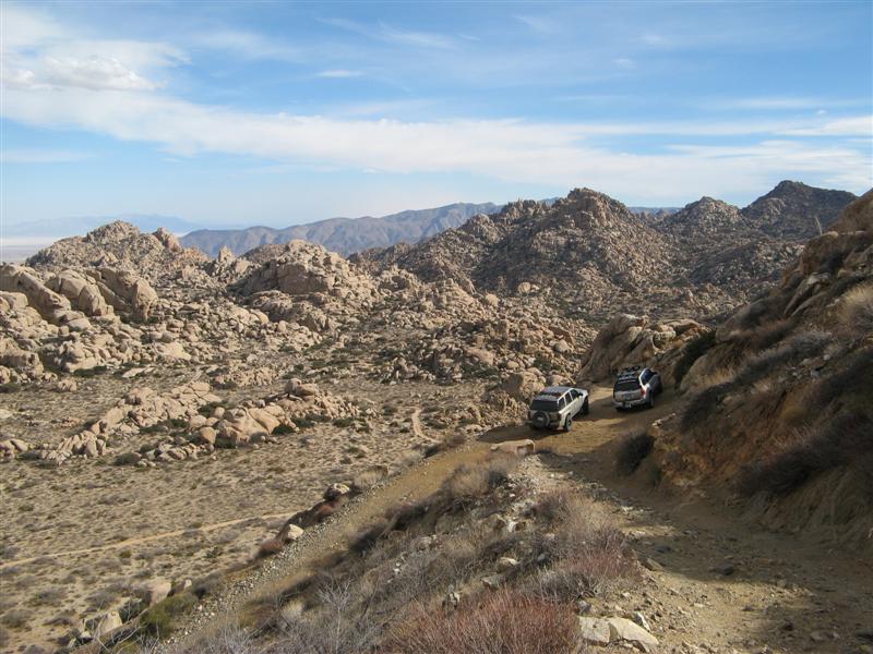
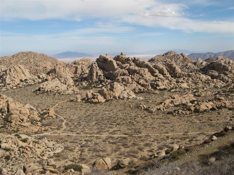
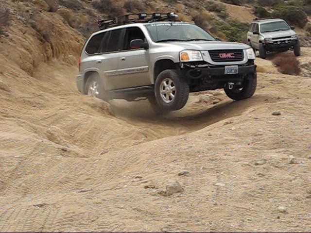
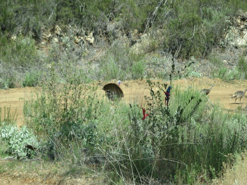
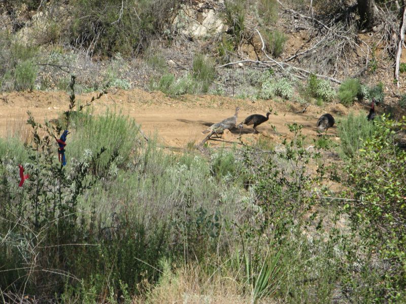
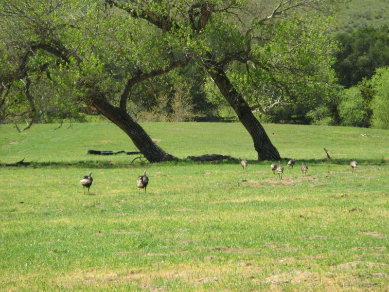
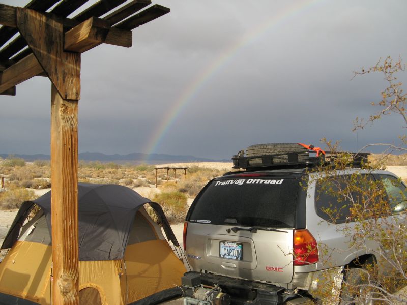
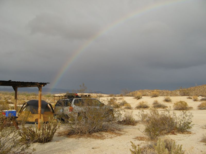
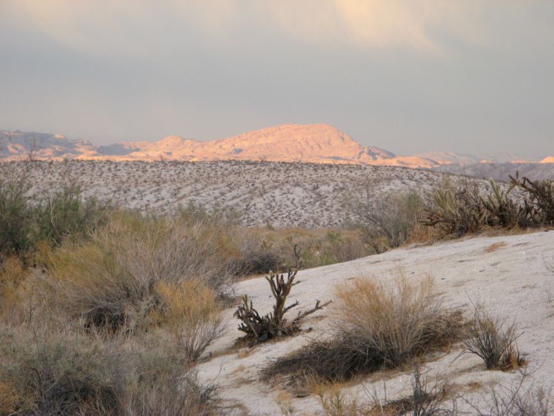
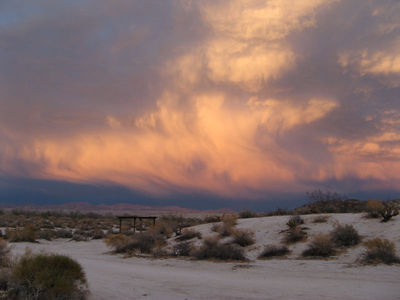
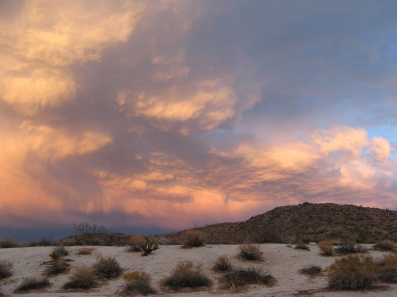
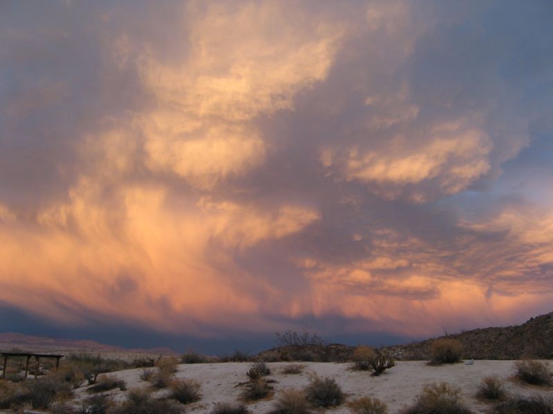
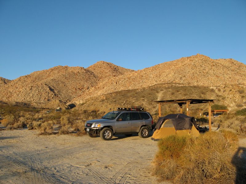
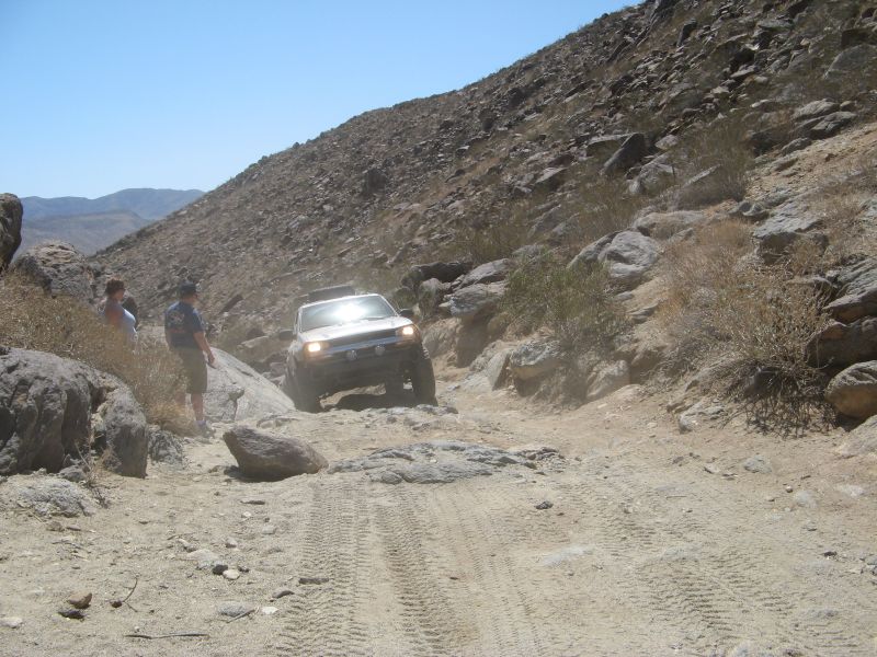
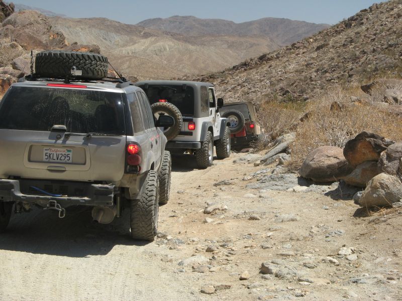
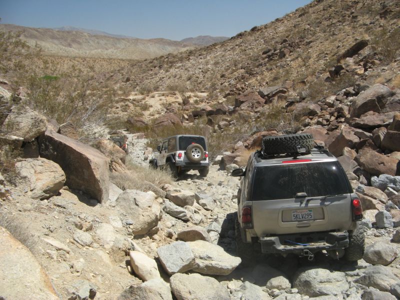
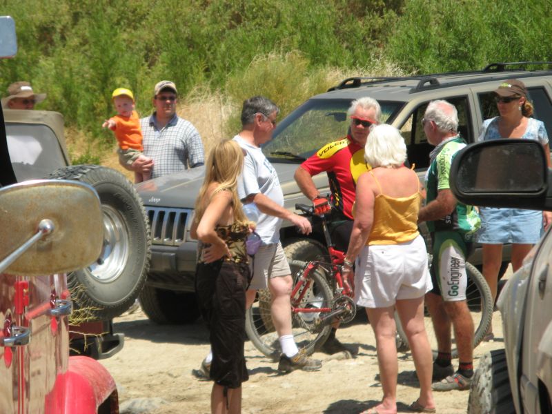
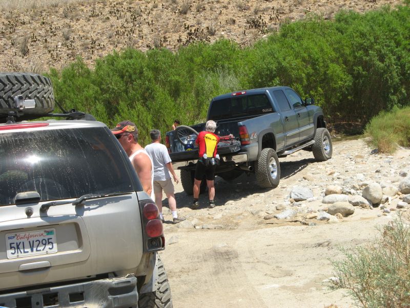
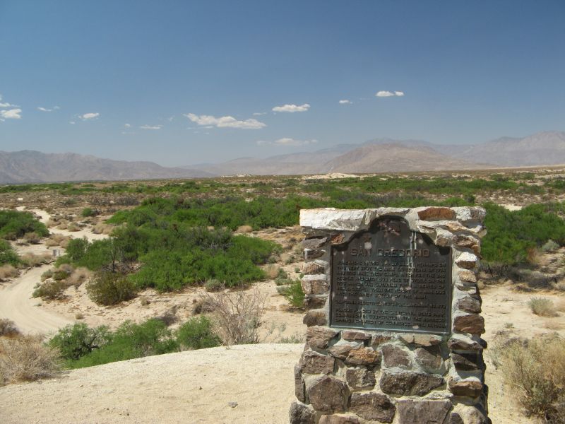
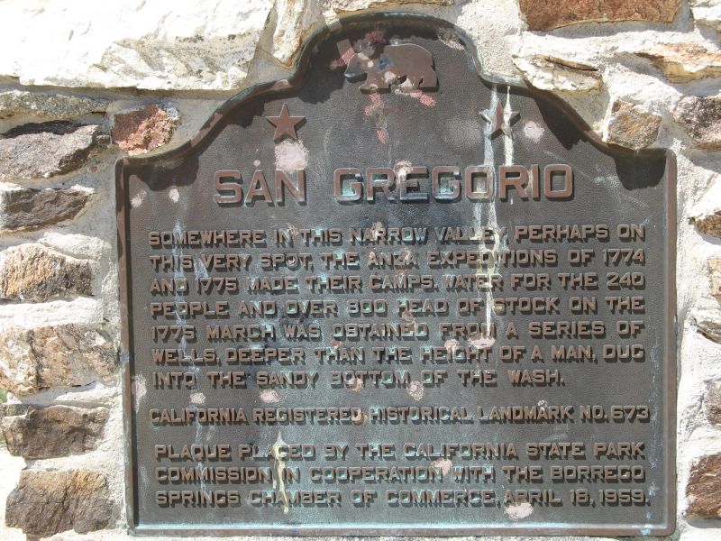
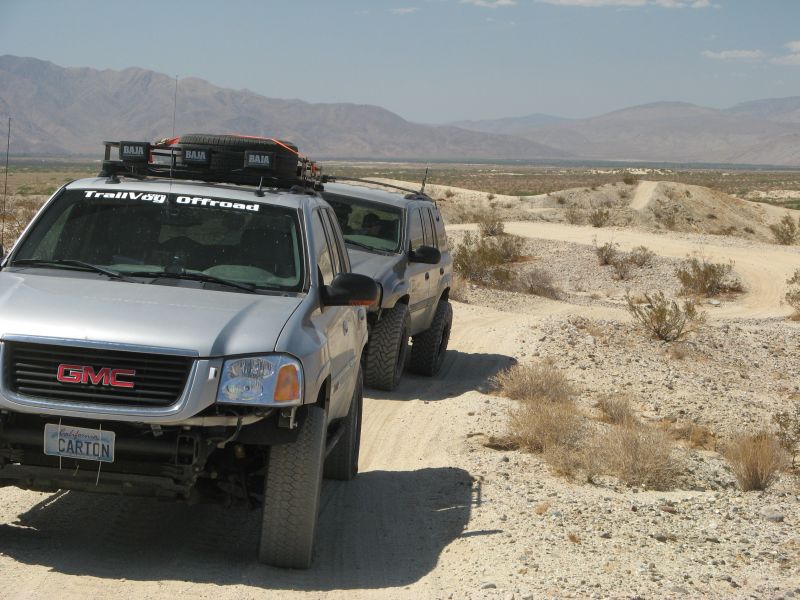
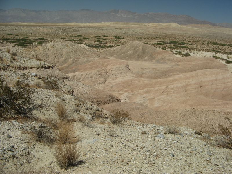
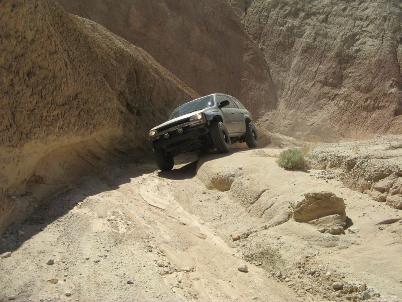
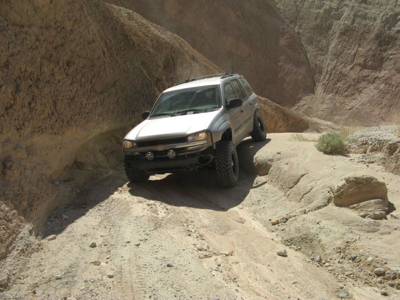
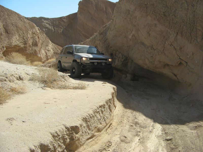
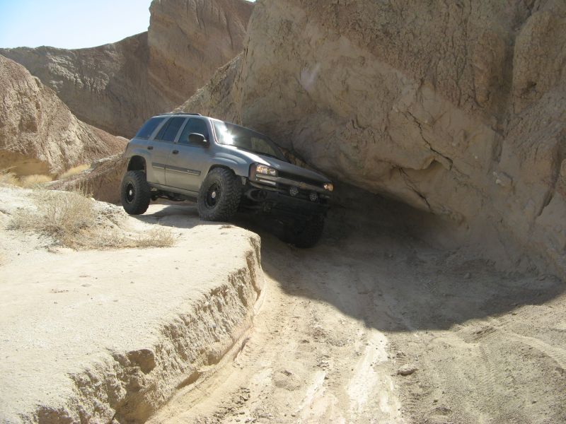
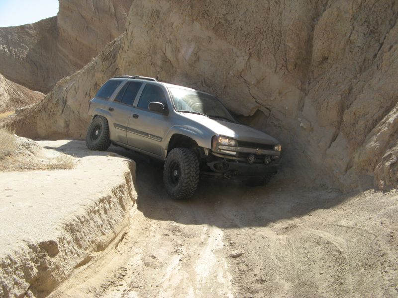
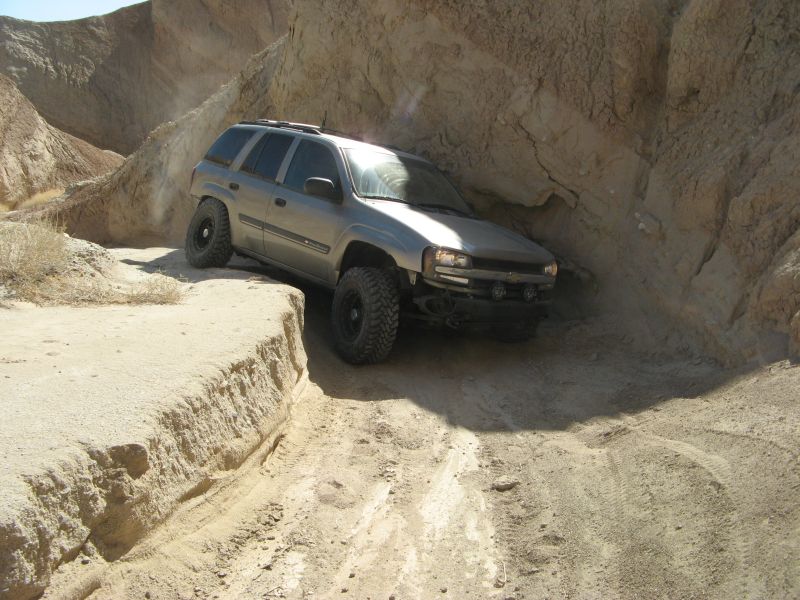
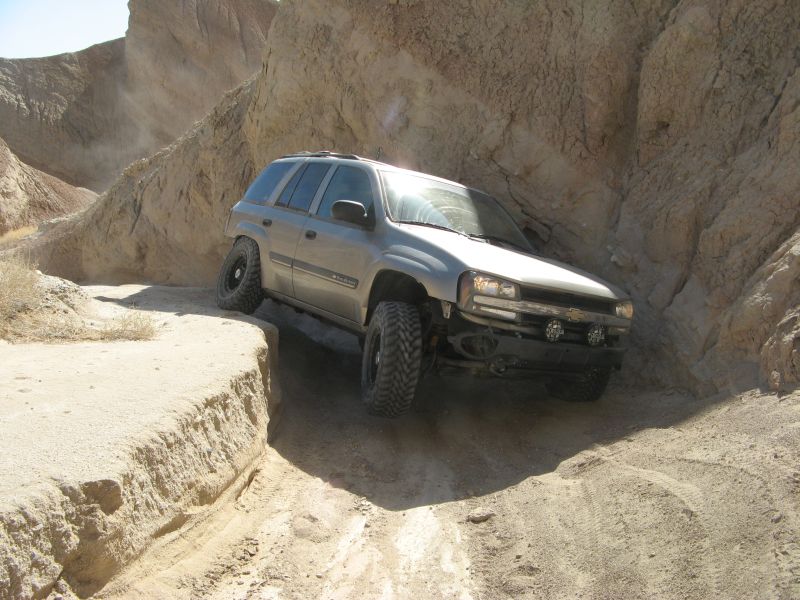
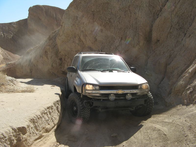
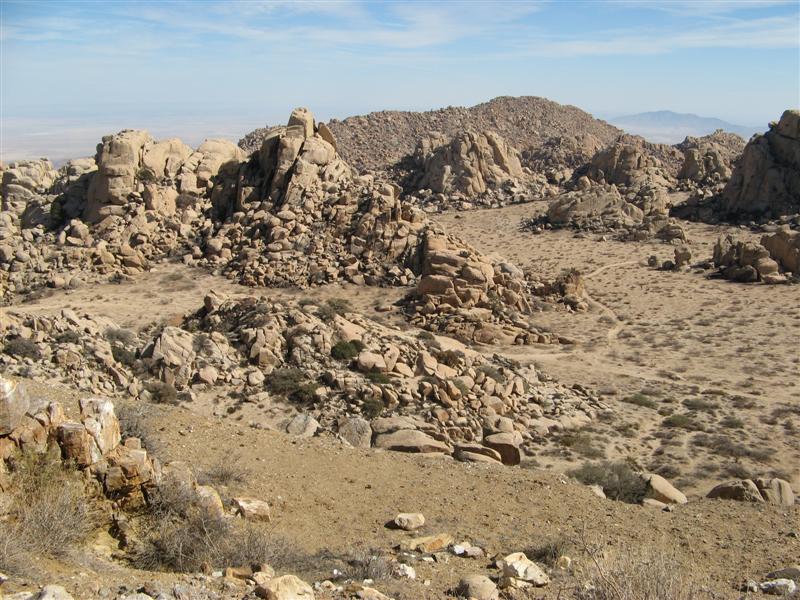
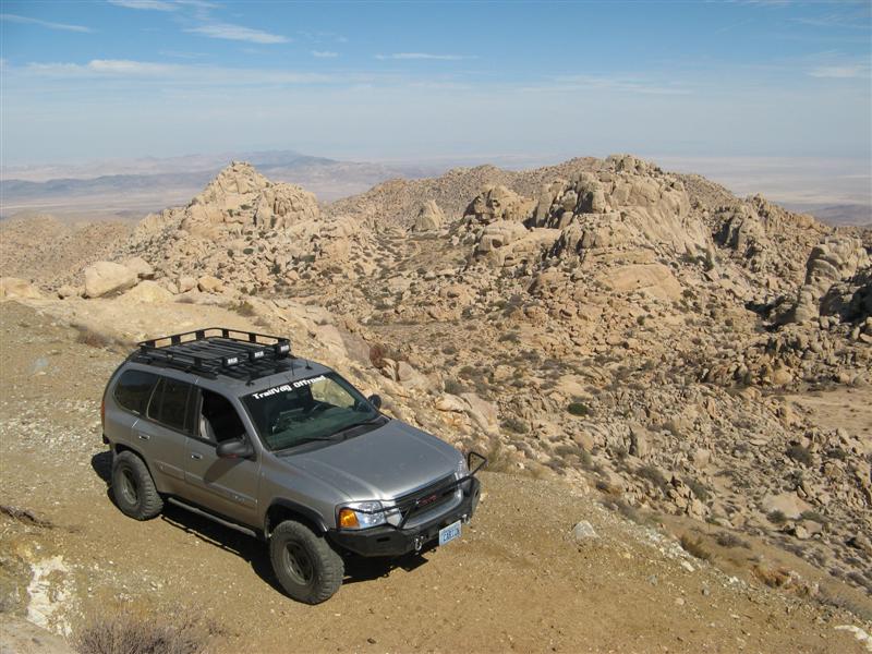
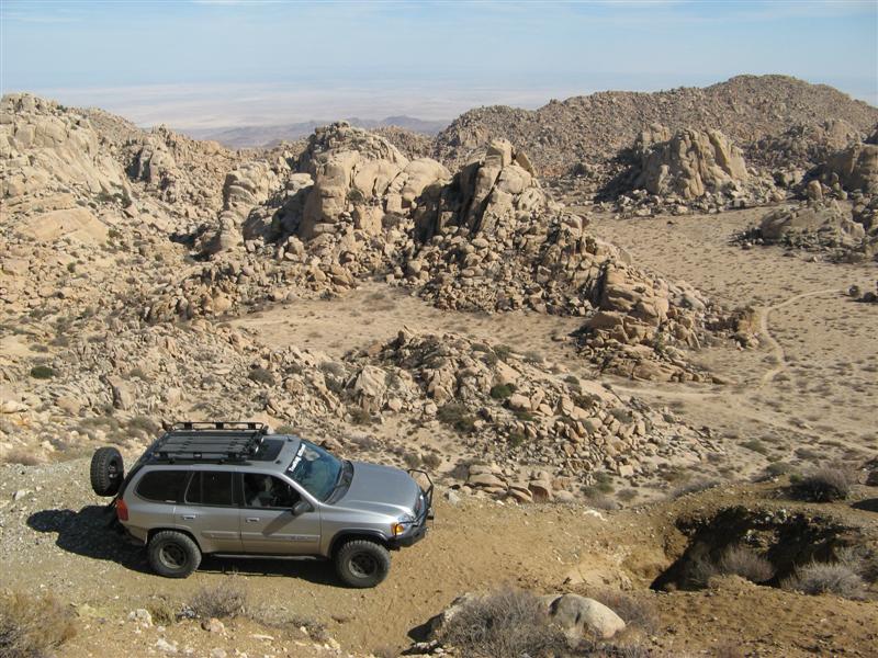
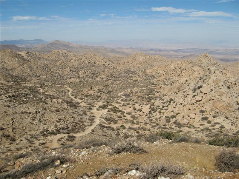
Had a pleasant day in the desert (Borrego) today. Some easy - some hard wheeling. More pics and videos later when I get them edited.

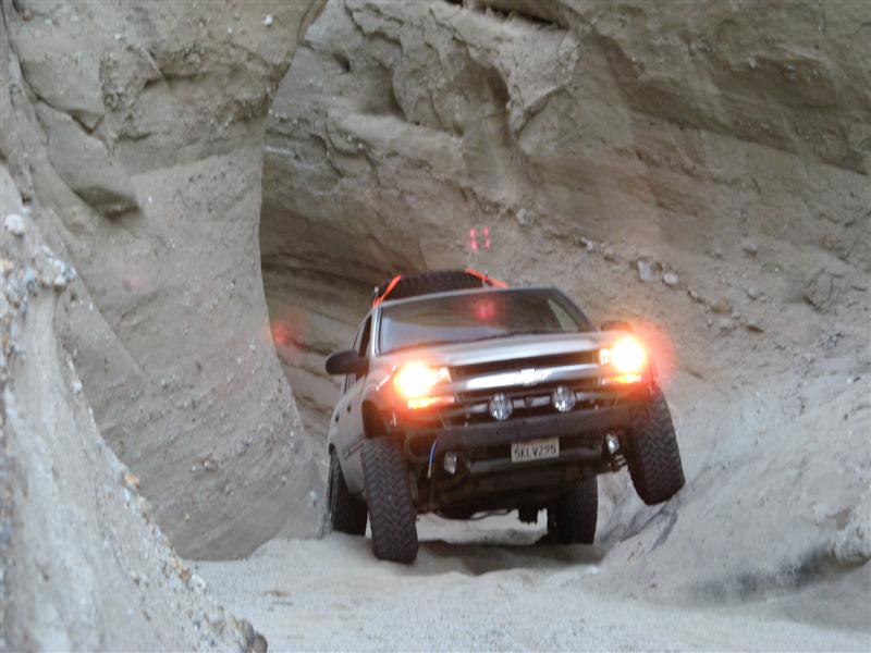
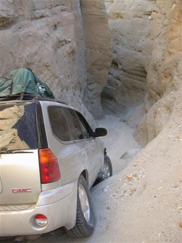
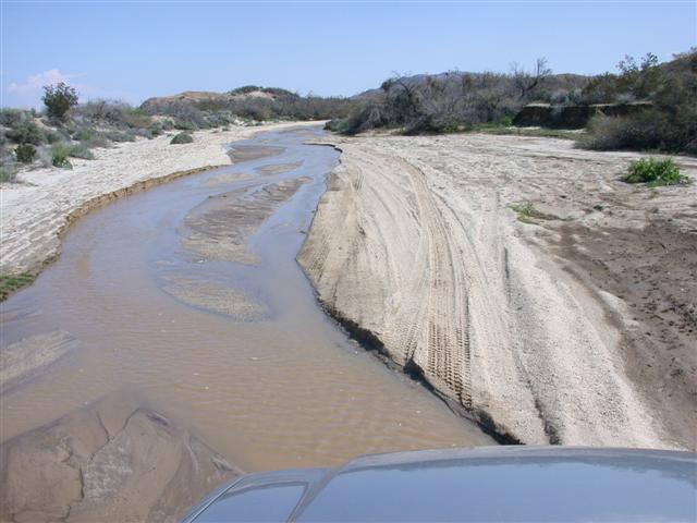
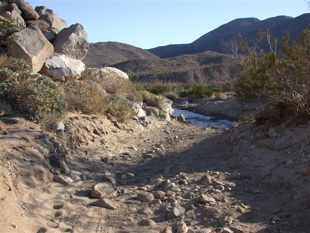
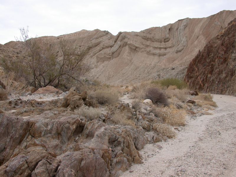
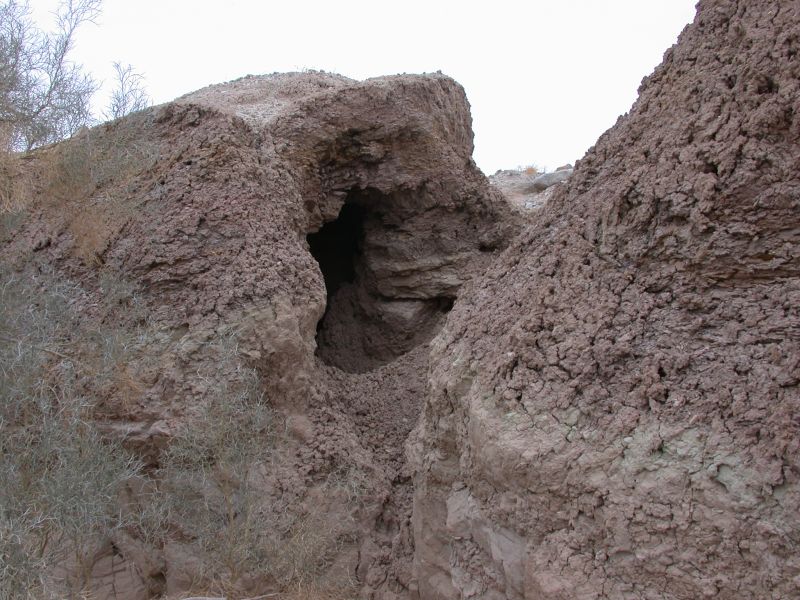
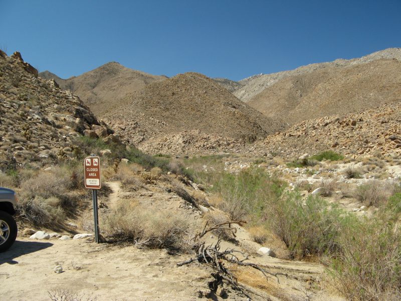
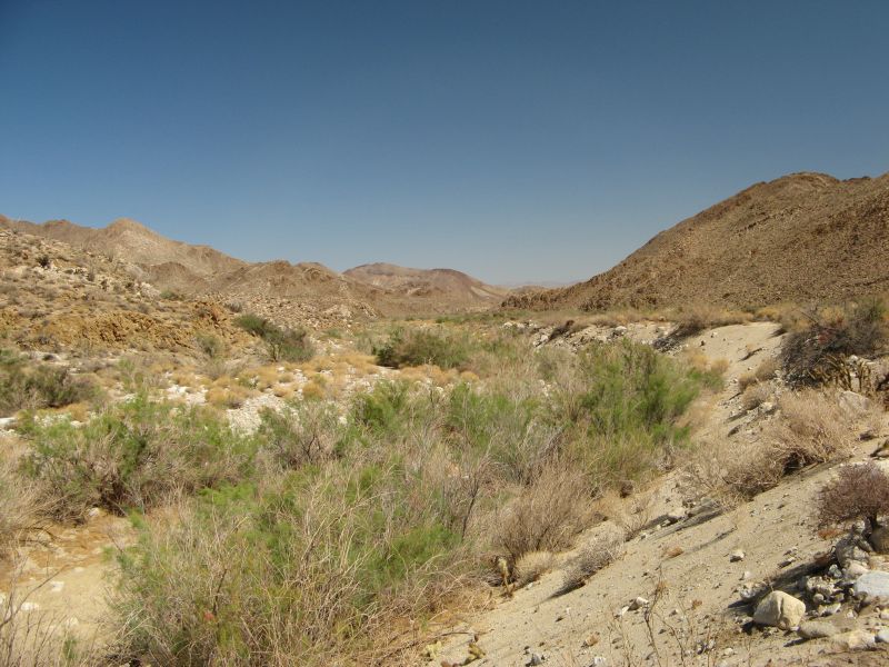
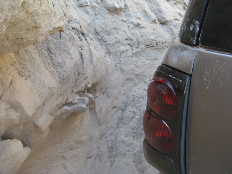
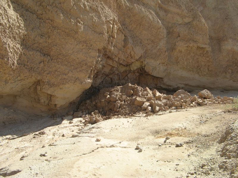
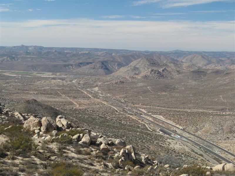
For now, enjoy these. Yes, the trail (Coyote Canyon) goes through the 10" deep water for 100 ft.

borrego1.JPG


borrego2.JPG


borrego3.JPG


borrego4.JPG


Goster asked me how it ran. I answered:

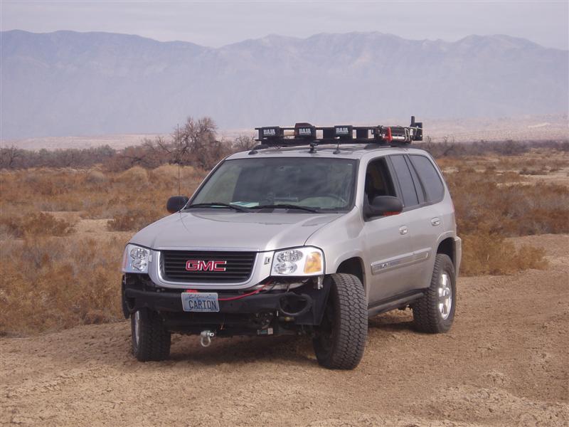
1) Water: With the new tires and lift, it definitely handles water better, especially getting up out of a wet wash. Looking at the service manual, the front and rear differentials *do* have vent tubes to raise the vent opening to a safe level. Otherwise I would have had to do more work to make them safe. But something tells me Mrs. Roadie would not support a snorkel mod:

snorkeltruck.jpg


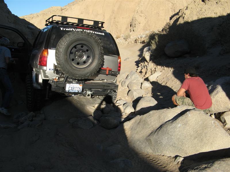
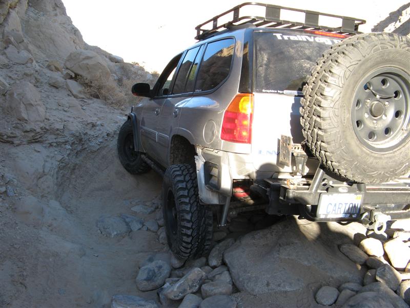
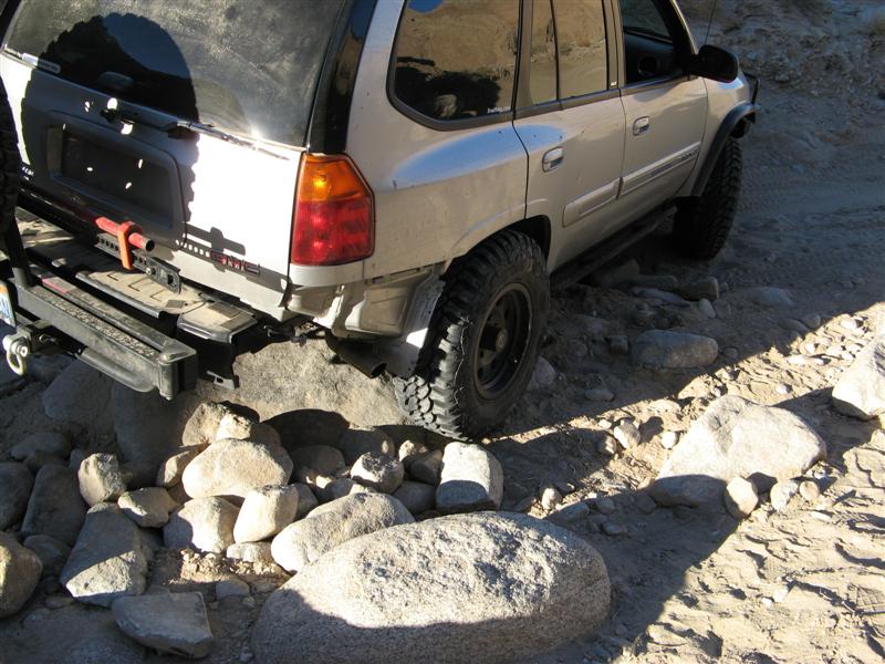
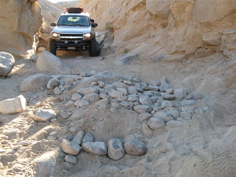
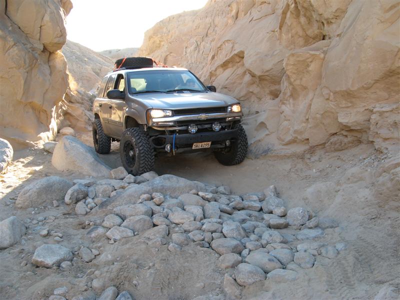
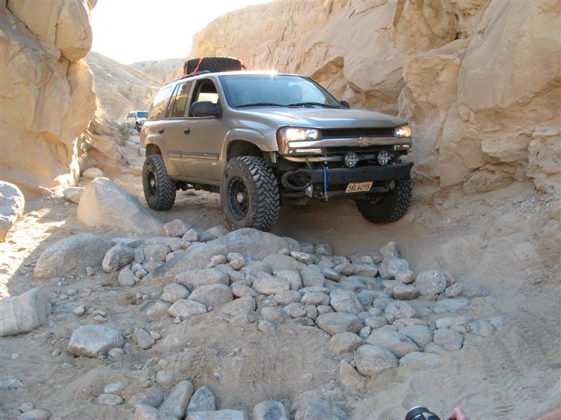
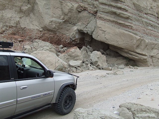
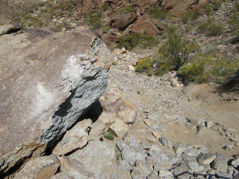
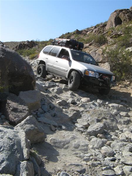
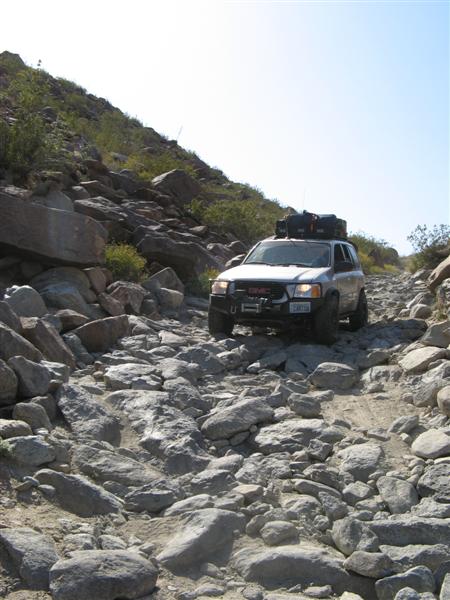
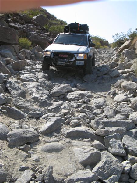
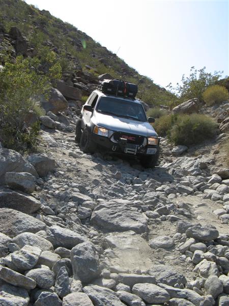
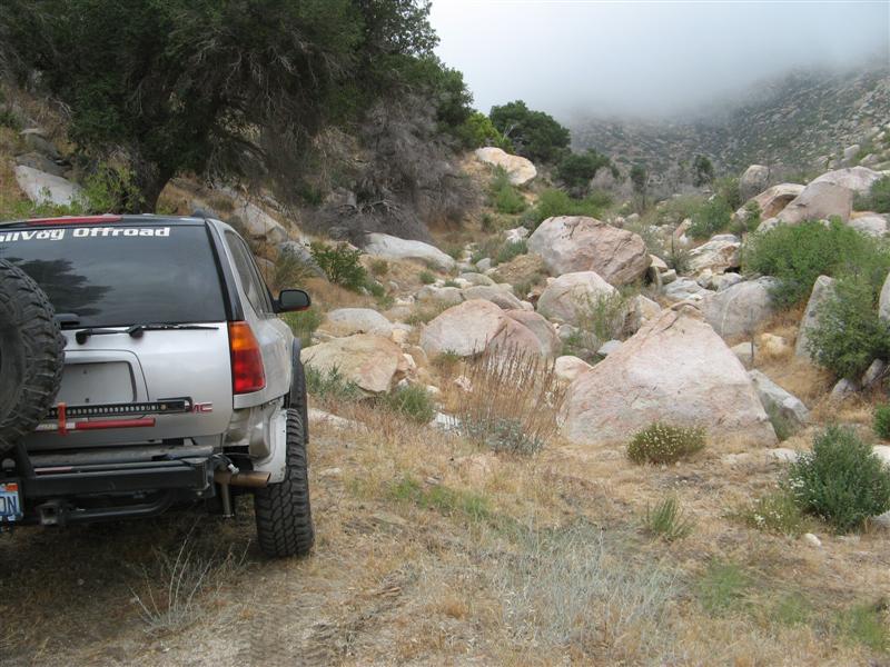
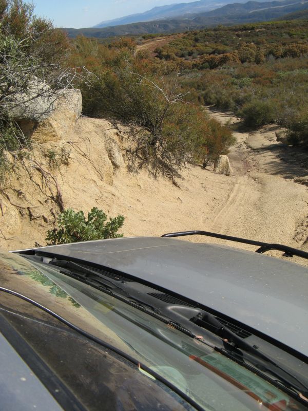
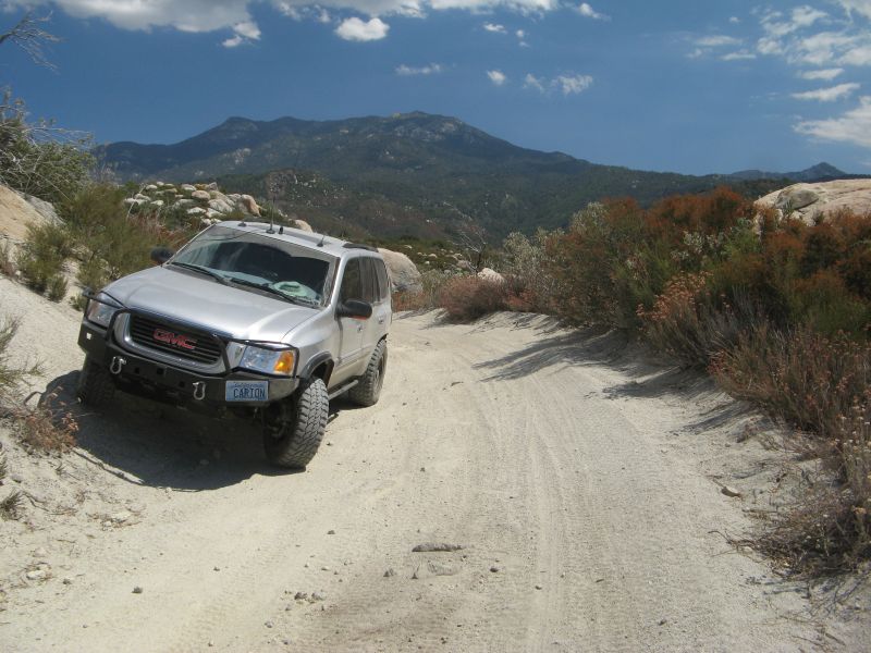
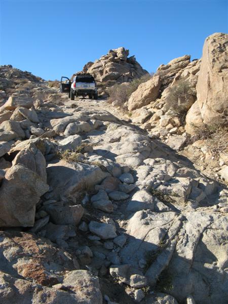
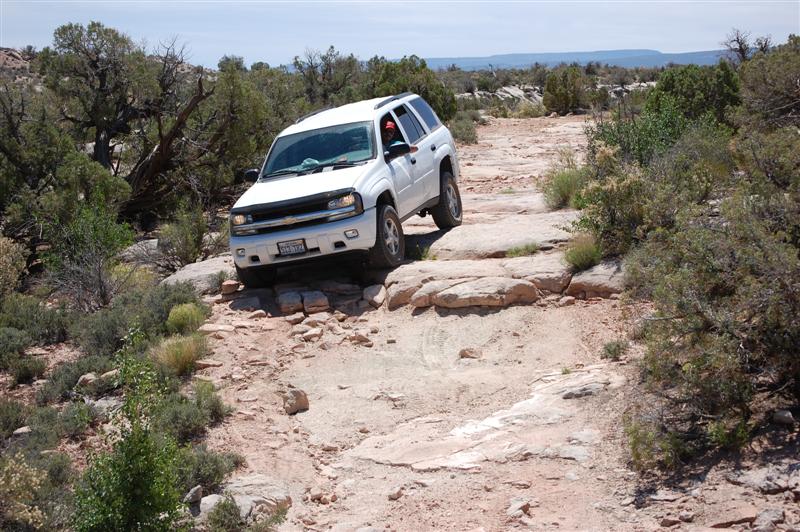
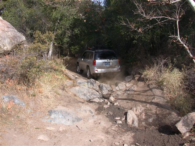
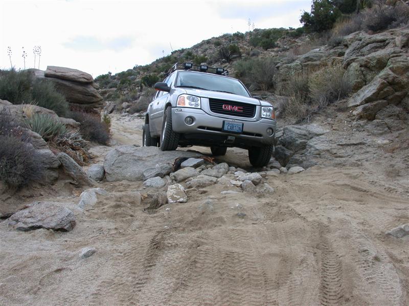
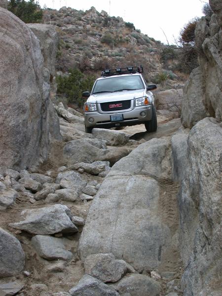
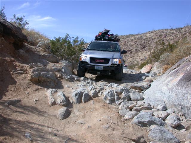
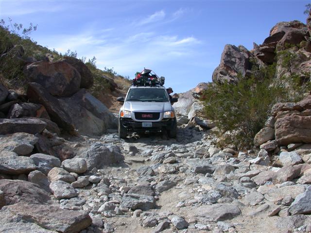
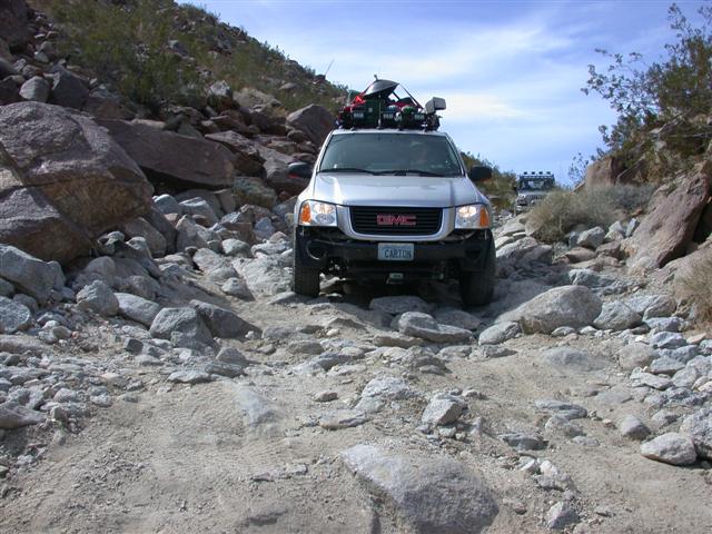
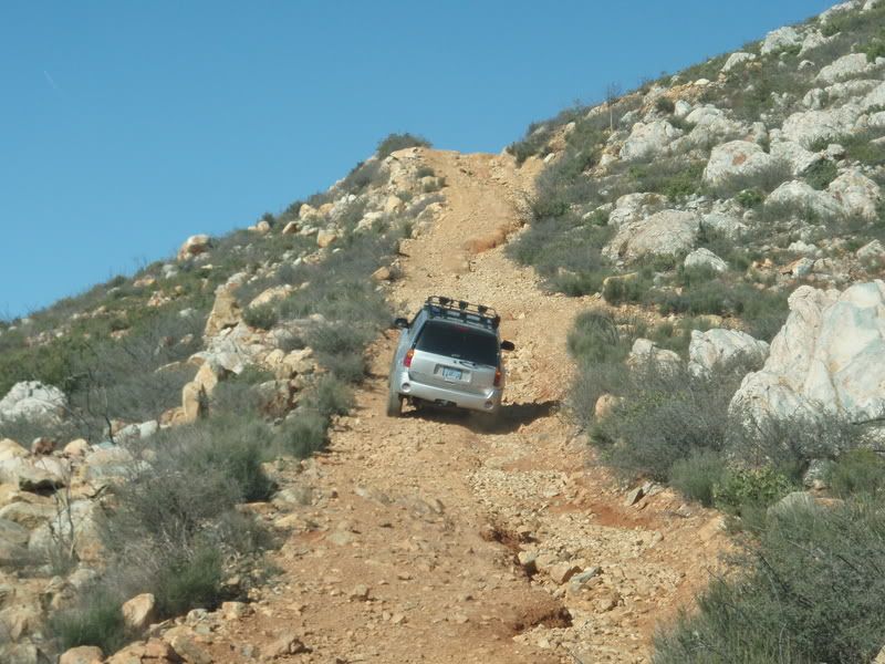
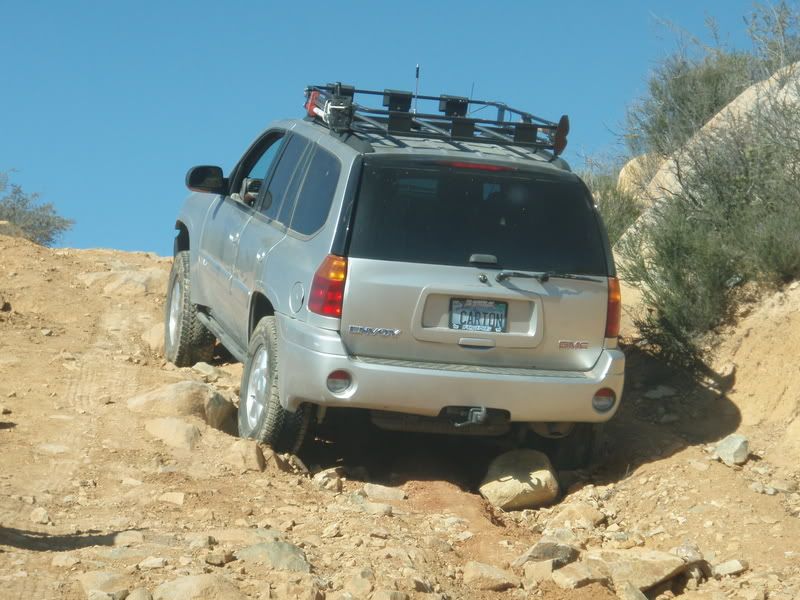
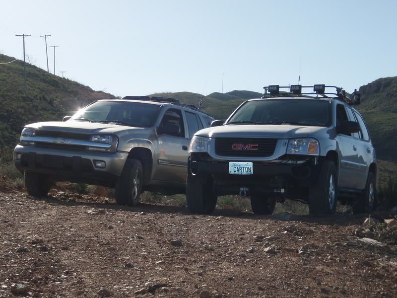
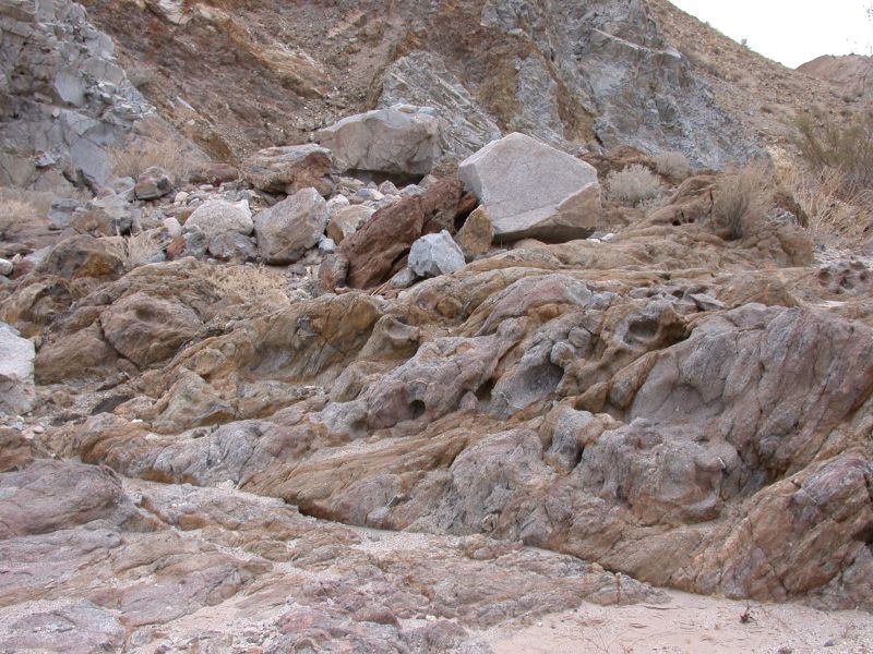
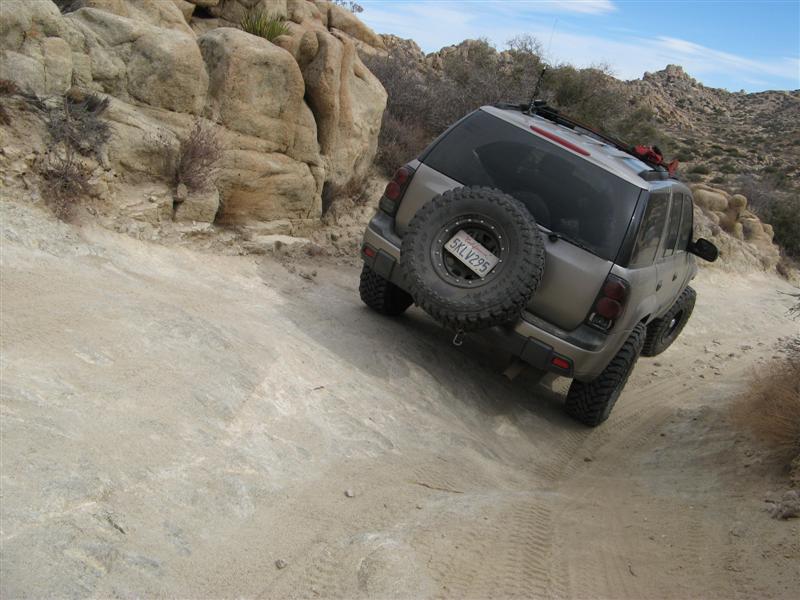
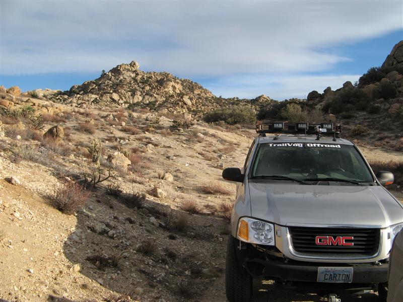
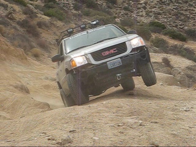
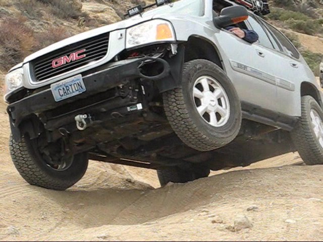
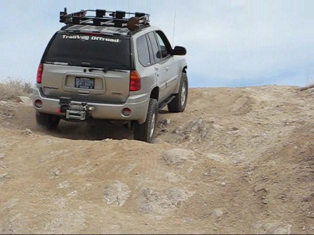
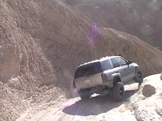
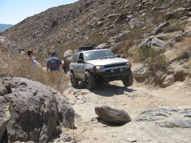
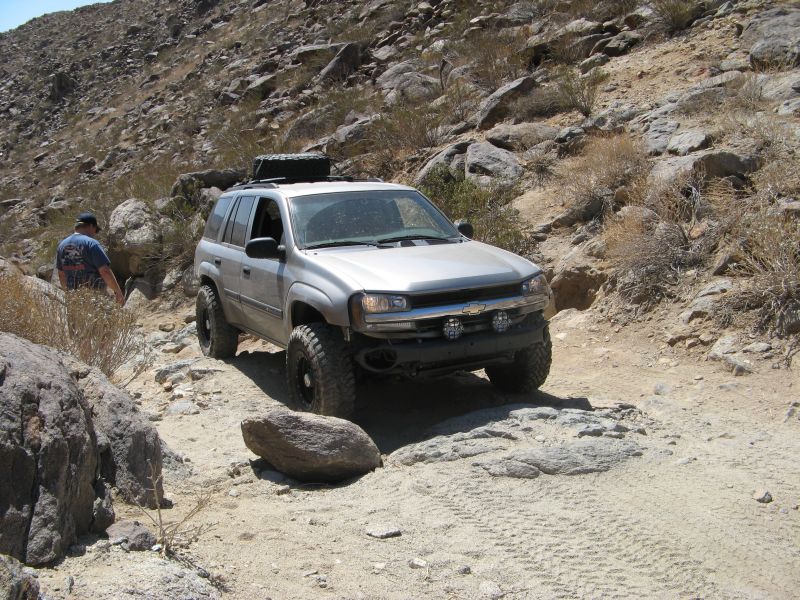
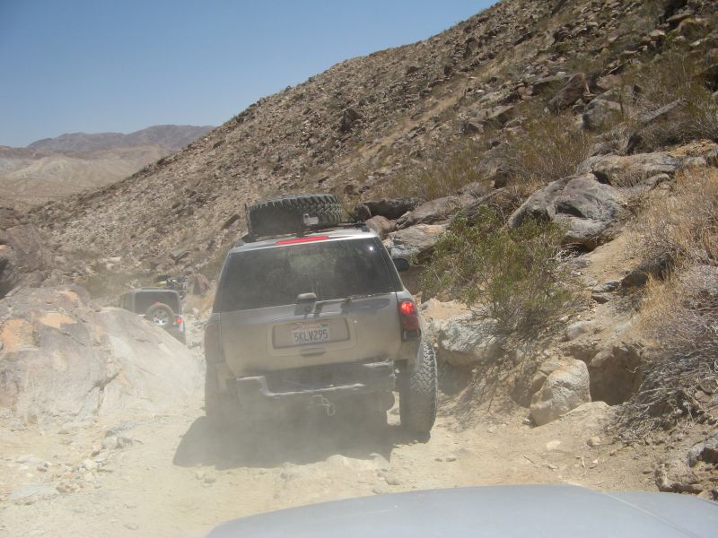
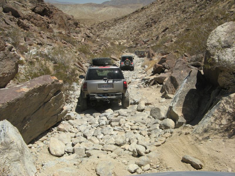
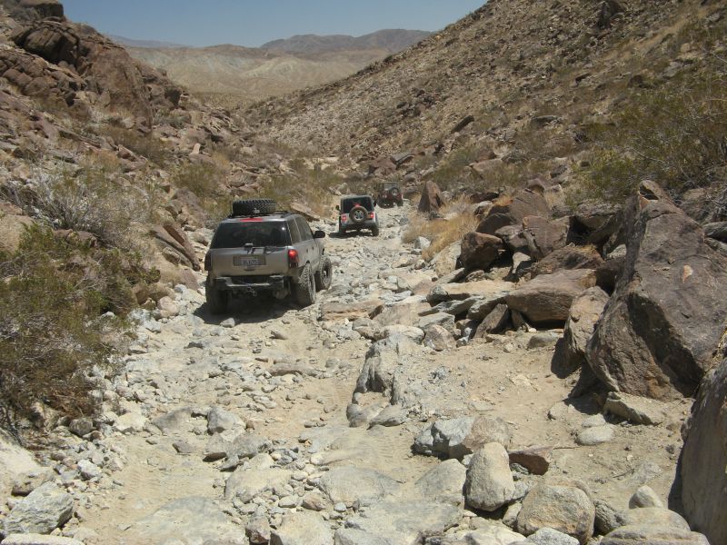
2) Rocks: Rocks up to 10" are no problem, and 16" rocks are OK if I put a tire up on them and steer around them before they hit the rocker panel. Wish I had rock rails instead of plastic rocker panels so I could use rocks as a pivot fulcrum. If I have to take a rock underneath and scrape something, it's nice to have a frame to slide them on, because the skid plates aren't structural enough. The skid plates will deflect kicked up small rocks, but aren't really useful to slide on. Our extremely tight turning radius helps a LOT when picking the right line to take on a rock trail. Experience going with my jeeper friends was very useful. Long wheelbase vehicles (EXT/XUV) aren't as suitable because of the danger of high centering.

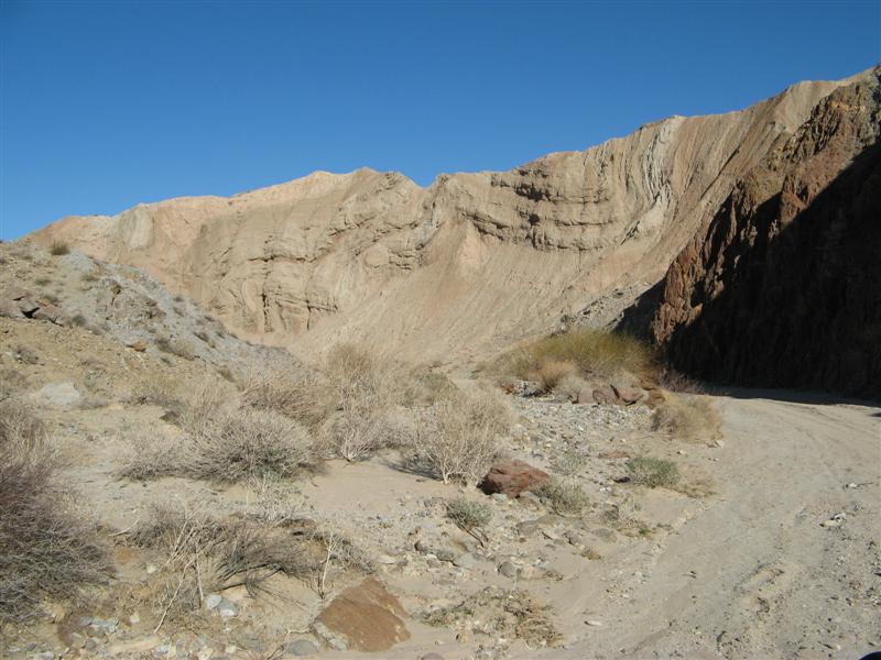
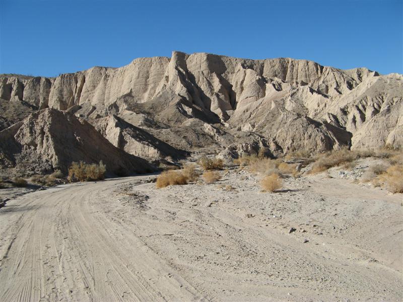
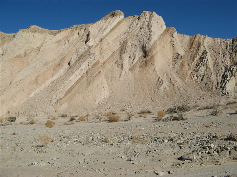
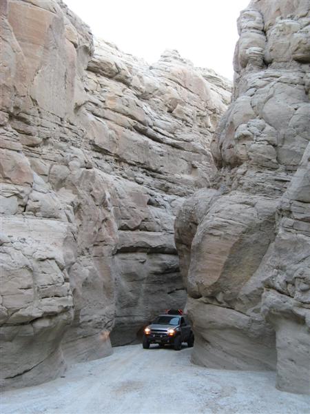
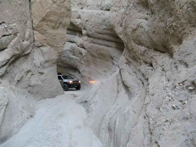
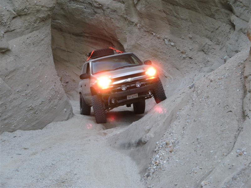
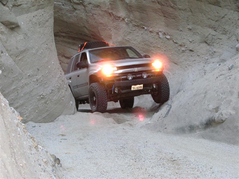
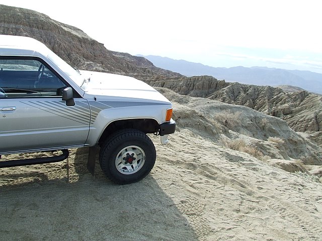
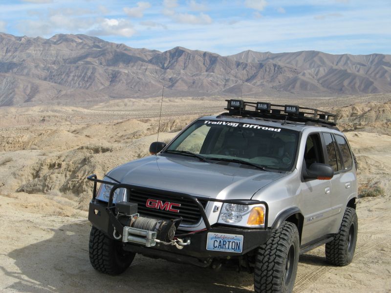
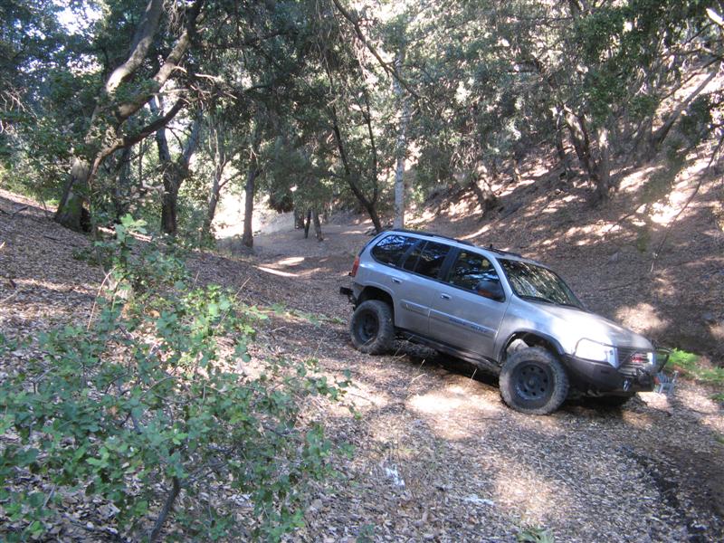
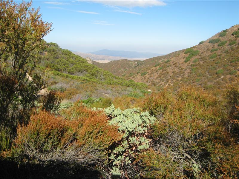
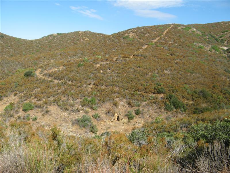
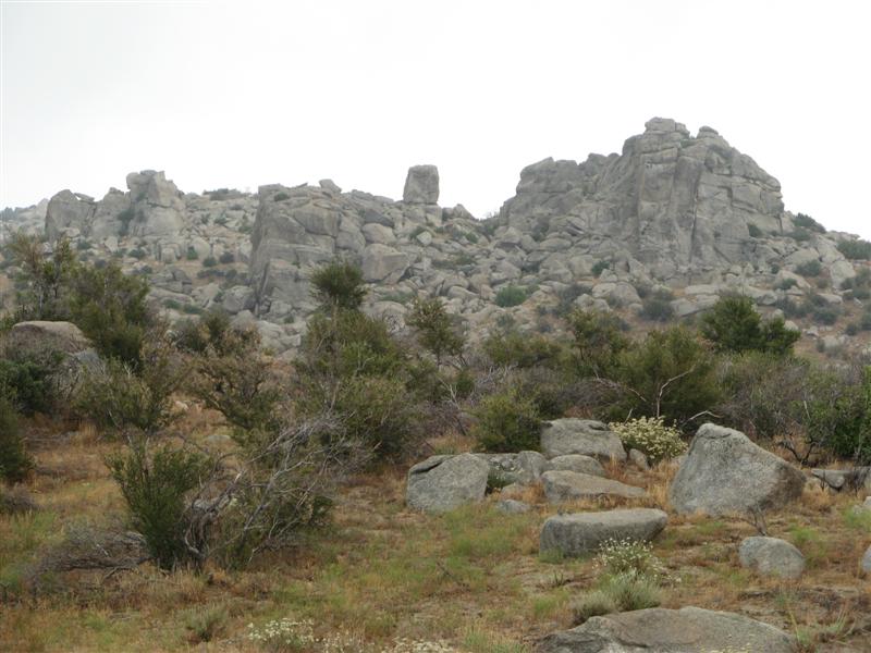
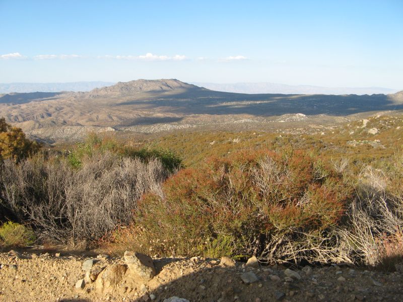
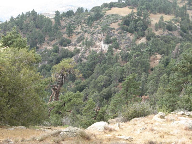
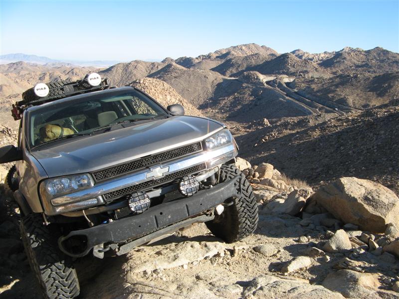
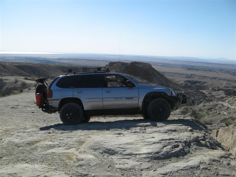
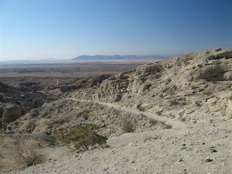
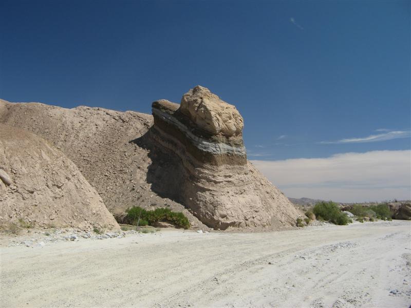
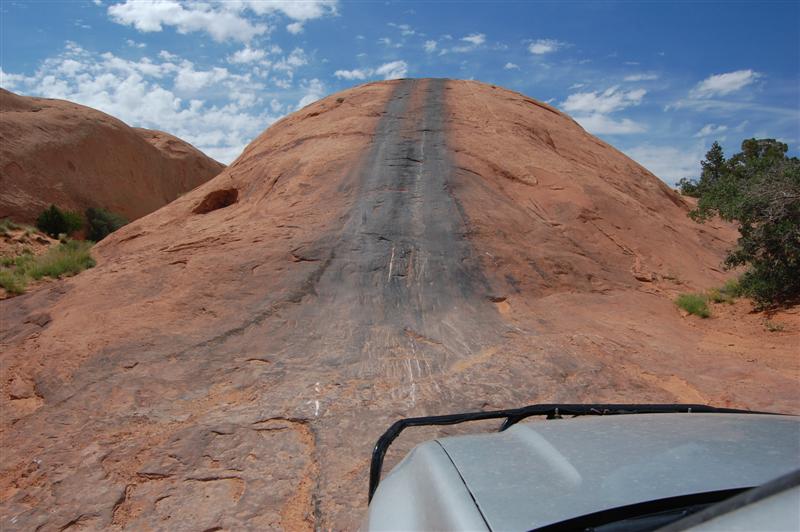
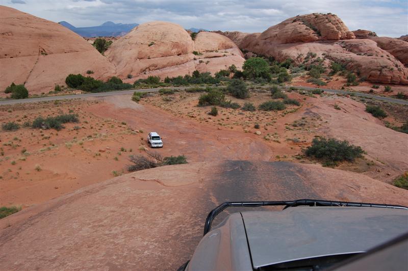
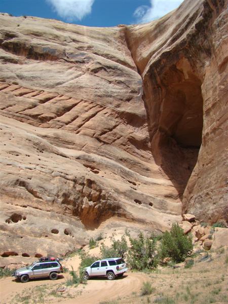
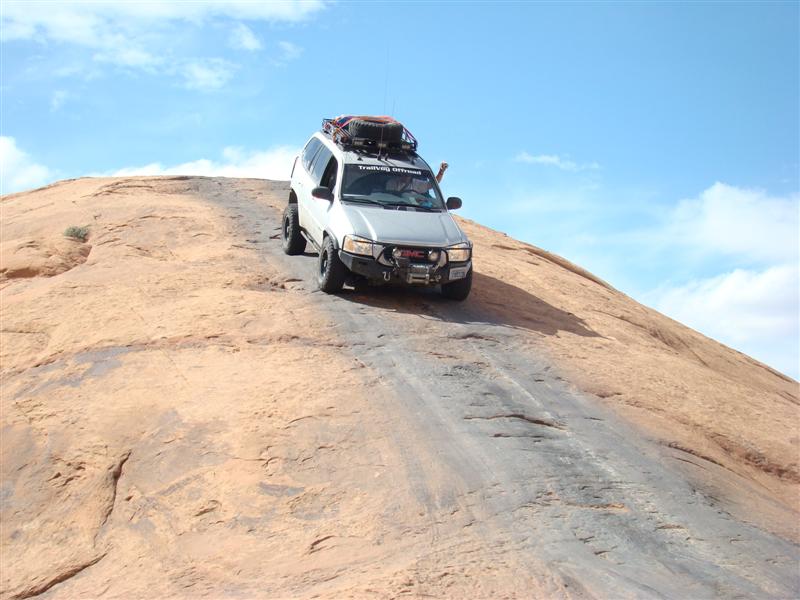
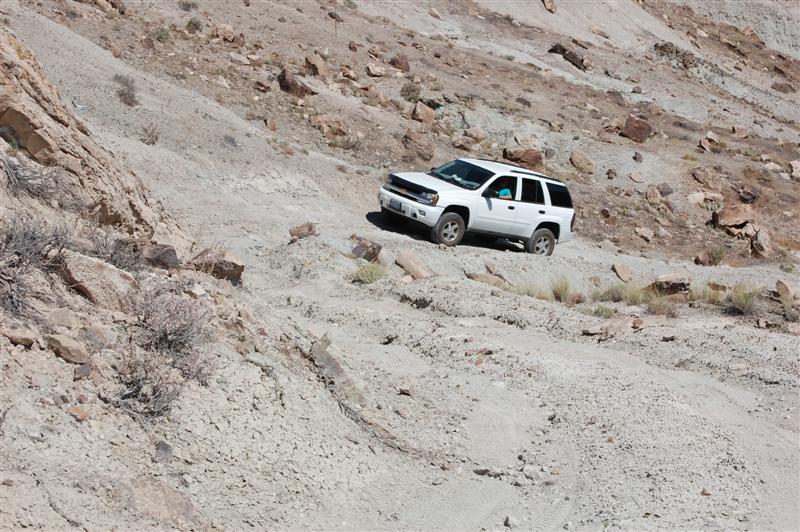
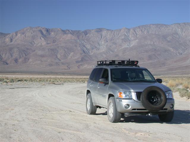
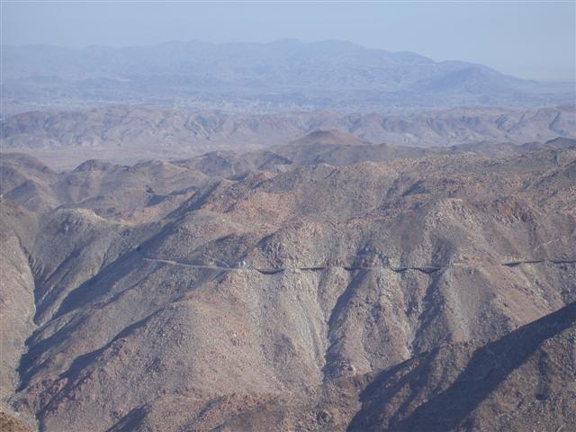
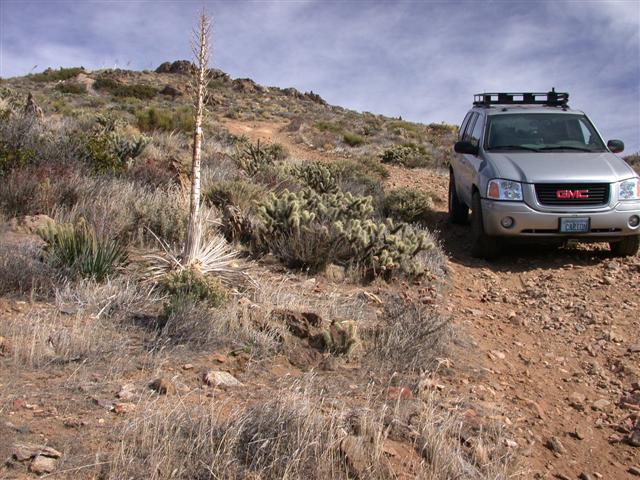
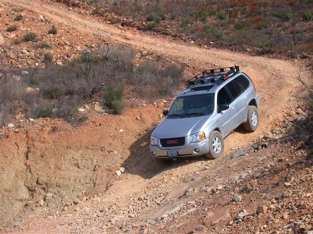
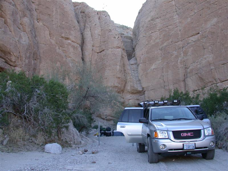
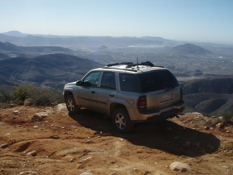
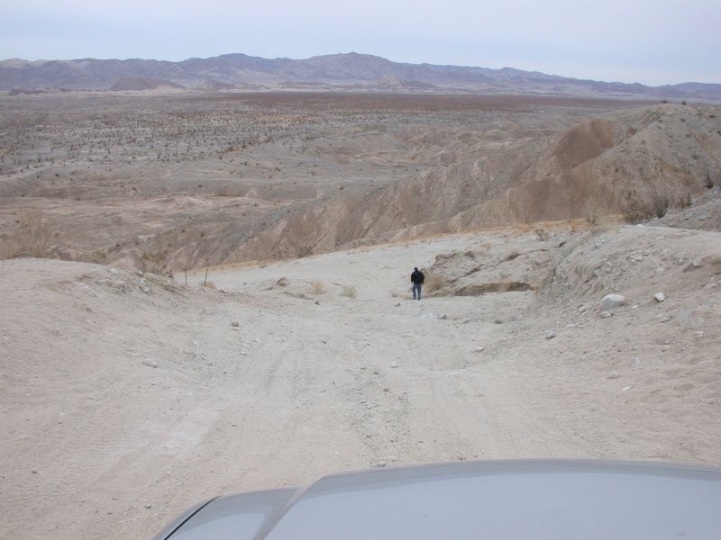
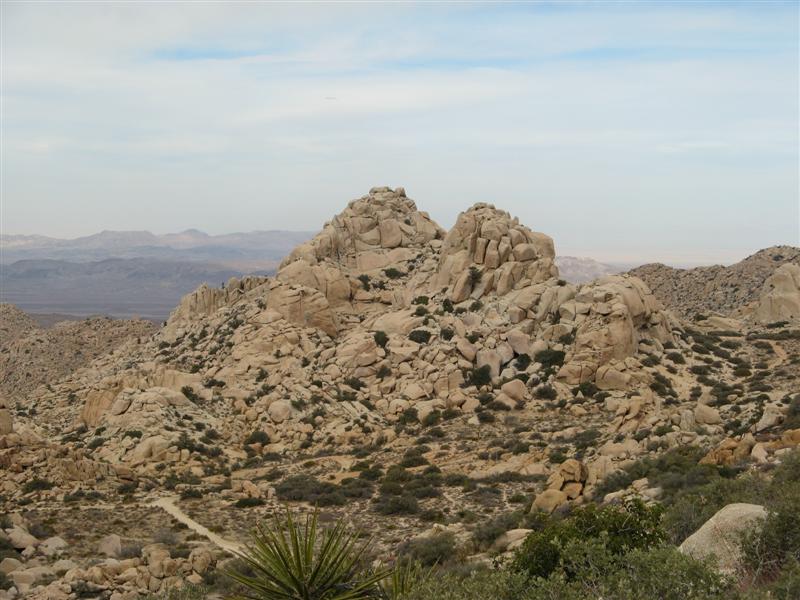
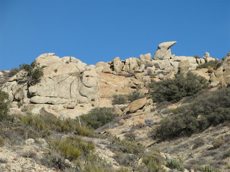
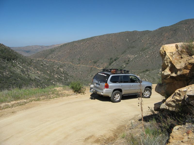
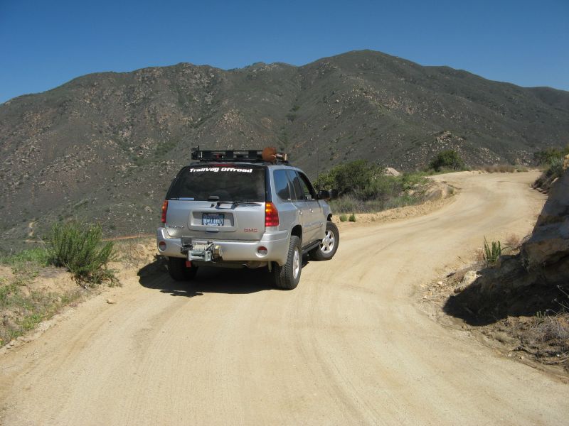
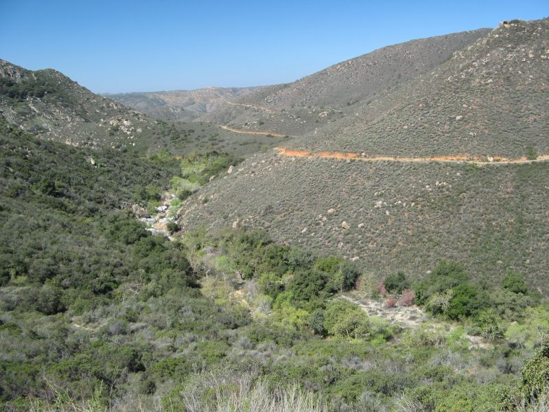
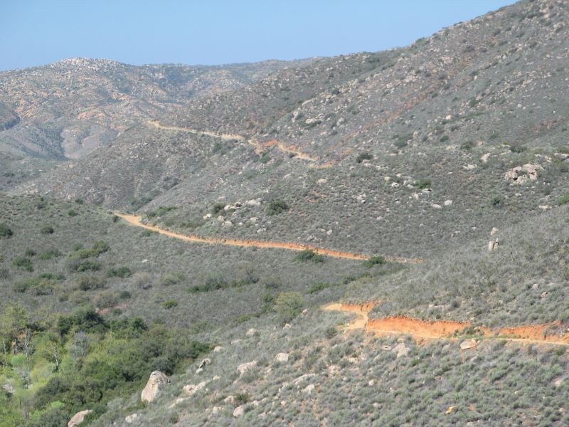
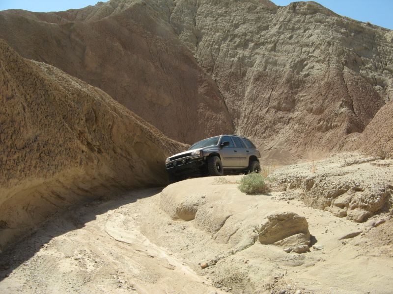
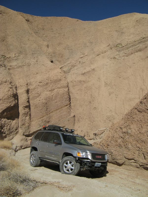
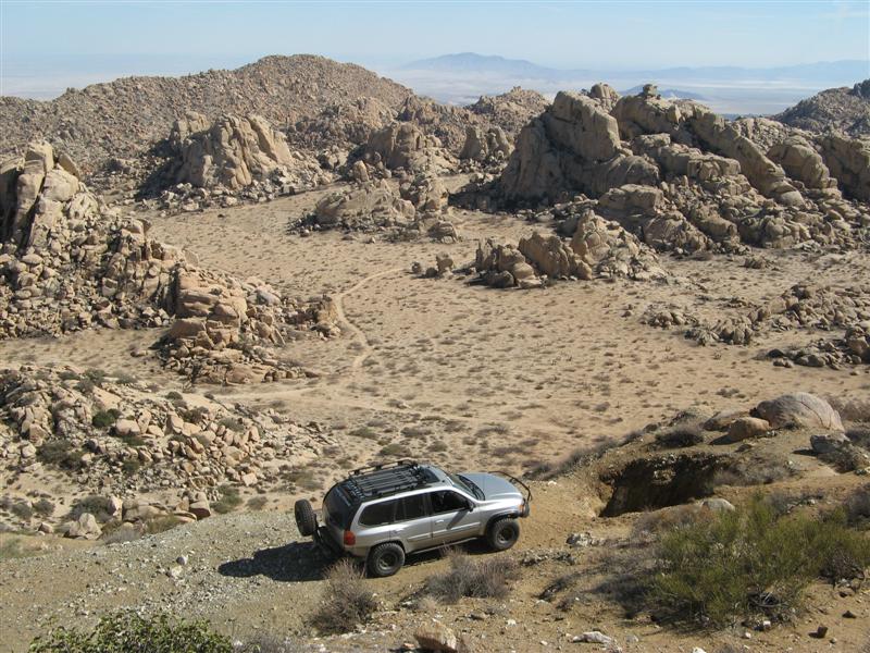
Favorite place to show off articulation and side-slope crawling is Sandstone Canyon:

sandstone1.JPG


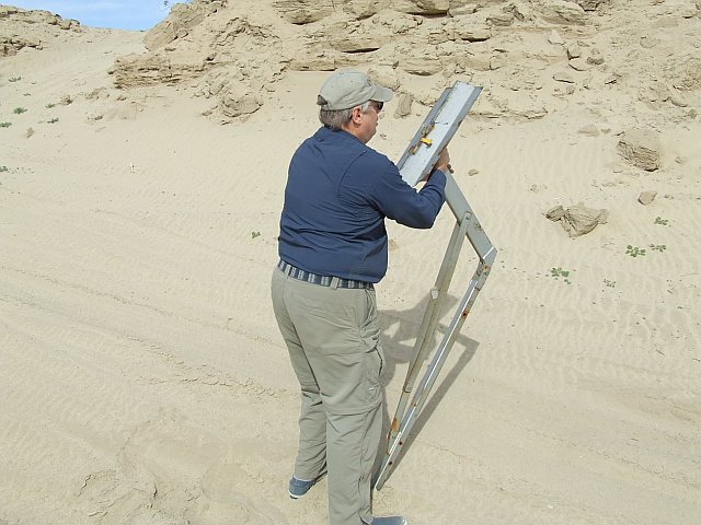
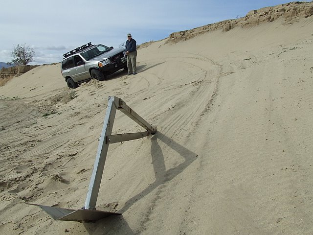
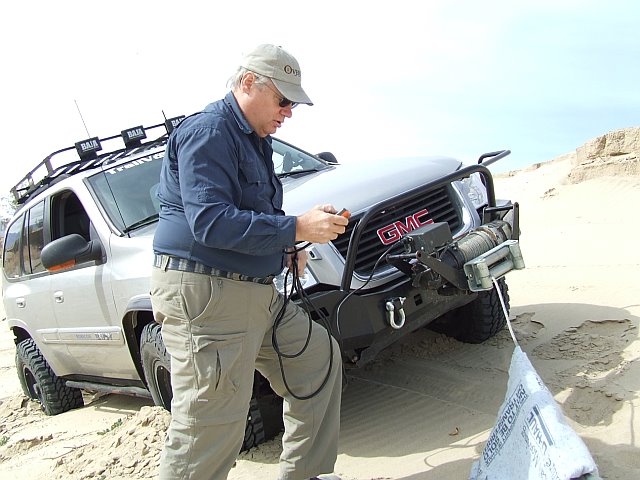
3) Traction: The G80 automatic locker is absolutely essential. I'm even considering upgrading to the electronic-actuated Eaton locker because it's annoying to let a tire spin to activate the locker. One trail situation sometimes shows up the problem of having an open front differential and a non-locking transfer case, and it's when climbing a trail that's composed of rocks embedded in sand, and both rear wheels end up embedded in sand. They would lock if only one of them was on a rock, but if both start spinning in the sand, the front wheels don't generally get enough torque transferred to them to pull out the heavy vehicle. Taking a slightly different line to keep at least one rear tire touching rock is enough to solve this issue, but the jeeps with total lockability don't need to learn this trick. Until I figured it out, I got stopped a few times and gave up on trails I can get through now. Getting out and stacking rocks on top of the sand is another alternative, totally allowed by the unwritten off-road rules.

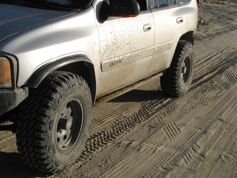
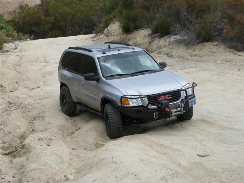
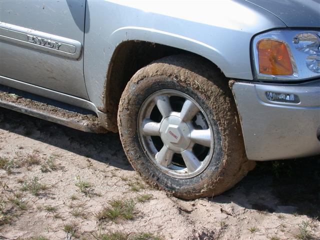
4) Tires: I'm really, really happy with the traction I'm getting with the Wrangler Silent Armors. Never even had to air them down for good sand traction, and I haven't ever felt nervous about any kind of deep sand, but that's partially a consequence of 4WD and the locker. With a built-in compressor (I put in for the Airlift 1000 rear air bags), I'm all set to air down if necessary, but then I don't do a lot of sand hill climbing like my buddies. The Envoy is simply too darned heavy!

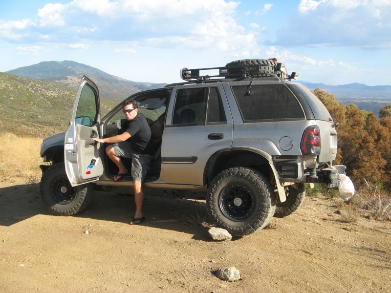
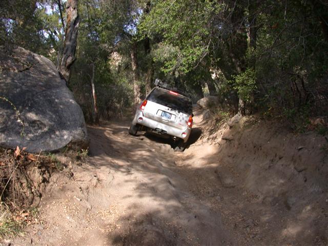
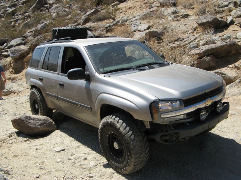
5) What I'm most nervous about: Approach angle. The bumper kills the approach angle. The departure angle is not so bad when I inflate the Airlift bags to their max, but the front bumper will have to go in the long run after the warranty is over. See what 4 wheeler magazine did to a Lexus for a project car and you'll see where I'll be going in the next 2-3 years.

6) What I'm next most nervous about: Body damage. Can't do much about the shape of the body, but it does stick out in ways that could catch tall rocks. It's also too wide to go through the Pinyon Squeeze. So that's one trail I'll just have to enjoy walking through instead of driving.

- - - Updated - - -

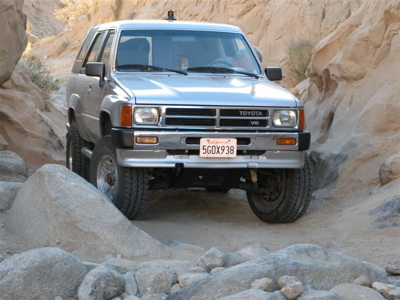
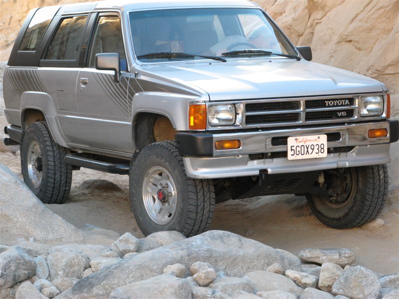
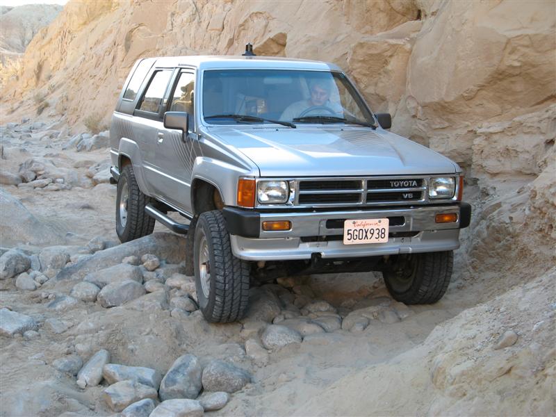
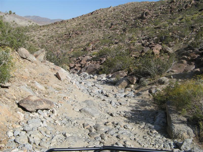
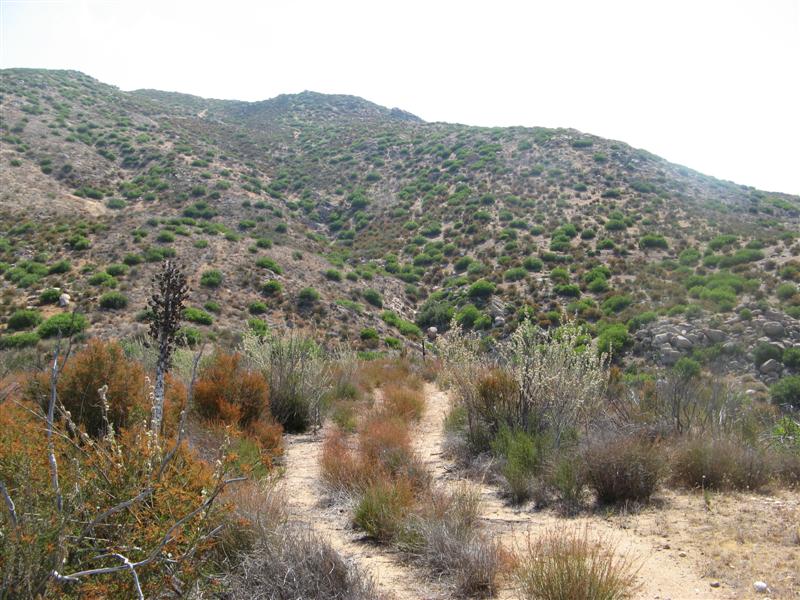
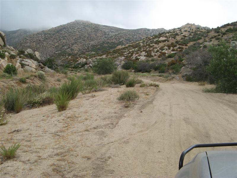
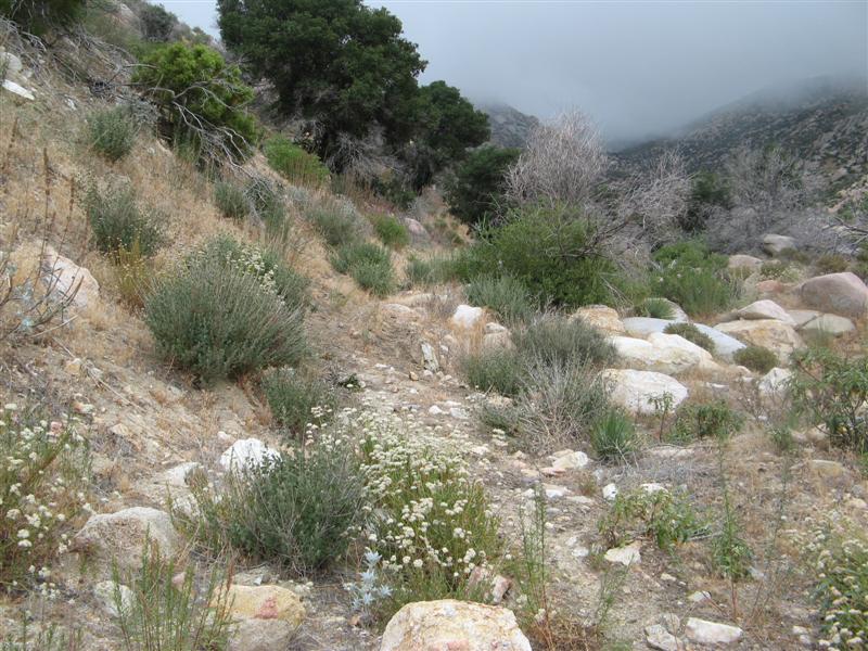
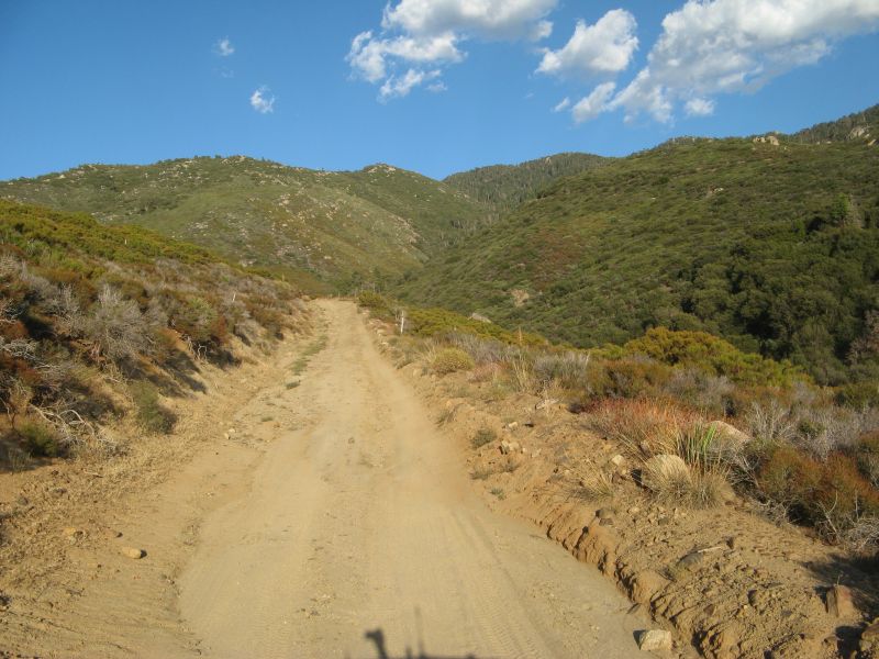
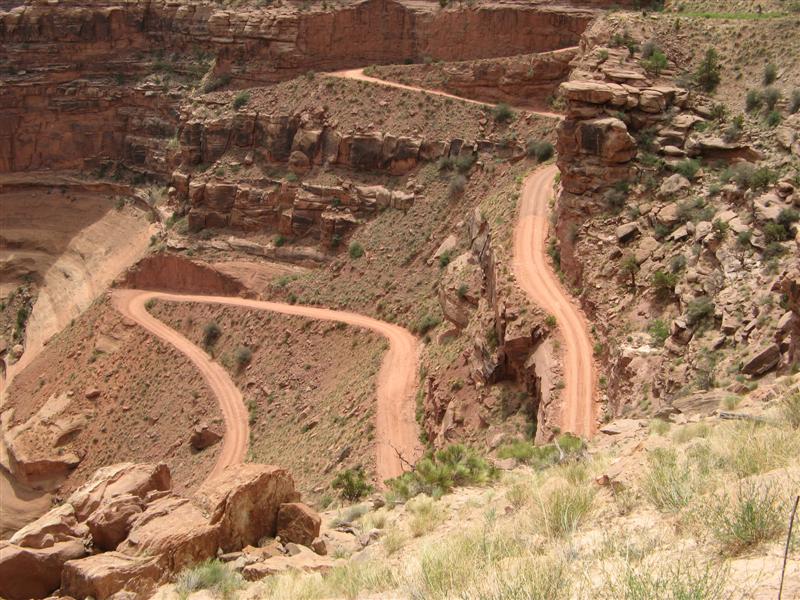
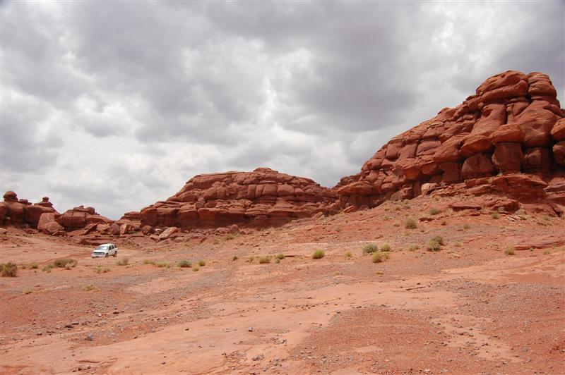
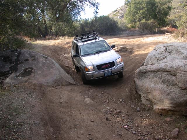
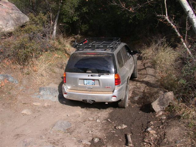
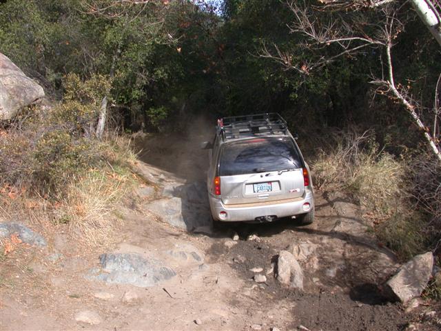
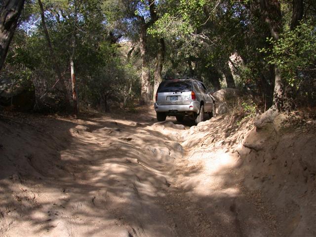
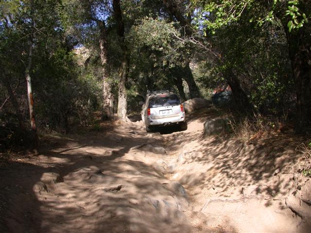
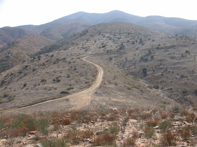
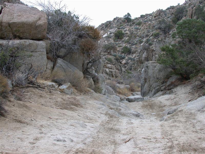
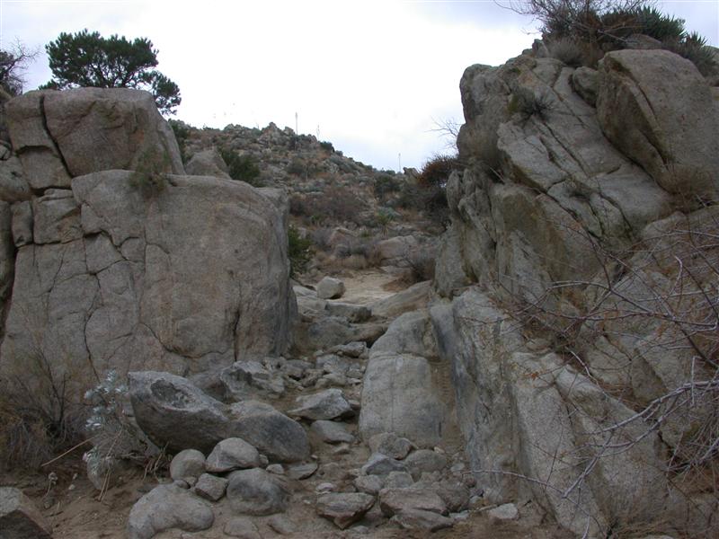
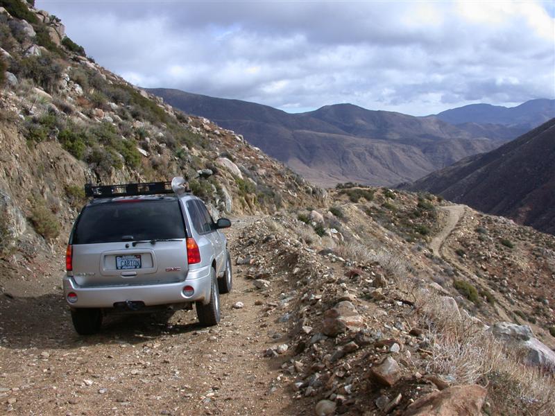
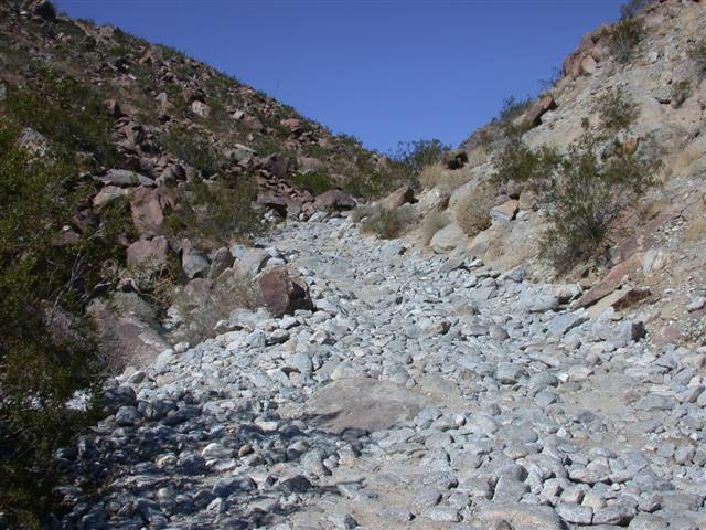
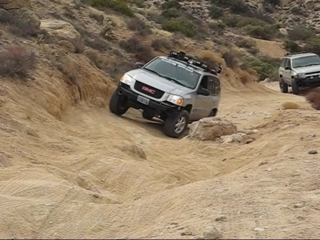
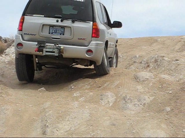
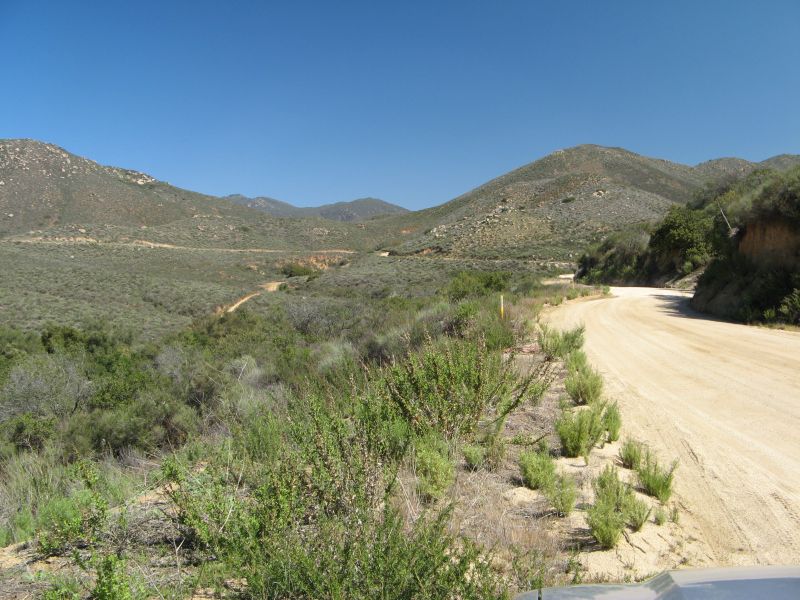
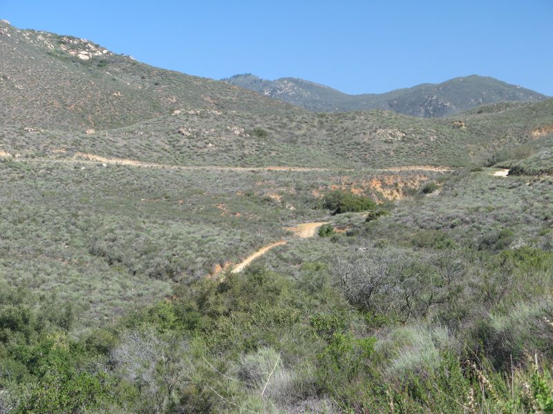
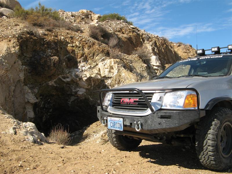
Tough trail today - Espinosa trail near Corral Canyon OHV area. Mostly for hikers and lifted jeeps. Too narrow for Hummers. Did manage to get some short video clips this time. Nice to have a volunteer photographer riding shotgun!

Here's one link, climbing to an asphalt helipad used for fire-fighting:
http://www.roadie.org/espinosa1.mov (warning 5MB - not for dialup)

Up a piece of slickrock:
http://www.roadie.org/espinosa2.mov

Down the slickrock:
http://www.roadie.org/espinosa3.mov

Trail stuff:
espinosa1.jpg


Tightest rock squeeze - not even tight enough to require putting in the mirrors. :raspberry
espinosa2.jpg


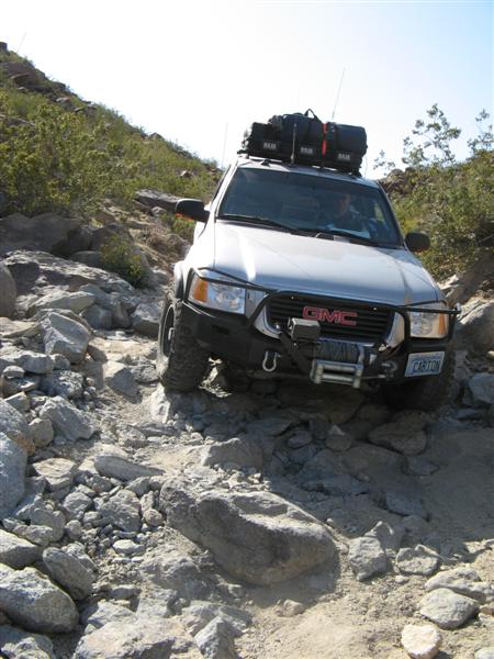
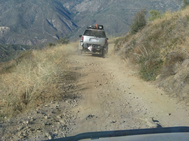
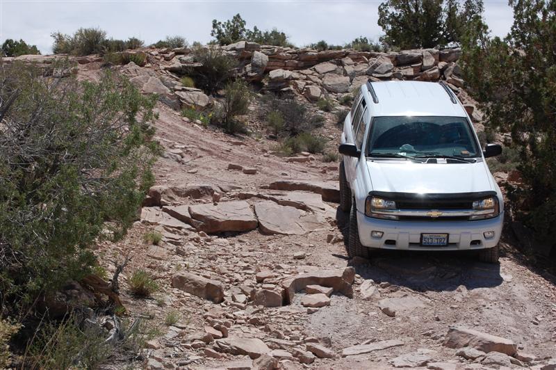
Steepest, rockiest part - just at the limit for my lift and tires. Stock vehicles - no hope.
espinosa3.jpg


Very careful choice of drive lines necessary.
espinosa4.jpg


Over the worst humps
espinosa5.jpg


Off camber
espinosa6.jpg


Almost through.
espinosa7.jpg


Clear sailing ahead? Not! Another two miles of this sort of crud.:hissy:
espinosa8.jpg


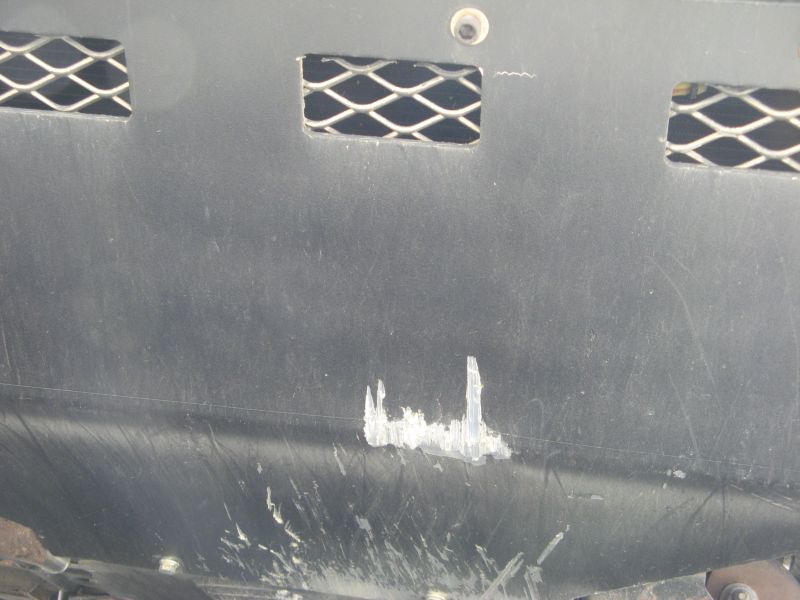
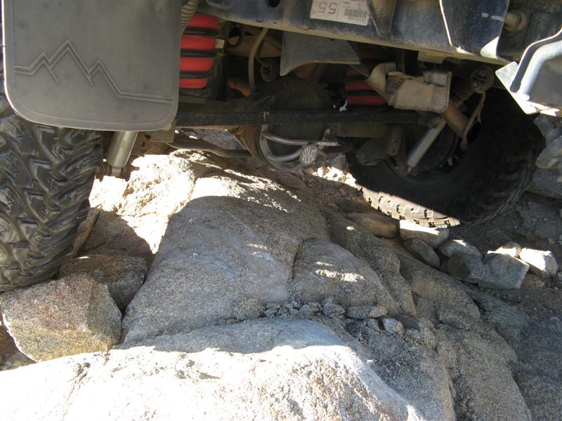
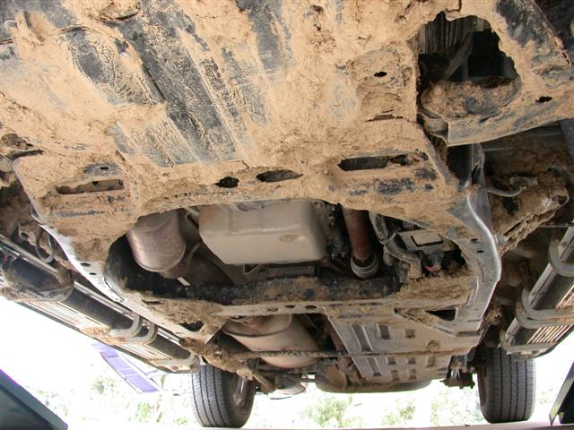
In one of the videos was probably the hardest hit I took all day, and it was a tow loop next to the front skid shield. I think I scraped the frame lightly on rocks 3-4 times, the gas tank skid plate took one minor hit, the front receiver skid shield twice, and the front receiver tow loops took the most damage. Not bad for a trail with 4 miles of 10-20" rocks, 2-foot deep ruts, about 20 dry stream bed crossings (down, across, and out the other side).

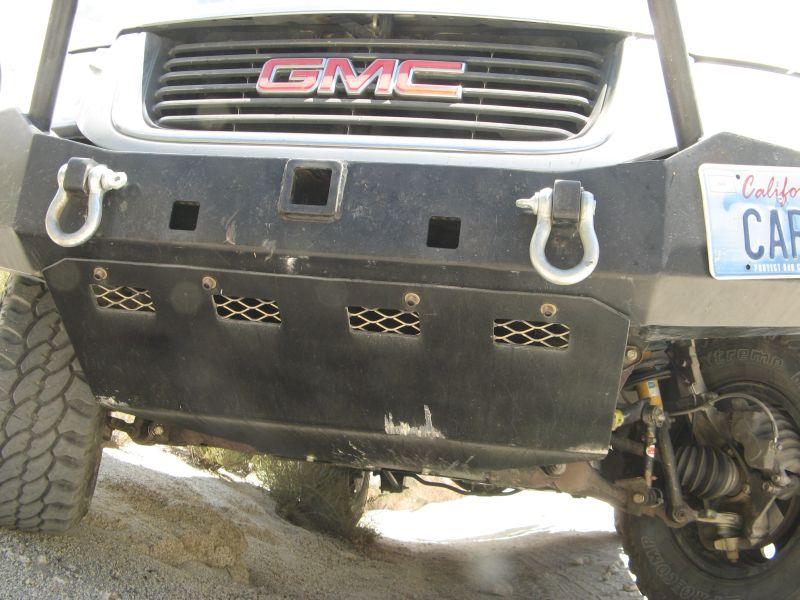
The Curt 31055 front receiver has these tow loops welded to it, and at this point they're the item that harms my approach angle the most, so I consider them sacrificial (meaning I don't care if I break them off.) It's actually useful to hit them on flat rock because they can't do anything but bend upwards, and that will save me a few sledge hammer hits later on before I finally get rid of them. After I cut them off, I'll add back in the proper kind of tow hooks in a place that doesn't hang down.

I already have two of these hooks, which aren't even available on Envoys like they are on TBs. When I originally installed them, I foolishly put them on the skid shield underneath the radiator, which was an insanely wimpy place, and when one of them hit a rock in Borrego, the radiator pushed the fan shroud back into the fan and jammed it. Until I got my jeep buddy to give it a strap tug, I had to drive into the wind to make sure it didn't overheat. Yet another embarassing episode in my trail driving training. :duh: All I had to do was pull it forward 1/2", but there were absolutely no trees around for miles, and it was easier to use him as a tug point than get out my sledge hammer. Everybody *does* carry a sledge hammer for those minor on-trail repairs, don't they?:crazy:

radiatorpull.JPG


Mostly, what happens in the desert *stays* in the desert, but you guys are my buddies so I can tell you the embarassing stuff. :tongue:

The front receiver skid shield doesn't take a lot of hits because I almost never take a high rock (>11") straight down the centerline, because it will hit the differential and rear sway bar later. So I tend to drive over those size rocks or ledges in line with the frame rails, which can take the stress, and the frame rails are just outboard from the tow loops. So the tow loops are an early warning noisemaker. If they take a really hard hit if I misjudged a rock, I'm always going slowly enough to stop before harming the expensive undercarriage parts. (meaning the ones I need to get home.)

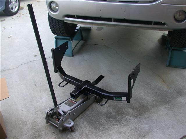
Here's the virgin Curt 31055 being installed. Note the loops look nicey-nice:

curt31055.JPG


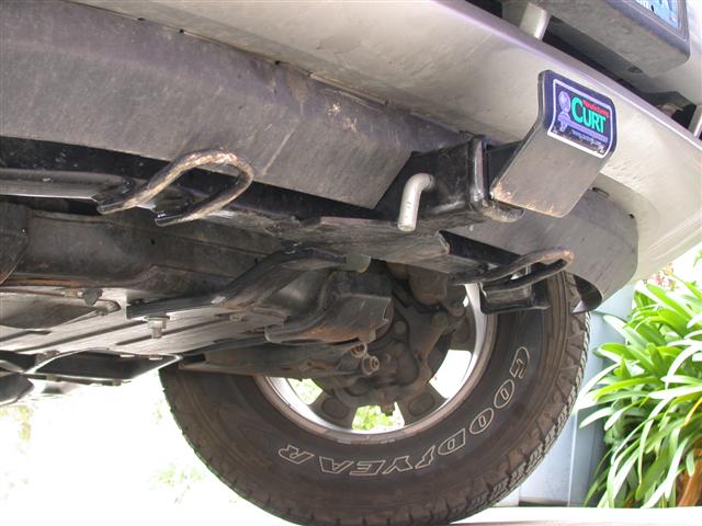
Here's what they look like today. Note very little damage on the skid shield in the center:

towloops.JPG


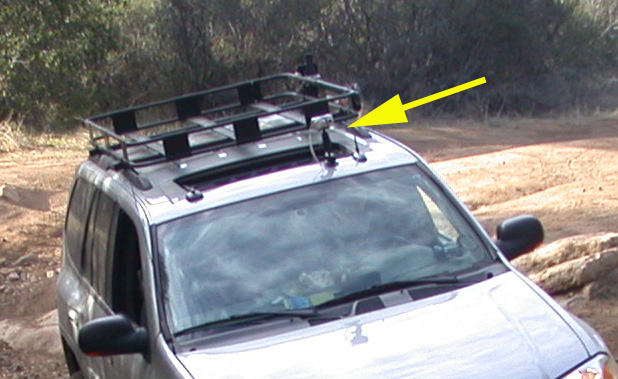
Anyway, I also took some videos from the roof of the Envoy. I got this suction cup mount from RAM-mounts, where I got my tablet PC mounting arm, and stuck it to the roof.

camera.JPG


Thought you might get seasick viewing a video from the vehicle, but maybe not. Enjoy:

http://www.roadie.org/espinosa4.mov
http://www.roadie.org/espinosa5.mov

Maybe there's a market for a DVD of Envoy rock-crawling? I know a lot of folks would love to see me get stuck in mud. :hissy:
 

The_Roadie

Original poster
Lifetime VIP Donor
Member
Nov 19, 2011
9,957
Portland, OR
Last weekend: couple of easy trails east of San Diego. Minnewawa Truck Trail (from Otay Lakes Road up the north approach to Otay Mountain. Ends at "Doghouse Junction" antenna farm.) and McCain Valley Road - excellent overlooks of Carrizo Canyon and the entire Anza Borrego desert region.

I discovered that a 30 degree slope is just at the limit of traction when the surface is dust mixed in with 2-6 inch broken rock shards. :yes:

Note: this is *not* reflecto-porn:

Minnewawa1.JPG


Yes, that's a railroad track attempting to cling to the canyon wall.

Minnewawa2.JPG


Minnewawa3.JPG


Minnewawa4.JPG


Minnewawa5.JPG


Minnewawa6.JPG


Minnewawa7.JPG


Time to get an inclinometer:

Minnewawa8.JPG


Minnewawa9.JPG
 

The_Roadie

Original poster
Lifetime VIP Donor
Member
Nov 19, 2011
9,957
Portland, OR
[Note the first time I ever saw Pinyon Squeeze here I was cautious and thought I'd never see it much again. Now it's the stuff of legends.]

Back to the desert again, with a storm system blowing in from the coast. Not much rain got to the desert, but the top of the local mountains got 2-3" of snow on my way there.

OR0.JPG


Camping in Hawk Canyon. Deserted. Wonderful ampitheatre to play the Bose XM radio into with nobody for miles around!

OR1.JPG


Lights lit up.

OR2.JPG


Not much side spread - I think I'll need to frost them to make them more like floodlights.

OR4.JPG


You can carry so much more car camping than backpacking.

OR5.JPG


Sunrise over Borrego from Butte's Pass.

OR6.JPG


Sunrise rainbow.

OR7.JPG


Interesting rock formations at a former native American site called the "morteros", named for the grinding bowls left in the rocks. (mortars)

OR8.JPG


Rock crawling on the way to the Pinyon Mountain trail.

OR9.JPG


A famous gateway to the Pinyon Mountain trail called "The Squeeze." An inch too narrow for the 'Voy, but I just had to drive her up to sniff around where the Jeepers even have to fold in their mirrors.

OR10.JPG


- - - Updated - - -

View from the far side of "The Squeeze". The rock on the right side tilts you after you get through the narrow part, and bashes the back of your vehicle on the side of the gateway. Evil.

OR11.JPG


Close, but never to penetrate. Seven miles back to the start of the trail. The stuff I go through to take pictures for you folks....

OR12.JPG


Straddling the sandy ruts.

OR13.JPG


Welllllll, excuuuuuuuse me, Mr. Trail Bike. Am I holding you up while I pose the 'Voy on this nice rocky hill? There's plenty of room on the right - just don't scratch the paint.

OR14.JPG


Switchbacks coming up in Oriflamme Canyon.

OR15.JPG


Yes, those certainly are scary switchbacks. 20 degrees downhill and hope the rain doesn't start to fall while I'm on this trail.

OR16.JPG


Glad for the superior turning radius of the 'Voy.

OR17.JPG


The view from here of Oriflamme Canyon is worth it all. This is why I ride. 'nuff said.

OR18.JPG


At the edge of the Borrego badlands are thousands of hills like this, attracting 1 VW sand buggy, 5 sand rail cars, 500 ATVs, 800 trail bikes, and one Roadie.

OR19.JPG


So I go up to this little hill, pose the 'Voy, parking brake holds (amazing), and then I step back to take pictures. Just then, 20 ATVs drive by and stop to see if I need help getting myself out of the mess they think I just got myself into. I think they believed I drove up there by not noticing this hill ahead of me. The concept of posing a picture just to show it can be done seems foreign to them for some reason. I just drive off, sputtering because I unported my gasoline pickup. Forgot that little detail. Sigh...

OR20.JPG
 

The_Roadie

Original poster
Lifetime VIP Donor
Member
Nov 19, 2011
9,957
Portland, OR
[THIS trail was one of my first great obsessions.]

Took the front bumper off before I even went to the desert this weekend, reading about this trail's difficulty. Soon as I saw the beginning, I stopped and took off the plastic rocker panels and tied them to the roof rack. Was carrying camping gear for five people, but two of them rode in a Jeep, and two with me. The Jeep had no locking differential and was spinning tires all the way up this rocky mess. I never spun tires, but scraped the frame 2-3 times a minute even with an experienced offroader helping me pick a driving line. There were just too darn many 10-15" rocks to avoid them all.

Only a mile long, it took us two hours going up because I had to strap down my roof rack that got loose. Stopped right in the middle of the trail once, blocking it for over 20 minutes, because if I had continued, the rack would have slid right off the car with half the camping equipment/cooler/lanterns. (Needed loctite in the screws that held it to the factory rails and I didn't do that.) The trail jostled stuff waaaaay too much. I'll write up the roof rack incident separately because I don't have any pictures of that. Too embarassing.

Videos will follow after I get them edited, as usual. After getting to the bottom on the way out this afternoon, I just sat on a rock for 10 minutes to decompress. Really put the ol' girl at risk this weekend - just so we could be seen where only Jeeps, horses, and hikers normally tread.

The trail was the Coyote Canyon "bypass" road from Lower Willows to Collins Valley in Anza-Borrego Desert state park. About six mostly sandy miles from the paved road to the rocky hill climb, including three river crossings about a foot deep. Each river crossing had a few vehicles parked where folks gave up and started hiking. And nobody brings stock SUVs on the last mile of the bypass road, which was bulldozed in 1988 to keep Jeeps out of the riverbed habitat which was the original trail path. Coyote creek is the only year-round water source in the region. The trail hasn't been maintained since it was built, and is closed every summer for 4-5 months to protect the bighorn sheep. But there's evidence of a lot of manual rock stacking that have filled in some of the largest ruts. We only needed to spend about 20% of our time on the trail doing additional rock stacking, and I had predicted ahead of time that we would spend an hour stacking to get an hour's worth of driving. Could be worse, I guess.

Ready to go:
collins0.JPG


The Collins Valley - traversed in 1775 by the Anza Expedition that brought the first outside settlers to the coastal area: (pic taken after we climbed the trail to get there)
collins1.JPG


View from the bottom:
collins2.JPG


Descending at the end of the weekend, done mostly at 1-2 MPH, half walking speed. You simply cannot do it any faster carrying any gear:
collins4.JPG


collins5.JPG


collins6.JPG


collins7.JPG


collins8.JPG


collins9.JPG


My boss' non-lifted Jeep, who took a 2" dent in his gas tank's skid plate which also dished in his gas tank. He's now seriously considering adding a lift and larger tires, which I recommended the day he bought it. He said he would not have gone on this trail at all with his equipment, but since I was going, how could he not go? A clear case where a decision made by two people jointly is inferior to the decision either one separately would have made.
collins10.JPG
 

The_Roadie

Original poster
Lifetime VIP Donor
Member
Nov 19, 2011
9,957
Portland, OR
[First trip with Teebes after he installed a BDS kit. Just on the market in 2006, this was bleeding edge stuff we were doing in 2007. Hardly anybody else had lifts, and nobody was wheeling them hard.]


Teebes' fresh BDS lift kit install just had to get tested today. Whew! The two of us went on one side trail in particular that we had to stack rocks to get up. And that was on the return trip to the main trail, so we couldn't just give up. Didn't need the winch at least. Went on Otay Mountain Truck Trail (a term used for historic routes, not "trucks" in the modern meaning), and Minnewawa truck trail, where we came across the carcass of a National Guard Huey that went down a couple of days ago. Under guard by Army types. Met a LOT of Border Patrol officers, on patrol.

Videos and Teebes' pics still to come. Check back.

Anyway, severe clear visibility with Santana winds - the first pic is what it looked like towards downtown San Diego, over 20 miles away.

downtown.jpg


The chopper. Nine were on board, five hospitalized, none with life-threatening injuries. Could have been landed in MUCH less hospitable terrain.
huey.jpg


The shelf roads in the area.
shelfroad.jpg


Target practice, anyone?
targetpractice.jpg


A hill pose by teebes:
teebesposing.jpg


At the end of one trail.
teebesendoftheworld.jpg


Yep, we went on that little trail in the background.
littletrail.jpg


And this is the start of the tough one.
littletrail2.jpg


And we had to go back UP to get on the main trail.
backup.jpg


The only two known BDS kit-equipped trailvoys in San Diego county.
twobdskits.jpg


- - - Updated - - -

Greg's pics:


Up, up and away
P1070179.jpg


The fun of wheelin'
P1070180.jpg


Just hanging around, watching Tijuana (Mexico) burn in the background
P1070158.jpg


You can see the crashed copter in the background!
P1070156.jpg


:grouphug:
P1070149.jpg
 

The_Roadie

Original poster
Lifetime VIP Donor
Member
Nov 19, 2011
9,957
Portland, OR
This time in one new trail for me: Canyon Sin Nombre leading to the infamous Diablo Dropoff. I'm confused by Canyon Sin Nombre, though. It means Canyon Without a Name. But if Canyon Sin Nombre is its name, it HAS a name, darn it!

Anyway, a geology lesson first. This piece of the Borrego region used to be the bottom of a great inland sea. Sedimentary layers after layers. Then the water went away, and volcanic and uplifting and folding processes took over. Check out the canyon walls and formations.

Posting pics tonight. Videos still loading from camera to PC - too tired to finish tonight. Come back tomorrow for videos. Extreme videos of dropoffs and slot canyons. Well, not extreme for Jeepers, but for trailvoys, I think they're unique.

diablo001.jpg


diablo002.jpg


diablo003.jpg


diablo004.jpg


diablo005.jpg


diablo006.jpg


diablo007.jpg


diablo008.jpg


One way down, as is usual for steep sandy hills. To drive around the county and get back at the top of this hill would involve 20 miles of sandy wash trails and 60 miles of pavement.

diablo025.jpg


diablo026.jpg


diablo027.jpg


diablo028.jpg


diablo030.jpg


diablo031.jpg


diablo032.jpg


diablo033.jpg


diablo034.jpg


diablo035.jpg


- - - Updated - - -

Posed in a canyon I've been in before, but next to a rockfall that almost closed it off:

diablo038.jpg


diablo039.jpg


At the end of Sandstone Canyon, set up for a picnic lunch. Cold, though - 41 degrees. Wish we had hot chocolate instead of sodas.

diablo044.jpg


At the trailhead of "the slot", a famous hiking canyon, at the vehicle turnaround place. Hope that wedged boulder above me doesn't fall.

diablo045.jpg


Turn sideways to hike through here, and hope for no earthquakes.

diablo048.jpg


diablo051.jpg


diablo053.jpg


diablo054.jpg


Time to go home.
diablo055.jpg
 

The_Roadie

Original poster
Lifetime VIP Donor
Member
Nov 19, 2011
9,957
Portland, OR
From last Saturday, the day that was cut short because I got food poisoning and barely got myself home by dark.

Three highlights videos: First is the long one of Teebes on 33's:
[video=youtube;2HgaiIq_dNE]http://www.youtube.com/watch?v=2HgaiIq_dNE[/video]

Then from earlier in the day, a solo run up Rainbow Wash, a mud-wall wash that gets alternately narrow and wider, ending up at a dead end 100 foot wall. Nice cirrus clouds in the sky, though: [video=youtube;oB0sM55SBrI]http://www.youtube.com/watch?v=oB0sM55SBrI[/video]

And one of me playing around at the bottom of the mud walls of the Borrego Badlands, driving up a few side hills - before I got the inclinometer. Just a fun swooping time: [video=youtube;9SmeA9bwC4w]http://www.youtube.com/watch?v=9SmeA9bwC4w[/video]

And a few pics of me on the Borrego Sink, a horrible mud pit when wet, over a mile diameter collection of the finest silt and slickest greasy mud. But OK, if a bit dusty and 6 inches deep when dry.

sink1.jpg


sink2.jpg


sink3.jpg


sink4.jpg


sink5.jpg


sink6.jpg


sink7.jpg


sink8.jpg
 

The_Roadie

Original poster
Lifetime VIP Donor
Member
Nov 19, 2011
9,957
Portland, OR
Still sore from a hike we took 1/4 mile from the Mexican border. I'll allow Teebes to explain why that was necessary.

First trail was to the Sacatone Overlook off McCain Valley Road in Jacumba, CA. The Sacatone Overlook gives great views all the way to the Salton Sea, about 40 miles away, on a good day, and into Carrizo Gorge, where a rail line clings to the side of the gorge. A side trip to a hill that overlooks the overlook thwarted me a couple of years ago with stock tires, and I had vowed to return. This was about a 33 degree climb - with gravel and a few sharp rocks embedded in just dust. No traction to speak of - no choice but to spin all four tires and try to get some momentum going. In a video of this climp, I get a couple of inches of air under both front tires at once.

Second trail was to the Elliot Mine and a few side trails, ending up 1/4 mile from the Mexican border. Time to be careful in that area. Teebes has already been "interviewed" by the Border Patrol for suspicion of inappropriate offroading.

Anyway, on to the pics!

Looking east towards the Borrego desert
jacumba001.jpg


Rail line clinging on for dear life
jacumba002.jpg


New graphics by Customsense.biz. THANKS, CHAD! (More pics to come in the Appearance Forum)
jacumba003.jpg


Sequence of Teebes coming down over a ledge. No scrapage on the frame with his 33"s. It's all in picking the optimum line.
jacumba004.jpg


jacumba005.jpg


jacumba007.jpg


jacumba008.jpg


jacumba009.jpg


jacumba010.jpg


The dusty hillclimb ahead
jacumba011.jpg


Got to the top of the dusty part! Both of us!
jacumba012.jpg


I climbed higher to look down on the world. Greg likes to stay in the car. Turns out his policy would have been a good one to follow later.
jacumba013.jpg


Bit of an off-camber tilt here, eh?
jacumba014.jpg


At the bottom of a great rutty hill - the video of this (in the process of being uploaded to Youtube) shows some amazing tire-in-the-air action!
jacumba015.jpg


Rocks
jacumba016.jpg


More rocks
jacumba017.jpg


Parked at the tip of the toughest part of the Elliot Mine trail
jacumba018.jpg


Valley of the Moon. You used to be able to drive this, now it's protected wilderness.
jacumba019.jpg


Rocks that look like a monkey and a bird. You can probably find more hidden.
jacumba020.jpg


End of the day - found the cars again. Whew.
jacumba021.jpg


Lots of wheel in the air action.

Anyway, here's some stills from the video. Ooops, noticed I bashed one of the tow loops on the Curt 31055 front receiver even more than it was bashed up before. They're there to be skid shields, so they did their jobs. :rolleyes:

Elliot%20Mine%201.jpg


Elliot%20Mine%202.jpg


Elliot%20Mine%203.jpg


Elliot%20Mine%204.jpg


Elliot%20Mine%205.jpg


Elliot%20Mine%206.jpg


jacumbamap.jpg
 

The_Roadie

Original poster
Lifetime VIP Donor
Member
Nov 19, 2011
9,957
Portland, OR
What's almost as frustrating as a washed-out trail that thwarted me a couple of years ago? Going BACK to the same trail with better equipment, and finding it fixed up by the forest service and defanged to the point a stock Jeep Liberty could get through. Fooey! No Fun! Too Easy!

But scenic anyway - here's some pics. It's the Black Mountain Canyon to Upper Santa Ysabel Creek trail and the Lusardi Truck trail in Ramona. Plus a couple of flocks of wild turkeys and a tiny spot of mud.

ramona025.jpg


ramona026.jpg


ramona027.jpg


ramona030.jpg


ramona036.jpg


ramona037.jpg


ramona038.jpg


ramona042.jpg


ramona050.jpg


ramona056.jpg


ramona057.jpg


ramona059.jpg


ramona065.jpg


ramona067.jpg


ramona069.jpg
 

The_Roadie

Original poster
Lifetime VIP Donor
Member
Nov 19, 2011
9,957
Portland, OR
Had to set up the tent in drizzle before sunset, but I left work early deliberately to see if I could get some sunset/cloud/rainbow pics. The plan worked better than I hoped. Amazingly rare rainbow, and astounding cloud formations. The campground is Bow Willow, off county road S2 just south of Agua Caliente. All of $7 a night for pit toilets, a shade ramada and picnic table at each site, and all the desert long-ear rabbits you care to watch. Also stinkbugs and kangaroo rats. Sorry, no pics of the wildlife.

bowwillow001.jpg


bowwillow002.jpg


bowwillow013.jpg


bowwillow016.jpg


bowwillow017.jpg


bowwillow018.jpg


bowwillow019.jpg


bowwillow026.jpg


bowwillow030.jpg


bowwillow031.jpg
 

The_Roadie

Original poster
Lifetime VIP Donor
Member
Nov 19, 2011
9,957
Portland, OR
Tough day yesterday in the desert. It ended up being 104 instead of the forecast 95 degrees, we each got stuck once but only my episode involved a Hilift, Teebes got all the way up Coyote Canyon on his new 33's for the first time, and we were involved (in a small way) in a rescue of some overheated mountain bikers.

We first went to the dreaded "Boulder Alley" of Coyote Canyon, a 1/2 mile stretch of 8-18" rocks and ledges that changes every time I go from vehicles or people moving the rocks. This was my third time, and it actually gets easier, except for the getting stuck part. Three heavily modified Broncos went past us (I waved them through) and had no trouble at all. At one point, I went over a rock that spun up and went its long way under my frame, picking up the passenger front wheel. Instead of driving forward, which would have wedged it tighter, I stopped to take a look before trying to back up and take a different line. Glad I did! If I had backed up the rock was about to destroy my steering tie rod on that side! (Sorry - no pics. Was too annoyed, and besides, I was blocking the trail totally at this point.)

So I whipped out the Hilift with the Wabfab rock slider adapter my daughter got me for my birthday. Teebes built a chock under the rear wheel out of rocks so I wouldn't slide backwards, I jacked it up 10", we threw rocks under the tire, and drive out - no sweat. Well, bunches of sweat, but no real issue. Good to be equipped for getting stuck.

Got to the top, drive over to a campsite with a little shade, and opened the cooler for lunch. Then the Jeep that was behind us came up and reported a mountain biker had met him and asked for help. The biker was going downhill to get cell coverage to call for assistance. He had left some other bikers in some brush shade who had overheated in the 100+ sun. They were coming down a hiking trail from the north, and some of the group were older, not in condition, and were carrying insufficient water for an 80 degree ride, let alone 104 degrees. When I saw them, not one was carrying a hydration pack, just little 1/2 liter bike bottles. EVERY ATV and offroad motorcyclist I see in the desert has a hydration backpack. I don't know how these bikers failed to get the word.

So the Jeep and the two trailvoys went north to find the bikers, and the three Broncos had already found them. Everybody shared water and ice, and the bikers got rides with the Broncos downhill. By the time the convoy got to the top of the rocky 1/2 mile section, a full-size truck arrived to carry the bikes, and the lady Park Ranger had arrived in her Rubicon. The convoy all headed downhill, with the Ranger just in front of Teebes. :biggrin:

Then we headed over to an uncharted, but legal, trail on a ridgeline overlooking the badlands where we discovered a historical marker I had only seen pictures of before.

Finally, we poked around and discovered the entrance to a dead-end wash called Hills of the Moon Wash, which I had been looking for years ago. The maps weren't specific enough to locate its mouth, but now with GPS and TOPO maps on my tablet PC, it was much easier. In Hills of the Moon, I scraped a bunch of Herculiner off my rock sliders, Teebes backed into a dried mud overhang and got a 1/2" dent just above a taillight, but didn't break the taillight, and he also got stuck on a 40 degree, 8 foot tall mud/sand hill by taking a slightly different line than I did. Just before we needed to drag out a strap, he backed up, got a better line, and made it. I was standing on top of the hill with the Roadiecam, and we were both roasted by the sun when that was over.

The Hills of the Moon video is up now on Youtube:

[video=youtube;yGRuZ75b4bs]http://www.youtube.com/watch?v=yGRuZ75b4bs[/video]

I'm still editing the Coyote Canyon video.

Here's some stills:

Awesome flex:

flex.jpg


Sequence going up Coyote Canyon:

CC-HOTM001.jpg


CC-HOTM002.jpg


CC-HOTM003.jpg


CC-HOTM004.jpg


In the convoy heading down:

CC-HOTM018.jpg


CC-HOTM023.jpg


CC-HOTM024.jpg


CC-HOTM025.jpg


CC-HOTM031.jpg


Bikers at the bottom:

CC-HOTM036.jpg


CC-HOTM037.jpg


Historical marker:

CC-HOTM041.jpg


CC-HOTM042.jpg
 

The_Roadie

Original poster
Lifetime VIP Donor
Member
Nov 19, 2011
9,957
Portland, OR
TeebesMobile and the RoadieMobile:
CC-HOTM051.jpg


Badlands overview:

CC-HOTM048.jpg


How to drive the switchbacks in a narrow wash:

CC-HOTM052.jpg


CC-HOTM053.jpg


CC-HOTM054.jpg


Caught between a mud overhang and the proper line:

CC-HOTM057.jpg


CC-HOTM058.jpg


CC-HOTM059.jpg


CC-HOTM060.jpg


CC-HOTM061.jpg


CC-HOTM062.jpg


The aftermath of a minor mishap. Out of position spotting by the Roadie. Sorry Teebes.

CC-HOTM063.jpg


The mudfall that finally blocked our progress:

CC-HOTM064.jpg


Roadie at the turnaround:

CC-HOTM066.jpg
 

The_Roadie

Original poster
Lifetime VIP Donor
Member
Nov 19, 2011
9,957
Portland, OR
Great day today in San Diego county. Low wind, decent temperatures, high clouds for great pictures. So I went back to the Elliot Mine trail in Jacumba, where Teebes took the wheel-in-the-air video last year. Now I've got the new tires and bumper, I wanted to see how traction was, plus if my center of gravity changed much.

I'm pleased to say traction was at least 50% better with the M/T's even without being aired down. Hardly ever slipped and had to use the locker, except for one place you will clearly hear on the video. (Plus some anti-sway bar squeaking - time for new bushings.)

Also discovered that I am no longer one with my vehicle. The track being 3-4" wider means I was constantly learning to place the tires again within an inch of where I wanted them, to the occasional detriment of the sidewalls. Never gave them a hard or sharp hit, but I kissed a few rocks as I went along. Also discovered that eggs may slide off teflon, but rocks don't, and the teflon loses. At least my first rim scrape is done, so I no longer have to worry about it. Picture included.

Video link: [video=youtube;65S9nOUpaCU]http://www.youtube.com/watch?v=65S9nOUpaCU[/video]

Mystery object seen at a truck stop. Looks too heavy to be aviation-related like a water bomber tank. Any ideas?

elliot1.jpg


Back looking down on the otherworldly Valley of the Moon wilderness. You used to be able to drive there, but no more.

elliot2.jpg


Parked outside an open shaft for amethyst mining.

elliot3.jpg


Posed Envoy

elliot4.jpg


More posing. Too late for the calendar this year, darn it.

elliot5.jpg


Looking back downhill where we came from:

elliot6.jpg


Another pose:

elliot7.jpg


My favorite lucky offroad tshirt. Wearing this shirt, I've never tipped over, or fallen off a shelf road into a canyon:

elliot8.jpg


Wheel carnage:

elliot9.jpg


Interstate 8 - way below. We're about 60 miles east of San Diego here.

elliot10.jpg
 

The_Roadie

Original poster
Lifetime VIP Donor
Member
Nov 19, 2011
9,957
Portland, OR
So Only1Balto's got a new BDS lift on his weiner dog EXT, and I was dissing it, but I helped him put in the lift because I'm a nice guy even though I've never actually wheeled with an EXT and I had to see if it would embarass me on the trails and the desert just got cool enough to visit and all that rot. :cool: Besides, I like to type a run-on sentence once in a while. :nono:

So we got up at 5AM, met for breakfast, and scooted out to Borrego where he had never been. I figured the amazing views would be as good as the offroading. So naturally I have to try him out first on Coyote Canyon, that starts out easy, but ends up tough.

He's got most of the pictures, but had a command engagement tonight, so I expect to see his pics later. Mostly he impressed me, got through water crossings up until the last one that was above my door sills, chose very good lines and didn't abuse the tires. Showed a lot of respect (certainly more than I do) for the truck, but I could tell he had a good time. It was a good day to leave the family at home, at least this first time out.

Finally the last water crossing was going to be beyond the capability of his lift and tires, so he parked and I drove while he took pics from the shotgun seat. I got to the bottom of the horrible rocky road, and his eyes got serious and said "no way." So I HAD to go on at that point, as he continued: "This is impossible." [BUMP] "This is insane." [LURCH!] "You're freakin' me out, Roadie." [BANG-CRUNCH!!] He said pretty much everything except the "safe" word: STOP! So I kept up until I got to the top again -#4 for me, but who's counting? :weird: 
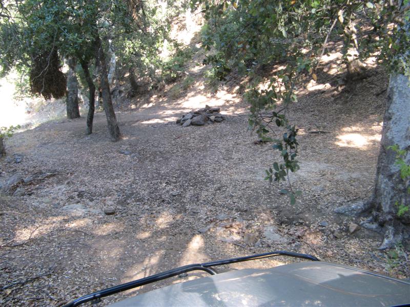
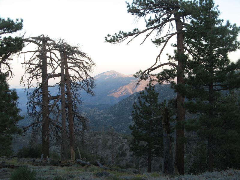
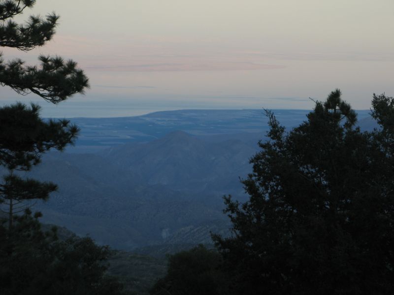
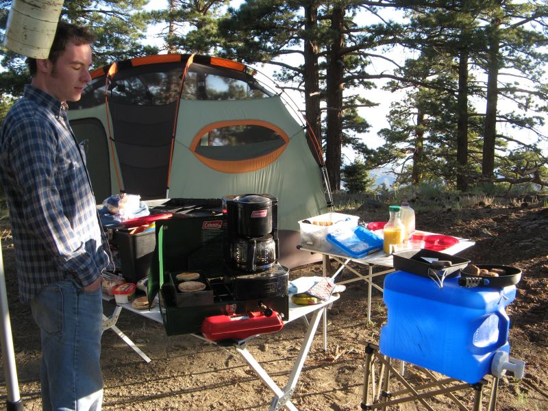
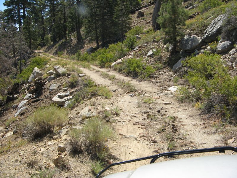
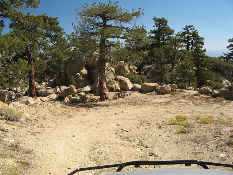
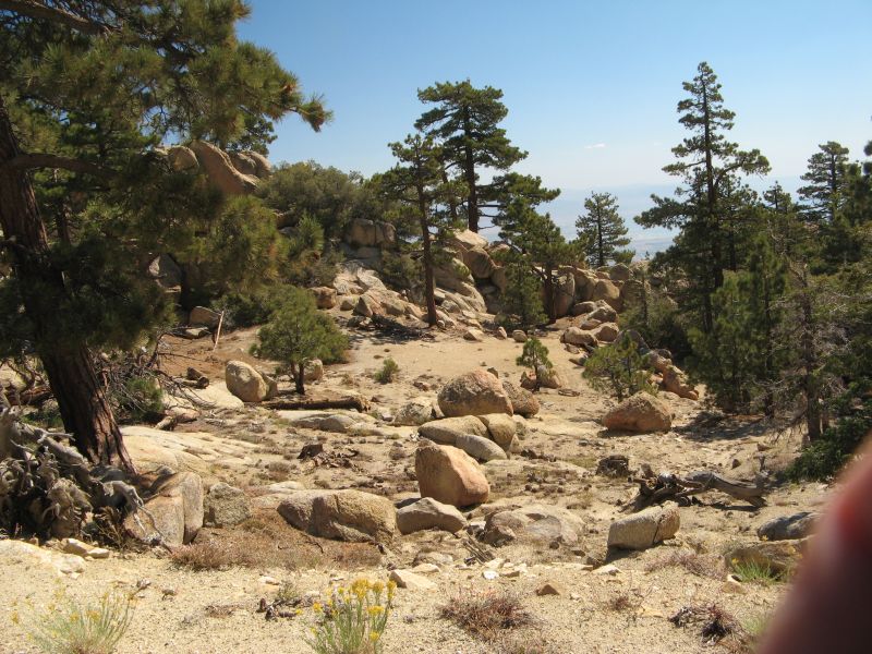
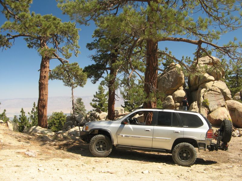
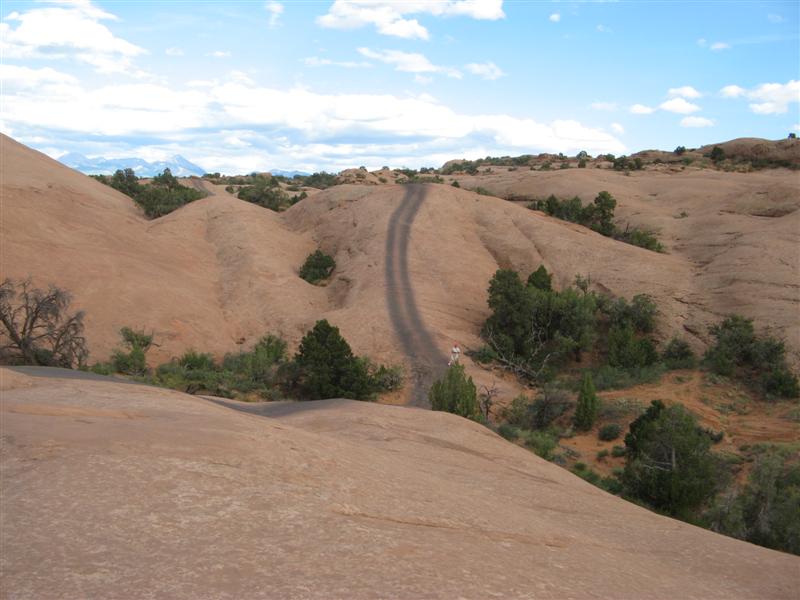
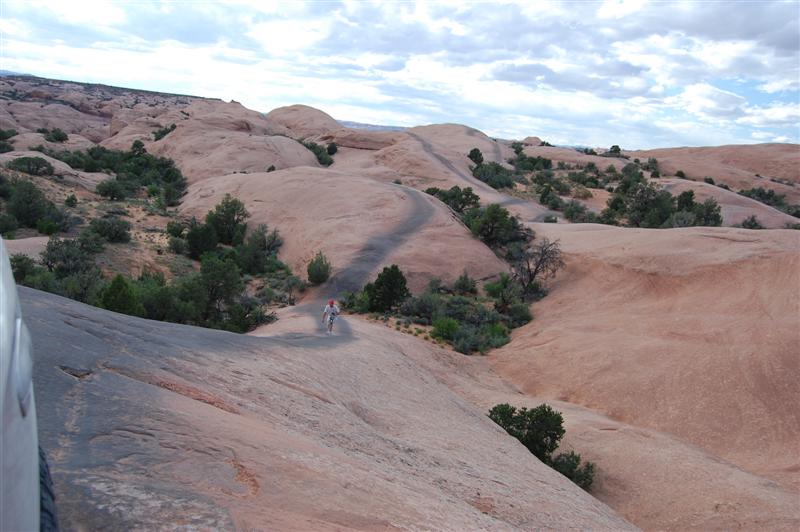
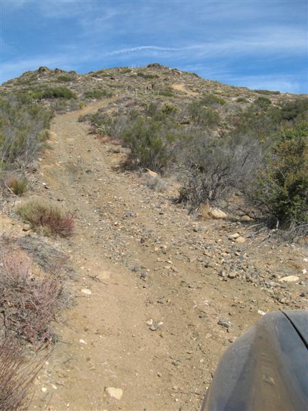
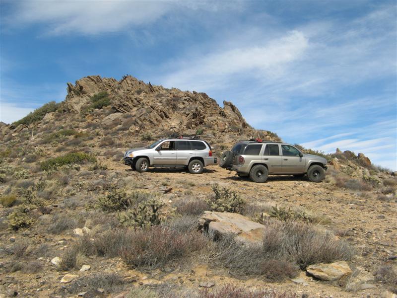
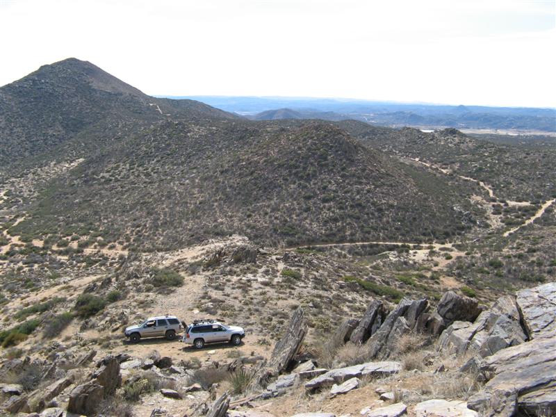
And then we did another few hours of easier stuff. :biggrin:

Here's some pics of one of his water crossings, and then the water level on my side panels after the deepest one. Nothing got inside - door seals worked as designed. Oh, yeah, and the wheel caps came in that were backordered, and I slapped black acorn lug nuts on them with locks because the OEM lug nuts look out of place on a black wheel.

balto16.jpg


balto7.jpg


balto8.jpg


balto9.jpg


balto10.jpg


balto11.jpg


balto12.jpg


balto13.jpg


balto14.jpg


balto15.jpg


Balto's pics:

Sorry for taking a bit. Here are some photos I've picked uploaded. I have plenty more if you guys like. The trip was awsome and I can't thank Roadie enough for taking me under his wings. Besides the frequent trips to the bathroom because of the virus I had, I don't think the trip could have been any better. I found out where I want my truck to go and what I'd like it to do. Driving with Roadie gave me a new "Refreshed" outlook on life and safty. Although he pushes his truck to the extreme its clear to me he knows exactly what hes doing.
Getting larger tires will be a must for me but for what I enjoy doing my stocker setup is fine as it is. I highly doubt an EXT will be able to do what Roadie has pushed his truck to do w/o heavy heavy modifications unheard of yet. Anyways enjoy! Hope more trucks will be able to come out with us!!!

Early morn' after breakfast
Onourway.jpg

Climbing Altitude
GainingAltitude.jpg

Finally Breaking Through
BrokeThrough.jpg

Sightseeing
Below.jpg

A Little Photoshot
RoadieNI.jpg

And another
RoadieNI2.jpg

And one more
MyCenterfold.jpg

Speeding through the flats
Speedingthroughflats.jpg

Going through the motions
RoadieNDirt2.jpg

Climbing around...
RoadieNDirt1.jpg

Roadie in a big world
RoadieNBigWorld.jpg

Heading home
GoingHome1.jpg
 

The_Roadie

Original poster
Lifetime VIP Donor
Member
Nov 19, 2011
9,957
Portland, OR
Went for a quick expedition to the desert this weekend - met a co-worker and his mother for a dinner (I grilled filet mignon and we had some great Cabernet.) Saw coyotes, a kit fox, hares, but no kangaroo rats this trip.

Went hiking to a palm grove, up a canyon you'd never know it was there. Drive to a 1857 historic stagecoach station site, but nothing was left but fenceposts. The site was about 12 miles down a trail whose last three miles was about 3" of running water in a narrow wash, so naturally it threw up some mud. Sigh. People who have been reading my reports for a couple of years know I don't really appreciate mud. Anyway, enjoy the pics, all ye with snow for Christmas.

Almost a full moon. No good views of the stars this trip, but Venus and Mars were spectacular.

bw1.jpg


Sitting around the campfire with nice wine at 45 degrees. The low that night was 30. Shared bodily warmth is essential, but less fun when your partner is wearing flannel long johns, mittens, and a wool hat.

bw2.jpg


Anthill cleanup after the rains.

bw3.jpg


The canyon to hike into.

bw4.jpg


Mutant barrel cactus.

bw5.jpg


Normal barrel cactus.

bw6.jpg


View of the grove.

bw7.jpg


Self-portrait with the camera on a tilt - forgot to being the tripod.

bw8.jpg


Up close. Some human had set the dead palm fronds on fire that normally hang down low on the trunks. The trunks are burned, but the palms survive, since fire is a normal part of their development. It does drive out the critters who normally live in the fronds - snakes, rats, and thousands of scorpions.

bw9.jpg


View back to the valley.

bw10.jpg


Spot of Christmas mud.

bw11.jpg


In the middle of frickin' nowhere, some prankster put up a semi-familiar intersection sign. I've seen pictures of this on the net, but never knew its location, which I suspect is not to be shared. You have to find it yourselves. :raspberry

bw12.jpg


A final close-up of the mud to freak out the folks who keep their trucks clean like show poodles. :thumbsup:

bw13.jpg


It is indeed a rare treat to just drive out and have your pick of secluded campsites. No worry about finding a spot. If I didn't want the pit toilets for Mrs. Roadie's comfort, which meant going to one of the six semi-organized campgrounds, there are 500 miles of trails on 600,000 acres you can just pull off anywhere and camp for free.

It's just that in the Anza Borrego state park itself, you can't drive willy-nilly off the trails because of environmental damage, and you have to use a portable fire pit because you can't leave ashes on the desert, and you have to use a porta-potti or dig a cat hole to poop in, and the Tread Lightly principles say you need to pack out the TP you use. I either carry a porta-potti or a PETT Toilet system. The Clean Waste Toilet System at NRSweb.com

Oh, and except for three of the semi-organized campgrounds, it's ALL FREE!

We grew up and lived for 40 years in Massachusetts. Mrs. Roadie was from Boston and then New Hampshire for a while, while I was born in the Berkshires. Worked in Boston or the suburbs for 20 years, and were regular tenters in Maine and New Hampshire that entire time until we got a pop-up trailer. So we've paid more than our share of dues in thunderstorms and mosquitos and biting greenheads!

If you've read my trip reports for the September Sierra Nevada expeditions, you'd know our budget for food and wine far exceeds the cost of the backcountry campgrounds, and even the petrol for the trip. I think for two of us this year for a week, it was about $350 gas and $450 food/wine/beer. We eat well. :biggrin: And we usually have more time for food prep on a trip, and no microwave, so it's all the old fashioned way. Here's a few pics of camping, Roadie style. It's my college housemate and expedition partner Paul working his Blackberry on a rare time we had a signal, and reading the book with the odd title.

Merry Christmas to everybody also!

crackberry.jpg


htsitw.jpg


s30.jpg


s31.jpg


s32.jpg
 

The_Roadie

Original poster
Lifetime VIP Donor
Member
Nov 19, 2011
9,957
Portland, OR
Three parts - lotsa pics!

Teebes finally got his act (and TB) together and we had a day to go play in the desert. Perfectly clear, 72 degree, and no wind! First was an easy and scenic trail into Oriflamme Canyon - some steepness and switchbacks, but I had taken SDFullerC here with a stock Envoy, so it wasn't a real challenge. Went with a 4Runner from another offroad forum AlekG and I are members of, driven by their member SWR, which stands for Scenic Wonder Runner.

diablo201.jpg


diablo202.jpg


diablo203.jpg


diablo204.jpg


diablo205.jpg


Then we took some pavement to get to the next trail, Canyon Sin Nombre, which I've posted about here before when I did a solo run. The first part of this is an entire semester's worth of sedimentary geology packed into a half hour ride.

diablo206.jpg


diablo207.jpg


diablo208.jpg


diablo209.jpg


diablo210.jpg


Then we get to the edge of the badlands, and face the Diablo Dropoff. Two separate descents, the first one sandy and the second one a rocky flume.

diablo211.jpg


Greg goes first on the sandy one to judge the avalanche danger, then sets up to shoot video of me and SWR after we know it's safe to go down.

diablo212.jpg


diablo213.jpg


Then the rocky one.

diablo214.jpg


diablo215.jpg


So into the tight runout from the dropoff, past a nasty rock that's in the middle of the trail and pretty much unavoidable. I got hung up on it two years ago, and even with the G80, did the exact same mistake and got hung up again. Backed up a bit, three times, and finally humped myself over it.

diablo217.jpg


diablo218.jpg


diablo219.jpg


But not without whacking the new Purple Cranium Spider diff protector.

diablo216.jpg


And depositing some of its blue powder coating on the nasty rock.

diablo220.jpg


So next up is Teebes, who attempts the same starting line as I did, with the exact same results. Wheel spin on the rock, sideways slippage, and hanging up on the diff. Manual pushing didn't help, and it would have taken longer to break out the Hilift for rock stacking under the tires, so I just gave him a quick strap assist.

diablo221.jpg


diablo222.jpg


diablo223.jpg


diablo224.jpg


diablo225.jpg


Finally comes SWR, with a narrower truck, more practice, and a healthy dislike of scratching anything including his rock sliders or frame. Without lockers (!!) he places his right rear tire exactly on the peak of the rock, bumps a few times to get over it, and makes our heaving and grunting look sick. Learned a lot about elegant driving from him!

diablo226.jpg


diablo227.jpg


diablo228.jpg


diablo229.jpg


diablo230.jpg


[Where we went in Sandstone Canyon is now closed off, probably forever, to vehicles. Never can do this trip again.]

Thought SWR was going to get the first dent in his door when he opened it here, but no. He's truly one with his truck and knows where the door will stop within a cm.

diablo231.jpg


Finally, as the sun was setting, we went into Sandstone Canyon - the place that the trail guides say that if you only have time for ONE RIDE in Borrego at all, this should be it!

diablo232.jpg


diablo233.jpg


You wouldn't believe you can drive through here, but it's possible!

diablo234.jpg


diablo235.jpg


diablo236.jpg


diablo237.jpg


I gave the camera to Teebes to get a few of me.

diablo238.jpg


There was one piece of carnage on the trail - a broken front sway bar link end. I can't cry - it was time to change 'em out anyway and now I can fab up the disconnectable ones to copy AlekG. It did make for a pretty floppy ride home through the mountain twisties running without the sway bar. Hope you enjoyed these!

diablo239.jpg
 

The_Roadie

Original poster
Lifetime VIP Donor
Member
Nov 19, 2011
9,957
Portland, OR
After getting stuck in the sand two trips ago in this thread, I vowed to bring my winch EVERY TIME, and also test it and the Pull Pal winch anchor, which I hadn't done under real-world conditions since buying them. It was also a great day to beat the approaching storm.

No Trailvoy buddies were available, so I went with a friend from Expedition Portal - Mark aka: SWR/Scenic Wonder Runner. He wheels a 4Runner, lifted but no lockers.

The first set of pics are from Mark:

At the edge of the Badlands

wt1.jpg


Getting stuck on purpose in loose sand. Side hills are surprisingly annoying with heavy doors and swing-away spare holders. (Video coming)

wt2.jpg


Assembling the fold-out Pull Pal winch anchor. In a place without trees or rocks or another vehicle, this is the gadget of choice. Alternatives include burying your spare tire in a deep hole to connect your winch line to. That's real work.

wt4.jpg


Pull Pal placed where its blade will bite in and dive down to whatever level will let it get traction. It's rated for 12000 pounds force. I know it's off-center from the truck and the winch, but this was supposed to be a worst-case test - me doing it all alone with Mark just taking pictures.

wt5.jpg


Connected up and ready to pull

wt6.jpg


The uhaul blanket is a safety precaution everybody should take with winch lines, to absorb a bit of energy in case anything breaks loose.

wt7.jpg


Tensioning up the winch line made the Pull Pal dive almost three feet, and it moved toward the truck by 6-8 feet as it got underground traction.

wt8.jpg


Almost out now.

wt9.jpg


Some Borrego Badlands shots:

wt10.jpg


wt11.jpg


wt12.jpg


wt13.jpg


wt15.jpg


The Roadie's lucky shirt - wearing this shirt has prevented me from rolling down ravines, running out of fuel, and disabling breakdowns on the trail.

wt16.jpg


Colorful badlands

wt17.jpg


The Pumpkin Patch, a unique collection of spherical concretions formed underground by sand and minerals in the groundwater. When the sand blows away when dry, these are left on the surface. Very rare to find the conditions necessary to grow them.

wt18.jpg


Hiking up to a palm oasis, possible only with an underground stream.

wt19.jpg


17 Palms oasis

wt20.jpg


Down a shelf road into a wash. The Envoy is in this picture.

wt21.jpg


Glad we missed this collapse

wt22.jpg


Down into another wash.

wt23.jpg


And up out of the wash to flat land again

wt24.jpg


Look up Truckhaven Trail for more reading
wt25.jpg


Badlands (for more reading click here)

winchtest008.jpg


Pull Pal assembled

winchtest031.jpg


Currently I have a 12 foot winch control lanyard. But I bought an RF version that will work up to 100 feet away, but it isn't installed yet. I prefer being well outside the danger radius with as much as 9000 pound stress on the winch, cable, and other parts. This wasn't that hard a simulation, though.

winchtest048.jpg


Trench dug by the Pull Pal as it dove down to get traction

winchtest055.jpg


In mud or dirt I'm sure it won't be this easy to retrieve

winchtest062.jpg


Trench left behind. I probably should have raked it flat so people wouldn't think I got stuck doing something dumb.

winchtest069.jpg


SWR cresting a rise

winchtest090.jpg


Narrow gap - H1's need not apply

winchtest093.jpg


"Prospector's Post Office" in one palm grove at 17 Palms Oasis

winchtest114.jpg


Yearly log books and geocaching stuff

winchtest116.jpg


Decent size rockfall in Truckhaven Trail

winchtest120.jpg
 

The_Roadie

Original poster
Lifetime VIP Donor
Member
Nov 19, 2011
9,957
Portland, OR
Another one in the continuing series of "Offroad with the Roadie". This is about the end of the desert wheeling season, since it's almost getting to 90 degrees in the daytime. But nighttime is still mid 50's, so the camping is outstanding. Went out with Mrs. Roadie and a former co-worker and his daughter. They had a Suburban, so couldn't go on all the tight trails I like, but they rode along for those parts.

Enjoy:

Lunch in the shadow of the "Leaning Tower of Mud". Hope I"m luckier than Alekg and it doesn't fall over on me.

ab1.jpg


The elusive Pumpkin Patch Trail.
ab2.jpg


The Pumpkin Patch - a rare example of sandstone concretions formed underground by water action with a cementing agent, then exposed to the surface by wind removing the sand.
ab3.jpg


A luxurious campsite.
ab4.jpg


The best backcountry luxury. A PETT toilet.
ab5.jpg


A modified warning sign
ab6.jpg


We trust a lot that there will not be an earthquake while we sleep.
ab7.jpg


The view through our mesh roof at sunrise. This is worth the whole trip. This is in Hawk Canyon, and the hawks, owls, swallows, swifts, hummingbirds prove there's a lot of life in what could be a miserable environment.
ab8.jpg


ab9.jpg


Back to the (now dry) mud pit called the Borrego Sink.
ab10.jpg


Spongy surface left after it dried out. Will bake to a hard surface later in the summer.
ab11.jpg


Back to the extreme Coyote Canyon "bypass road". I've posted about this before, but the Park just sent in a rock crusher to take off the sharp parts of the mose extreme obstacles and make the trip safer for the rangers who have to patrol the area 3-4 times a day. If it was a 6 out of 10 trail before, they didn't improve it that much, and now it's only a 5. Still at the limit of trailvoy suspensions with 31-33 tires and max BDS lifts.
ab12.jpg


ab13.jpg


ab14.jpg


ab15.jpg


ab16.jpg


ab17.jpg


ab18.jpg


ab19.jpg


ab20.jpg


More rocks. Do not try this with stock suspension. I hit my frame a couple of times, but in its former condition, I'd take 8-10 slams, and have to pick my lines MUCH more carefully.

ab21.jpg


ab22.jpg


ab23.jpg


ab24.jpg


Start of the deep water crossing.
ab25.jpg


ab26.jpg


Bow wave
ab27.jpg


Water line on the side. Probably 20" deep? Took a few ounces of water past the door gaskets. No surprises there.
ab28.jpg
 

The_Roadie

Original poster
Lifetime VIP Donor
Member
Nov 19, 2011
9,957
Portland, OR
This place needs some excitement, I figured - so I went out and made some. Always wanted to poke about near Ranchita, a tiny wide spot in the road at 3000 feet elevation on the way down to the desert. There are very interesting looking trails on the topo maps, but most of them turned out to be on private property. One of the open ones was Buck Canyon, on a small section of BLM land at the end of a bunch of private land. But the road was a right of way, and the property owners had to allow access. But I figure the "PVT" addition to the street sign for "Old Mine Road" would keep out all but the locals who knew better, or explorers like me with the topo maps.

It was outstanding. Narrow in places, and brushy, and almost no signs at all of significant traffic. I might guess only a dozen vehicles a year come up here? No tracks to speak of and overgrown centers where the rain encouraged it.

ranchita01.jpg


Nice grove.

ranchita02.jpg


One fire ring - BLM allows free camping, and this remote and secluded site didn't show evidence of the possible yahoos that sometimes infest remote and secluded sites with beer cans to clean up, shotgun shells, brass casings, trash, etc. A clean, underutilized and remote site is worth keeping track of.

ranchita03.jpg


Outside the canyon, there's a trail to the Montezuma Mine, mentioned on gorp.com as follows:

...it dead-ends high on the mountain at a caved-in gold mine workings, Montezuma Mine. California Dept. of Mines and Geology (CDMG) Report #3 offers this on the Montezuma (Rice) Mine district:

Gold-bearing deposits in the district consist of northeast- trending quartz veins in metamorphic rocks that consist mainly of schist, and hybrid rocks composed of schist and quartz diorite. The deposits probably were prospected first in the 1890s by the Rice brothers of Warner Springs.


ranchita04.jpg


View down-valley

ranchita05.jpg


Progress stopped by this gulley

ranchita06.jpg


Grass on the trail

ranchita07.jpg


Mr. Hawk about 30 feet up

ranchita08.jpg


More trail

ranchita09.jpg


More grass on the trail

ranchita10.jpg


Mine entrance

ranchita11.jpg


More trail beyond the mine.

ranchita12.jpg


What a day. Clouds held it to 85 degrees from the typical 95.

ranchita13.jpg


More growth in the trail.

ranchita14.jpg


Back to the edge of civilization. Odd boundary marker.

ranchita15.jpg


The way back to the main road

ranchita16.jpg


Up a nearby valley (Cherry Canyon) also hinted at by the topo maps as having a Jeep trail next to the creek. Property owners want to make sure you know which way is the BLM land.

ranchita17.jpg


It starts out OK

ranchita18.jpg


But gets extreme after a couple of miles. Sigh..... Note the clouds building at the top of the canyon

ranchita19.jpg


Where I gave up.

ranchita20.jpg


I saw tracks from an extreme rock crawler getting past this part.

ranchita21.jpg


At this point I was getting concerned about the clouds looking like thunderstorm cells, and since I had a cell signal, checked Accuweather for the area:


...FLASH FLOOD WATCH REMAINS IN EFFECT UNTIL 9 PM PDT THIS
EVENING...

THE FLASH FLOOD WATCH CONTINUES FOR

* A PORTION OF SOUTHWEST CALIFORNIA...INCLUDING THE FOLLOWING
AREAS...APPLE AND LUCERNE VALLEYS...COACHELLA VALLEY...
RIVERSIDE COUNTY MOUNTAINS...SAN BERNARDINO COUNTY MOUNTAINS...
SAN DIEGO COUNTY DESERTS AND SAN DIEGO COUNTY MOUNTAINS.

* UNTIL 9 PM PDT THIS EVENING

* SLOW MOVING THUNDERSTORMS WITH HEAVY DOWNPOURS ARE EXPECTED
TODAY. THE POTENTIAL FOR FLASH FLOODING IN THE AFTERNOON AND
EVENING EVENING IS MODERATE. PEOPLE TRAVELING IN THE MOUNTAINS
AND DESERTS MAY ENCOUNTER VERY HEAVY RAIN...FLASH FLOODING...
AND POSSIBLE DEBRIS FLOWS IN THE BURN AREAS.

* NORMALLY DRY WASHES AND CREEK BEDS CAN QUICKLY BECOME INUNDATED
WITH RAPIDLY RISING WATER AND SHOULD BE AVOIDED.


Yep - time to leave the canyons for some nice safe shelf roads elsewhere

Nice pile of rocks on the way out.

ranchita22.jpg


More hard sandy trails

ranchita23.jpg


Grrrrr. National Forest web site said this road was supposed to be open. Wasted 8 miles driving to get to this gate that should have been a short cut to the pavement. Actually, it wasn't at all a waste because I got to see a bunch of unique terrain, and as the saying goes: A content person is one who can enjoy the scenery on a detour.

ranchita24.jpg


Videos still baking. I'll call the Cleveland National Forest supervisor's office about the gate issue Monday. Seems they do this to me about once a year. Their web site is supposed to be updated with closures for rain, fire, resource protection - etc. This looks like a ranger's mistake.

Video's up now: [video=youtube;Xo1OVerqIU8]http://www.youtube.com/watch?v=Xo1OVerqIU8[/video]

You would have loved this. Yes - I did some up near Indian Flats, which is northwest of Warner Springs and rt 79, but mostly I was poking about north of S22, just west of the Ranchita Store. South of S22 has some very tight brushy trails, one of them the historic Grapevine Canyon trail that connects to the difficult Jasper Trail and goes diagonally to rt 78. And the Culp Valley trail. I know all those. The ones north of Montezuma Valley Road were more of a mystery. I have a foreign exchange student I was supposed to take to Borrego today, but he go sick overnight and couldn't go. So I came up with this plan on no notice to do SOMETHING useful with a day off and a full tank of gas.

ranchita.jpg
 

The_Roadie

Original poster
Lifetime VIP Donor
Member
Nov 19, 2011
9,957
Portland, OR
Been pretty busy to post, but here's what we did last weekend. I had house guests from Oregon, so I took the guy out with me and left the girls to do their thing. Teebes met us out there, after a near head-on meet-up on the one-way-in-one-way-out trail to Santa Rosa Mountain.

Getting north on I-15 was delayed 20 minutes by one of those inexplicable clear, sunny day overturnings.

santarosa23.jpg


santarosa24.jpg


santarosa25.jpg


Forest road 7S02 off State Route 74

santarosa26.jpg


Nice clouds for a sun-dappled effect:

santarosa29.jpg


Hills to start:

santarosa33.jpg


Then the fun stuff:

santarosa34.jpg


santarosa35.jpg


A famous fire warning:

santarosa37.jpg


Looking down to the east onto Palm Springs and the mountains farther away

santarosa39.jpg


Down a side trail to a deserted campsite:

santarosa40.jpg


santarosa43.jpg


santarosa45.jpg


santarosa47.jpg


Trail back to the main trail:

santarosa52.jpg


Then some fun wheeling the next day:

santarosa53.jpg


santarosa54.jpg


santarosa55.jpg


santarosa56.jpg


The Salton Sea at the far side of Anza-Borrego desert:

santarosa62.jpg


Rocks. More rocks.

santarosa65.jpg


santarosa68.jpg


Deserted campground - too much civilization for us. A picnic table, INDEED. What laziness to insist on a picnic table! :biggrin:

santarosa76.jpg


Interesting erosion results

santarosa77.jpg


SOmetimes you have to share the trail

santarosa78.jpg


santarosa79.jpg


Lake Hemet (reservoir) in the background

santarosa80.jpg


Yeah! Shelf roads!

santarosa86.jpg


Good wheeling!

santarosa91.jpg


Teebes posing on a rock accidentally, a little bit. He slays me sometimes. :dielaugh:

santarosa94.jpg


The two silver ones together

santarosa98.jpg


Yes, that ridge you see to the right of center is our route down

santarosa101.jpg


santarosa102.jpg


Teebes is such a good guy he scoops his pooch's poop, but nobody wants to carry it inside.

santarosa104.jpg


Yes, more trail ahead

santarosa119.jpg


Eating Teebes' dust

santarosa121.jpg


Skid plate carnage;

santarosa122.jpg


santarosa124.jpg


Almost down now. Nice shelf roads.

santarosa11.jpg


Oh, is that a hill climb I see coming up?

santarosa02.jpg


santarosa03.jpg


santarosa09.jpg


Video of the hill climb

[video=youtube;IvN_T6Xdol4]http://www.youtube.com/watch?v=IvN_T6Xdol4[/video]
 

The_Roadie

Original poster
Lifetime VIP Donor
Member
Nov 19, 2011
9,957
Portland, OR
Note: My favorite shot of Teebes is in this series. Right after this weekend, I was laid off for the first time in 35 years, and that put an instant and deep hole in my budget and enthusiasm for risky offroading. :wallbash: I've been back to work for two years now after 15 months off, :excited: but it will never be the same as in the "Golden Age of Trailvoy Offroading".

Some of the shots are looking down on Interstate 8 from the trail, except to get there was about an 8 mile drive.

tablemountain-26.jpg


tablemountain-31.jpg


tablemountain-33.jpg


tablemountain-35.jpg


tablemountain-41.jpg


tablemountain-45.jpg


tablemountain-47.jpg


tablemountain-48.jpg
 

The_Roadie

Original poster
Lifetime VIP Donor
Member
Nov 19, 2011
9,957
Portland, OR
Haven't been going out much while between jobs, unless somebody rides shotgun that can split the gas. But last weekend, I had a former co-worker want a tour of the local desert. Jeff's a full-spectrum outdoorsman who's lived around the country including Arizona, New England, and Oregon, but he'd never been to our local Anza Borrego desert. So I came up with a big loop tour for two days, camped in my primo favorite canyon spot (Hawk Canyon), and hit most of the highlights. Alas, the wildflowers were gone by.

The Saturday route was pavement to Calcite Mine Trail, then Truckhaven to Arroyo Salado, Pumpkin Patch, Pumpkin Patch Trail, Cut Across, Buttes Pass, Borrego Mountain Dropoff to the Slot, then down to San Felipe Wash, Blow Sand Canyon to Goat Trail, then Hawk Canyon. Sunday: to Fish Creek Wash, Split Mountain, Sandstone Canyon, then out by way of BLM road EC085 along the US Gypsum railroad tracks down to Plaster City.


And some of Jeff's pics first.

borr01.jpg


borr02.jpg


borr03.jpg


borr04.jpg


borr05.jpg


borr06.jpg


borr07.jpg


borr08.jpg


borr09.jpg


borr10.jpg


borr11.jpg


Made it to within 1.5 miles of a gas station before needing the spare can. Sigh....

borr12.jpg


My pics:

borr20.jpg


borr21.jpg


borr22.jpg


borr23.jpg


borr24.jpg


borr25.jpg


borr26.jpg


borr27.jpg


borr28.jpg


borr29.jpg


borr30.jpg


borr31.jpg


borr32.jpg


borr33.jpg


Here's a compilation video:

[youtube]MVaCfr9VORY[/youtube]
 

The_Roadie

Original poster
Lifetime VIP Donor
Member
Nov 19, 2011
9,957
Portland, OR
More old, historical trail reports moving over here from the OS.


Got going this morning after the usual last minute repairs and packing.

I was not pleased with the handling in the mountains because of the missing JKS disconnectable endlink in the front, so I just got some Moogs to see me through this trip. Going with Mike from Vegas, and he doesn't have disconnectable end links, so I can't be going any places he can't follow.

Oh, and new bushings bought from a fellow Trailvoy member.

moab1.jpg


On the way.

moab2.jpg


Vegas

moab3.jpg


moab4.jpg


Now HOW did these get in here? :duh: :thumbsup:

moab5.jpg


95 degrees does make some folks want to wear less.

moab6.jpg


View from the hotel on the outskirts.

moab7.jpg


Roadiemobile safe below.

moab8.jpg


Mrs. Roadie thoughtfully ran a couple of polo shirts off on her embroidery machine last night. I'll be amazed if I can convince Mike to wear his for a pic sometime along the way....

moab9.jpg


I'm now sharing my SPOT with a former co-worker who needed it for rock climbing this week, so I don't have that. But Mike, bless his cautious heart - picked one of his own up today. We'll configure it tonight and post up the tracking URL for you to follow along.

Plan to have dinner with Steve tonight for a reunion of the Roadie Colorado Rescue Crew. Then on to Moab for 5-6 days of wheeling.

Here's some pics. No time for explanations right now. There's some daylight left and wheeling to be done.

moab100.jpg


moab101.jpg


moab102.jpg


moab103.jpg


moab104.jpg


moab105.jpg


moab106.jpg


moab107.jpg


moab108.jpg


moab109.jpg


moab110.jpg


moab111.jpg


moab112.jpg


moab113.jpg


moab114.jpg


moab115.jpg


moab116.jpg


OK, OK. I'm in Vegas now, beat up and sunburned and every arm and finger muscle hurts. Home tomorrow night. But here's a few more. I expect there's some calendar class pics in the 1000 we took.

Look closely to see Mike in this one.

moab200.jpg


moab201.jpg


moab202.jpg


moab203.jpg


moab204.jpg


moab205.jpg


moab206.jpg


moab207.jpg


moab208.jpg


moab209.jpg


moab210.jpg


moab211.jpg


And a few raw videos.

How to climb a 45 degree fin and forget that everything is going to fall off the dashboard into your lap or out the window:

[youtube]AheKwL2AYhE[/youtube]

How to climb a MORE than 45 degree slope when your winch is in the way.

[youtube]k-lt3sLaktk[/youtube]

Longer clip -down then up

[youtube]WCnRaNqIKAk[/youtube]
 

Forum Statistics

Threads
23,330
Posts
637,976
Members
18,530
Latest member
jvest

Members Online